10:00 AM UPDATE:
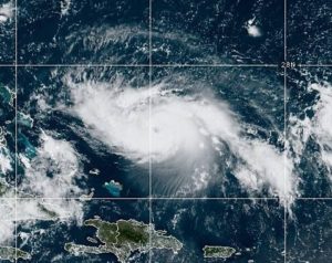
Good morning! We continue to enjoy our lower humidity levels. After a comfortably cool morning, we have a hot day on tap, but still the humidity is under control. Hit or miss storms return for the Labor Day Holiday Weekend. BUT, All eyes are on Hurricane Dorian. Dorian is forecast to be a nearly catastrophic hurricane when it arrives in Florida on Labor Day. But what about Dorian’s Future track after Florida landfall? Could it have an impact on Alabama’s weather? I’ll show you various model solutions, along with the latest forecast cone from the National Hurricane, on this hurricane destined for the history books. Plus…are worried about your Labor Day Beach trip? I’ll show you what to expect.
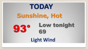
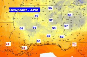
Comfortable morning….HOT day, but still tolerable humidity.
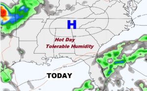
Still the afternoon dewpoints are going to be very tolerable today. Over the Labor Day Weekend the big humidity returns.
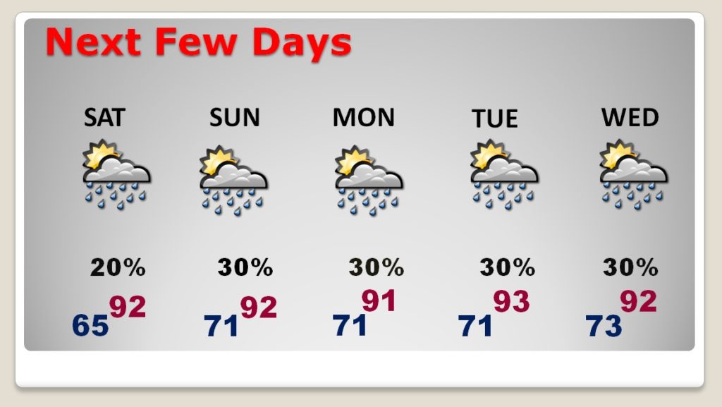
Hot, Humid Holiday Weekend…a few hit or miss storms. Routine summer forecast. BUT, what about Dorian’s possible impact towards mid week? The forecast is subject to change depending on Dorian’s track. Stay tuned.
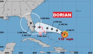
One of the important global models we like to look at is the EURO (ECMWF)…It takes Dorian to the east coast of south Florida Tuesday morning and then sharp curve to the north raking the coastline. An awful potential scenario.
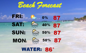
Got a weekend Beach Trip planned but you’re worried about Dorian? You should be OK through Labor Day. Scattered storms at times, but no impact from Dorian yet.