Good Morning! Get ready for a weekend which will feel like late June. In fact, it looks like we are headed to record territory by Sunday. After the weekend, though, this string of hot, dry days will fade. Will we see some much needed scattered showers Monday? I have the updated rainfall potential. We’ll look ahead to some moderating temperatures next week. And, will we see a tropical depression or tropical storm in the Atlantic over the weekend? The tropical potential is growing.
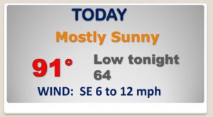
HOT for May today. High near 90 Rain chance about 10%
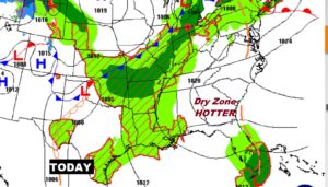
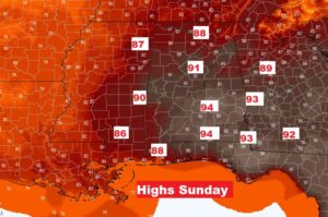
Building upper ridge aloft will lead to a very hot weekend. More like summer than May.

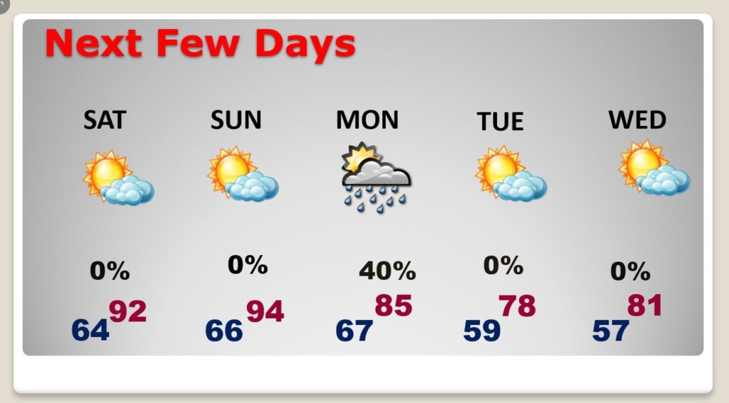
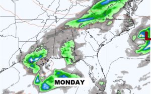
Scattered showers and thunderstorms will dot the radar screen Monday. Much cooler Tuesday. Nice Wednesday. Cooler nights again.
 ‘
‘
Sunday’s record high of 93 is in jeopardy from 1995.
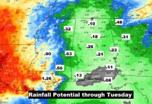
Fingers crossed that some towns will get wet Monday. Scattered showers and thundershowers.
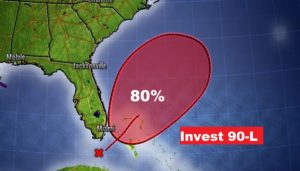
That pre-season disturbance off the Florida coast now has a number. Invest 90-L has an 80% chance of becoming a Tropical depression or tropical storm over the weekend. It will not affect the US coastline. It should move to the northeast.