10:00am UPDATE:
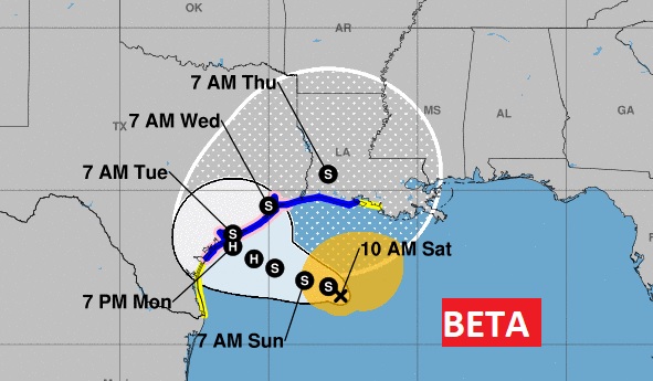
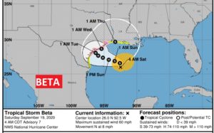
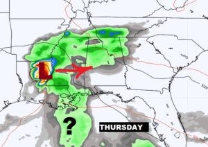
Interesting to see the evolution of Beta’s future track. Beta is 60 mph Trop. Storm in the western Gulf, which will interact with the Texas coast perhaps as a hurricane Tuesday, before looping the northeast and east into LA Thursday. It’s been a busy season for Gulf landfalls.
EARLY MORNING UPDATE:
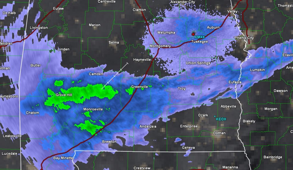
Good morning! How about a taste of cooler, much more comfortable air on the last full weekend of summer? No, we are not expecting blue skies and sunshine, but, that’s the trade off for now. If you look at the radar this morning, it looks like it’s raining all over south Alabama. It isn’t. Clouds and moisture are streaming into the state from Tropical Storm Beta. However, the air near surface is very dry. Most raindrops falling are drying out before they reach the ground. It’s an effect called virga.
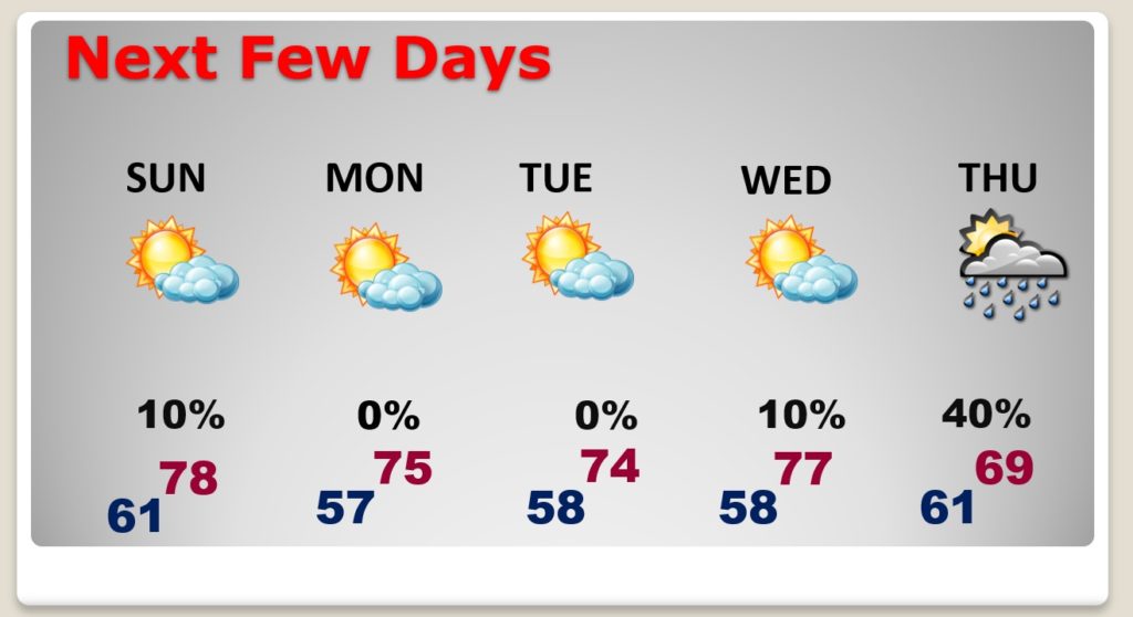
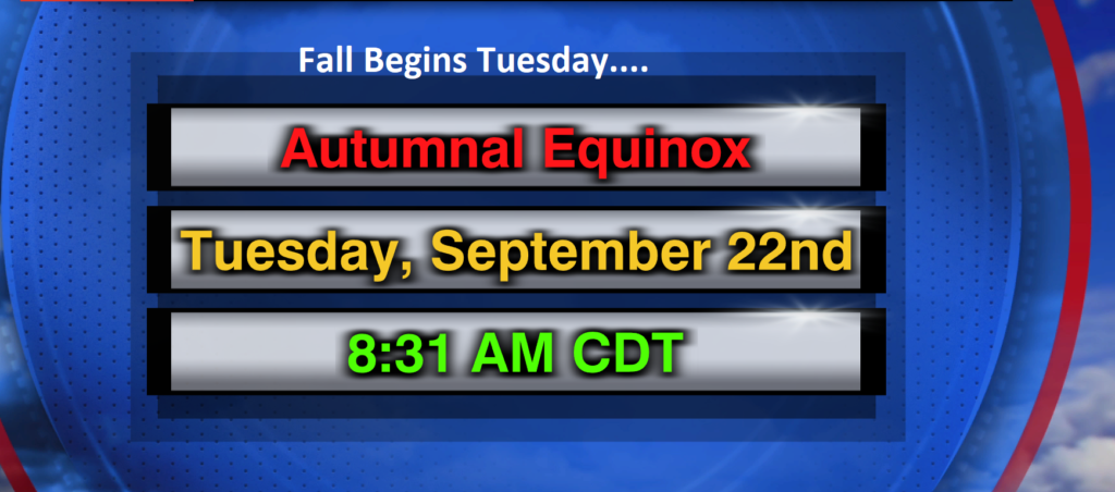
So, we’re in for cloudy weather today, light showers at times, but the days and nights will be comfortable this weekend. We could even see some lows in the 50’s by Sunday and Monday night. Fall officially begins on Tuesday.
Then there is Tropical Storm Beta in the western Gulf, which is expected to become a hurricane within 36 hours. Is Beta just a Texas/Louisiana problem? Or could we be dealing with Beta’s effects later this week here along the central Gulf coast.? It depends on which model you look at. Obviously, after dealing with Sally this week, NOBODY wants to worry about tracking another potential tropical threat. Much more on Beta, below. We are now two letters into the Greek alphabet.
TODAY: Cloudy. Spotty isolated showers are possible at times today and tonight. High in the upper 70’s. Low tonight 61. East wind at 5 to 10 mph.
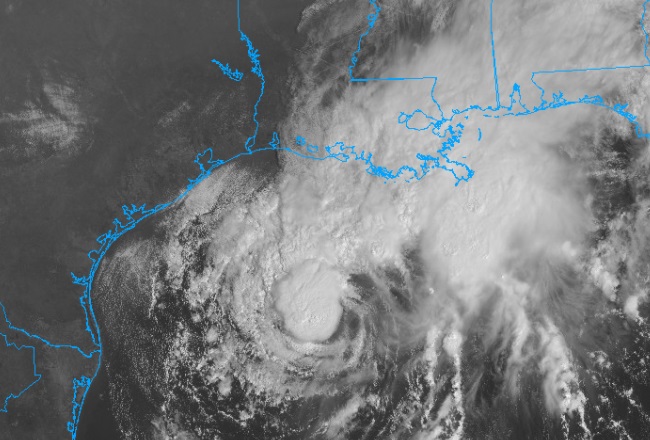
TROPICAL STORM BETA: Beta is a 60 mph tropical storm in the western Gulf, halfway between the mouth of the Rio Grande and the mouth of the Mississippi. It’s moving north at 8 now, but, it’ll drift west to closer to Texas later in the weekend. It’s expected to become a hurricane. A hurricane watch is in effect along the Texas coast.
CURRENT SET-UP AND BETA’S FUTURE: Right now, the Jetstream has reached south to the Gulf coast. That’s why we are enjoying this nice cool-down. It’s also keeping Beta away from us. In a few days the Jetstream will retreat.
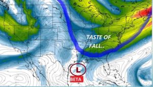
After the jet retreats, will that allow the tropical system to move eastward later in the week? How strong would it be? What effect could it have on us? We simply don’t know. It would be late week.
ELSEWHERE IN THE TROPICS: There’s two other named systems out there. Teddy is the most interesting. It’s still a Cat 4 hurricane with 125 mph winds. It is causing tremendous wave action in much of the Atlantic islands and along the east coast. It could have a profound impact on the Canadian maritime provinces by late Tuesday. Wilfred is a weak tropical storm. And there are two other areas on interest out there in the eastern Atlantic. One of them is the remnants of Paulette.
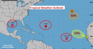
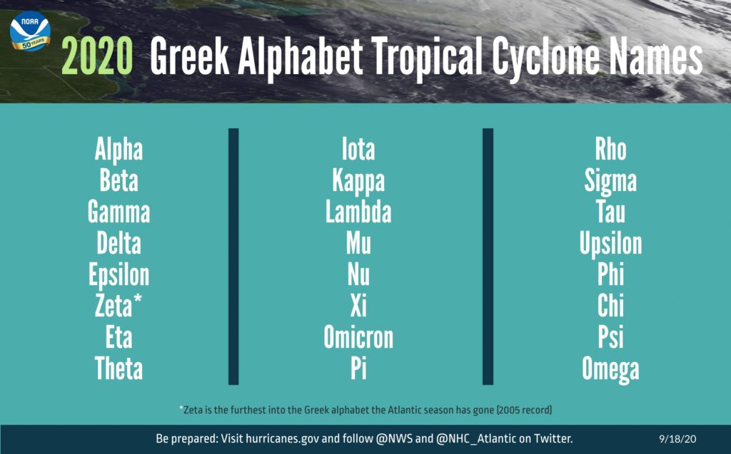
THE GREEK ALPHABET: It’s out with the old hurricane list and into the Greek Alphabet. Already we are two names in. We’ve only had to use this list one other time in 2005. We got down to Zeta that year.
NEXT FEW DAYS: Comfortable weekend! Look at those morning lows Monday through Wednesday. By Wednesday and Thursday, will we be dealing with some of the moisture from Beta? We just don’t know.
FALL BEGINS TUESDAY: Monday is the last day of summer. Fall begins Tuesday.
—
I’ll have another blog update in the morning, or later today if needed. I’ll have new information from the National Hurricane Center.
Stay safe and well. Enjoy your weekend!
–Rich
