
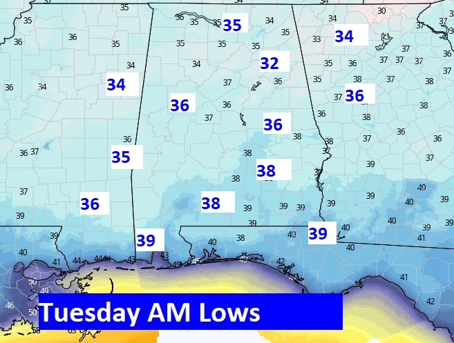
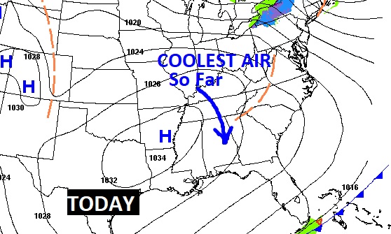
Good morning! Don’t leave the house without a jacket or a sweatshirt this morning. In many cities and towns, this will be the coldest morning of the season so far. Tomorrow morning will be even colder, as we reach the 30’s for the first time. Welcome to November.
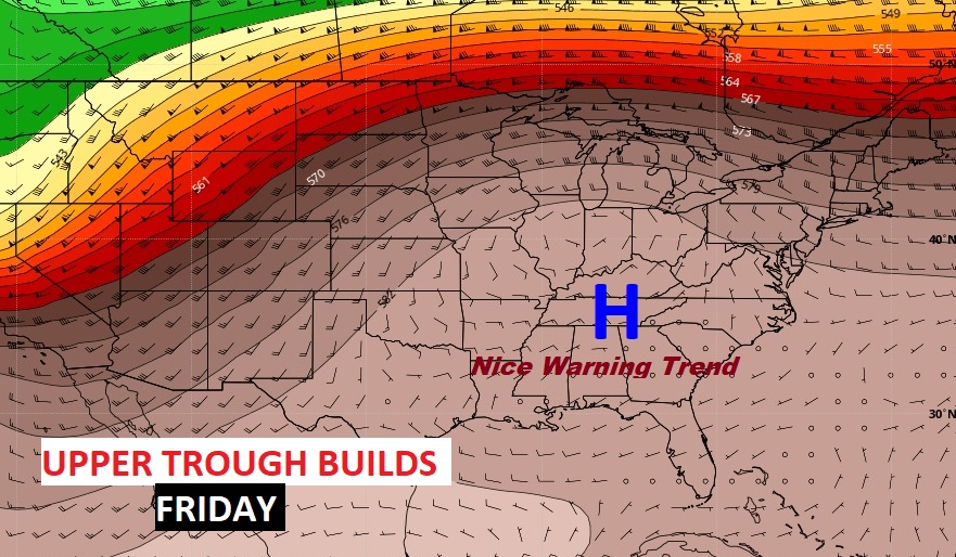
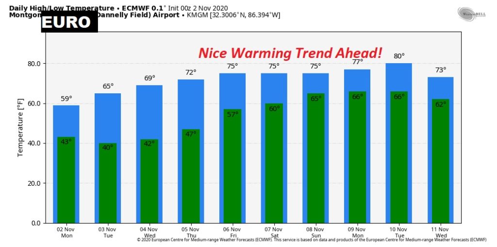
The news for the week ahead is good. Looks like we will be storm-free. One week ago, we were getting ready for Hurricane Zeta. This week will be care-free. And we have a nice late week warming trend to look forward to, which will continue into the weekend. Good news!
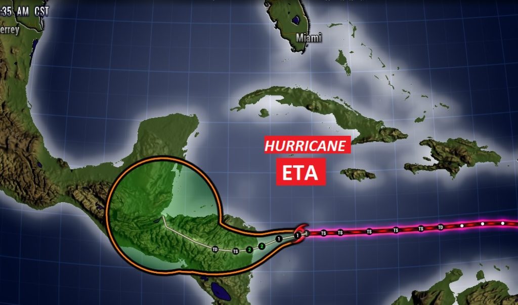
ETA just became a Hurricane in the Caribbean. Where is it headed?
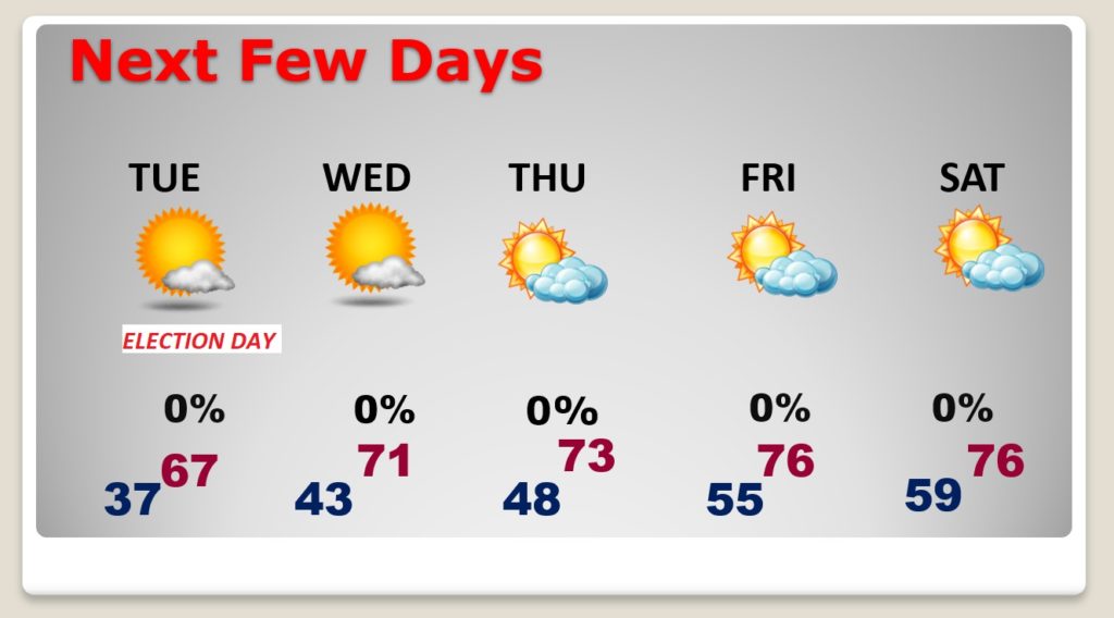
TODAY: Today will be the coolest day of the season so far. We may barely make it to about 61°. (Normal High 74, low 48) Sunshine will dominate. Nice north breeze at 6 to 12. Clear and cold tonight. Overnight low is headed for the 30’s.
NEXT FEW DAYS: Election day, after a cold start, will be pleasantly cool, and storm-free. High 67. We’ll make it into the lower 70’s Wednesday and Thursday. Look for late week warning. High in the mid 70’s
The Upper High, building late in the week will promote a nice warming trend. Beautiful. The warming trend will last through the upcoming weekend. Looks great.
HURRICANE ETA IN THE CARIBBEAN: ETA has intensified overnight, and it just became a hurricane at 4:00AM. It is headed for a landfall in central America. However, the very long range models, warn that Eta’s remnants could linger in that region for days. We’ll have to pay attention.
- –
I will have another Blog Update for you tomorrow morning, bright and early, before Dawn. Have a great Monday! Enjoy this nice air.
–Rich
- –