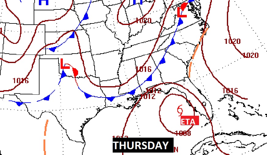
Good Morning! This week will start on a warm, dry note. But, weather changes are approaching. We have ETA in the Gulf of Mexico which certainly has our attention. Meanwhile, an approaching mid-week front may have a powerful effect on Eta’s future track. Will the front arrive in time? I have the latest on the timing of those important systems in the week ahead and the effects for Alabama.
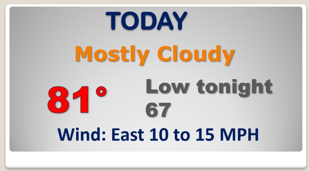
Today will be dry and warm for November. Very mild tonight. Breezy this afternoon.
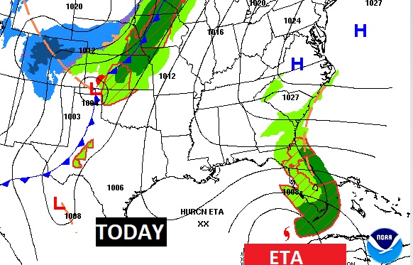
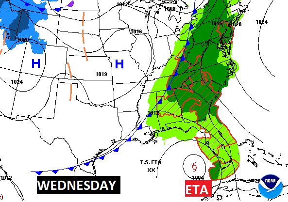
An approaching frontal system will not only increase out rain chance by mid week, it will likely be the steering mechanism that will pick ETA up and steer it toward the Florida Big Bend.
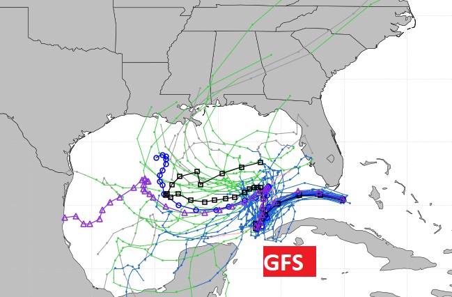
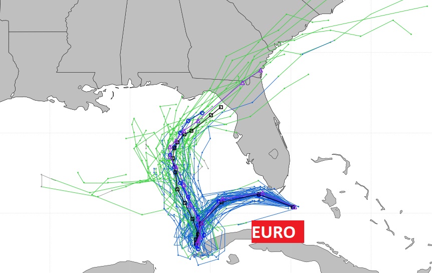
Still though, all the models do not agree on that scenario. The GFS Ensembles area a mess. the EURO is certainly more encouraging, on the idea of ETA being steered into Florida.
Showers return mid-week. Best chance Wednesday, with the front in the state. I’ll keep in a small chance Friday, but I think Saturday will be dry.
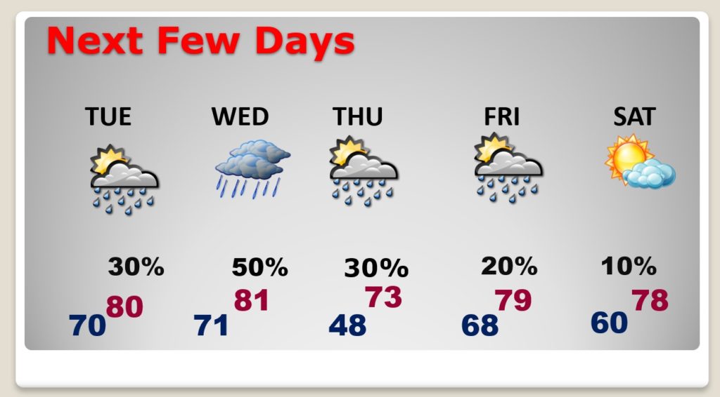
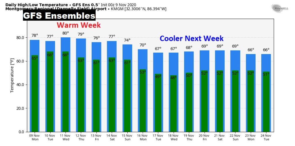
Model trends indicate this will be a warm week, and next week will be a cooler week.
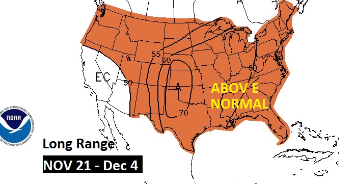
Long range, much of the US could be ABOVE normal late November into early December. Fortunately no Winter Blasts yet.