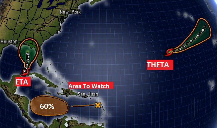
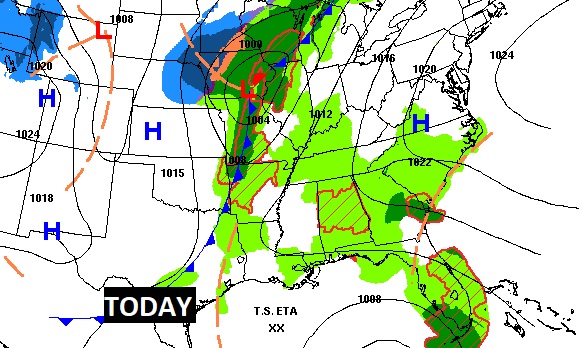
Good Morning! The forecast is little murky for the next few days. There are 2 players in our future: an approaching cool front, and a weakening, northward moving Eta in the Gulf. Showers and storms are back in the forecast today and tomorrow ahead of the front. There are new indications that Eta may weaken before it makes landfall on the coast. But, that’s not all. There’s a newly named Theta in the Atlantic, and in the Caribbean, we may see Lota by the end of the week, as the wild tropical season of 2020 rolls on. I’ll do my best to sort it out for you.
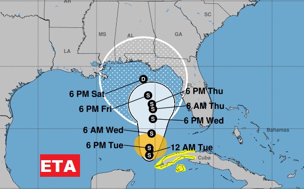
ETA, this morning, is a 50 mph Tropical Storm just north of the Yucatan Channel, nearly stationary. The official NHC forecast keeps ETA slow moving and rather weak, as it encounters a very hostile environment in the Gulf, including wind shear and dry air infusion. It’s possible that Eta may weaken (fade out) all together before Gulf Coast landfall.
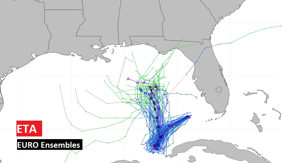
Many of the EURO Ensemble members show ETA weakening and perhaps fading out completely before Gulf coast landfall.
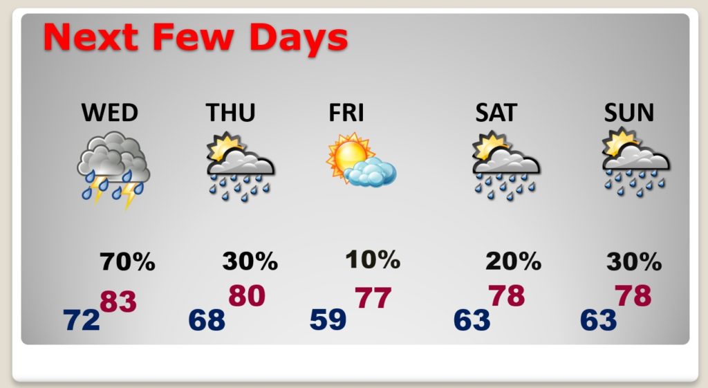
An approaching cool front will bring scattered showers and thunderstorms back to our forecast today, tonight and Wednesday.
BEST rain chance will be Wednesday as the front sweeps through the state. We’ll hold on to a small chance Thursday. Over the weekend, some of that lingering Eta moisture could bring a few showers.
The tropics continue very active. New sub-tropical storm Theta is a “fish storm” . But, that area to watch in the Caribbean could have Gulf implications down the road. Next name on the list if Lota.
