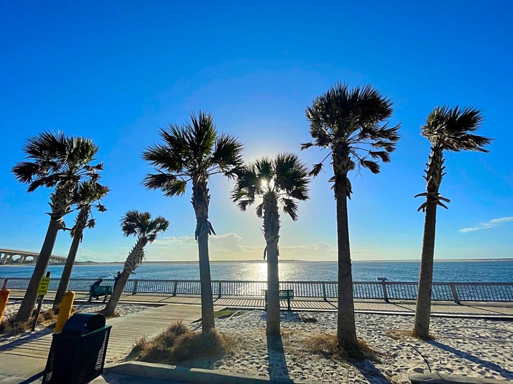
Good Morning! On this last day of 2020, expect another warm day. We had 75 in Montgomery yesterday. We’ll be in the 70’s again today, but big changes are on the way. A significant storm system is approaching, as 2020 ends and 2021 begins.
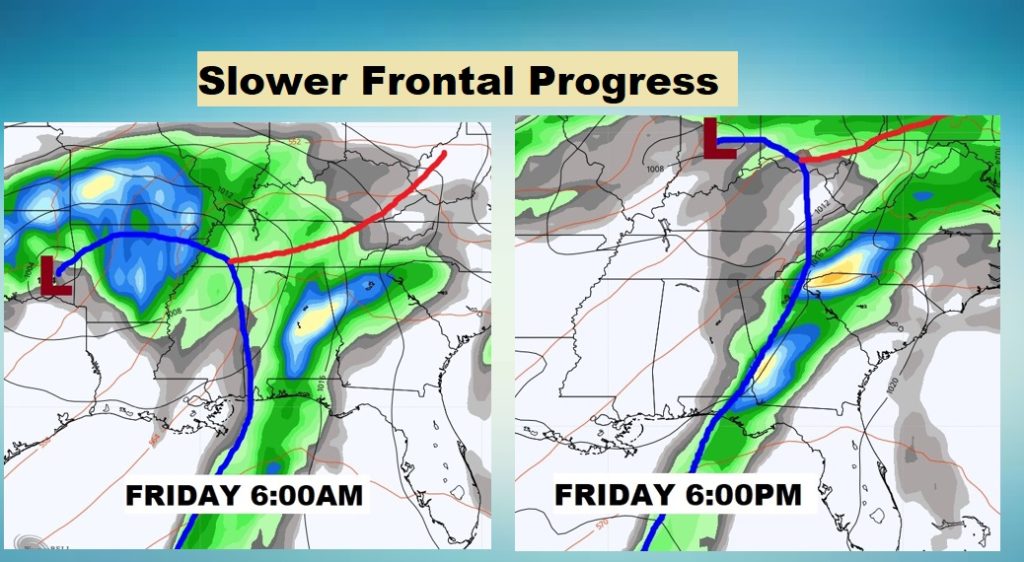
The timetable of the storm system is slower now. The risk of showers and storms will continue for much of Friday, until the storms move east into Georgia. Most of the state remains in a severe weather threat beginning late tonight and well into Friday.
TODAY: Mostly cloudy, breezy and warm. High in the low to mid 70’s Scattered showers possible by this afternoon and this evening. Overnight tonight, temperatures will be in the very mild 60’s, as the storm threat increases. It will become windy.
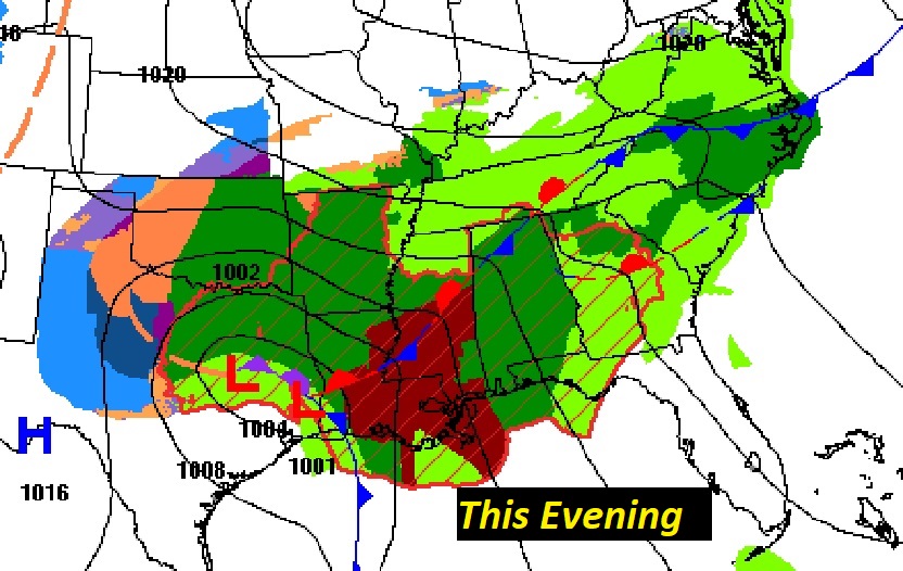
SEVERE WEATHER THREAT TONIGHT: The approaching storm system and frontal system is moving slower now. The threat will begin around Midnight in the far west and southwest counties, and exit extreme east Alabama by about 1PM Friday.
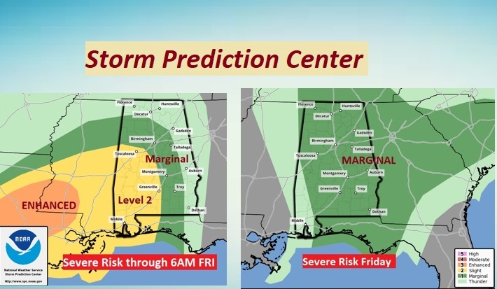
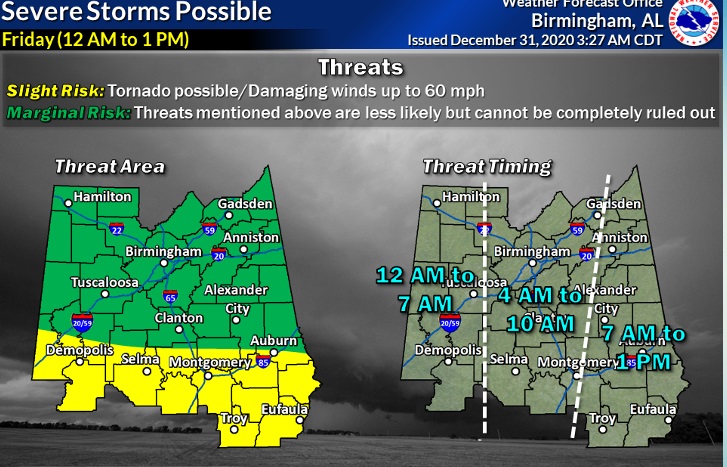
The Storm Prediction center shows a greater Level 2 threat for severe thunderstorms and a few tornadoes over much of west Alabama, (west of I-65) through 6AM Friday. Then, for the rest of Friday, through early afternoon, a Marginal Risk covers much of our state.
The Birmingham NWS office has a slightly different take on the threat level. They extend the Level 2 risk to include much of southeast Alabama as well, as potential storm redevelopment occurs during the daytime heating on Friday. I agree with this assessment. The greatest threat of a few brief tornadoes would be along and south of the US 80/I-85 corridor. Notice the very helpful timeline of their graphic. They show much of central Alabama in a 4AM to 10AM window, with storms exiting the state by about 1.
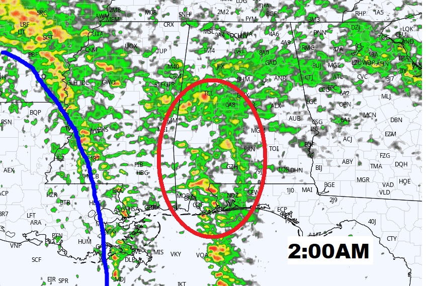
FUTURE RADAR: Here’s a Future Radar loop which covers the timespan from 11PM till 2PM Friday. Note some of the strong cells from Midnight through the morning hours in west and SW Alabama.
Here’s a 2AM snapshot. It’s these discrete cells, well ahead of the main front, which could start to rotate and produce tornadoes.
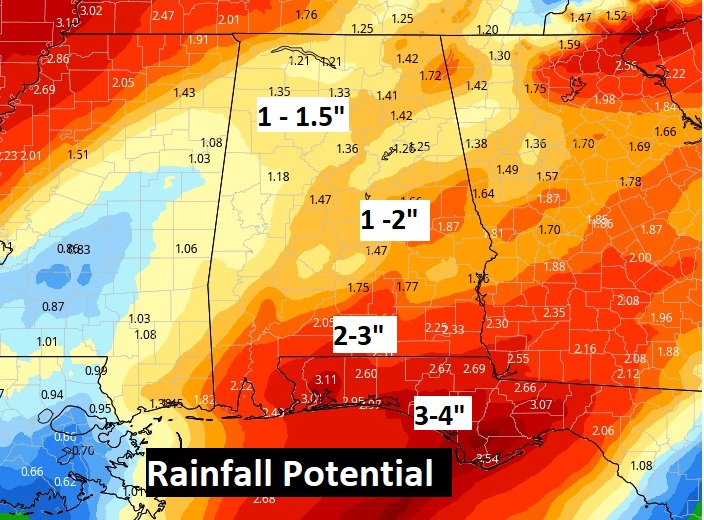
Expected rainfall amounts are not concerning. No flood threat is expected.
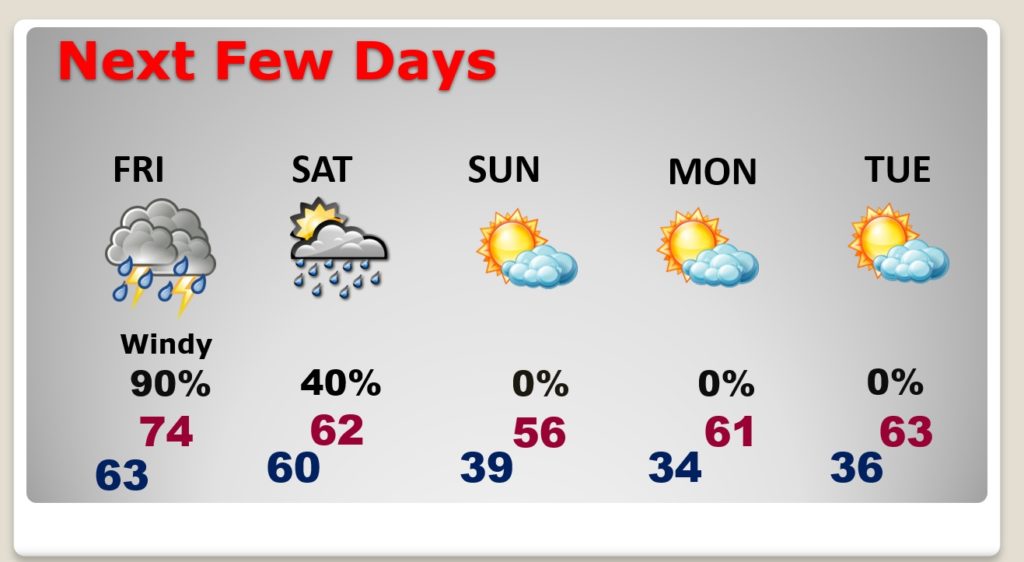
NEXT FEW DAYS: News Years night will be dry. A few showers are possible Saturday as a brief disturbance brushes by the area. Sunday will be nice, but a little cooler. Coldest night will be Sunday night. Another warming trend begins Monday & Tuesday.
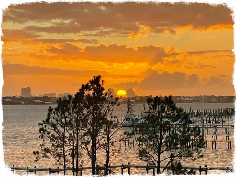
Here is the final tranquil sunset of this truly terrible year, for all of us. A Toast to better days in 2021! Happy New Year!
Chase and I will be headed back northward later this morning. I’ll be in place for any potential severe weather tonight and Friday. I’ll have updates as needed.
Make sure you have our weather app on your phone or tablet. It will instantly alert you to severe weather Watches and Warnings for your location. Go to the app store and search Rich Thomas Weather.
Chase and I enjoyed our brief but very nice stay here in paradise. Happy New Year to you and your family!
–Rich
