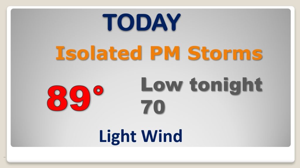
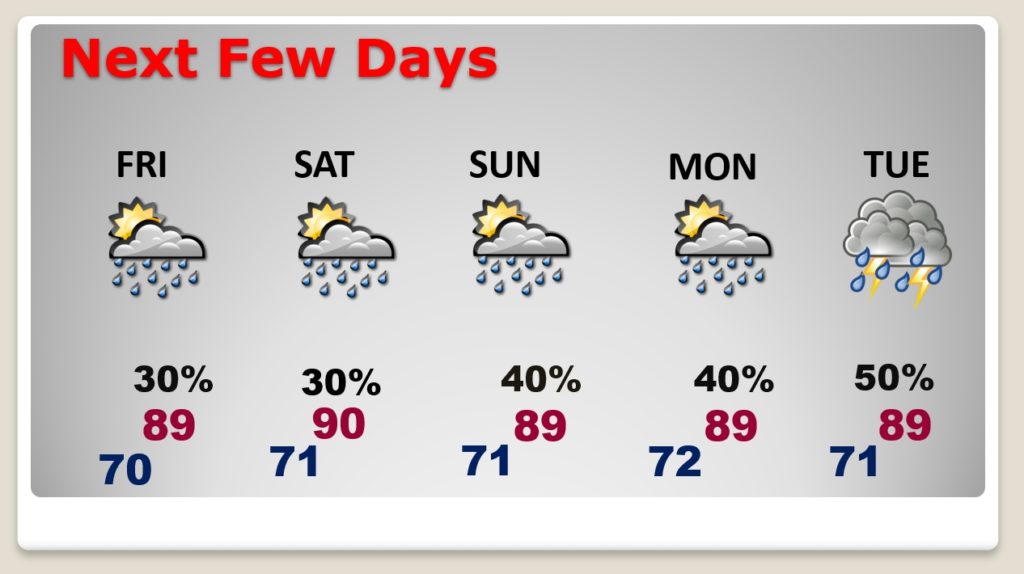
Good Morning! While much of the country sizzles with extreme heat, the southeastern US continues to be the most reasonable area of the country, temperature-wise. This pattern will continue. Some days we may tease 90°, but many days, highs will be held down to the upper 80’s. Meanwhile, our daily risk of random, spotty, “hit or miss” storms will continue for the next few days. There will be little day to day changes. I’ve the updated forecast through the weekend for here and the Gulf Coast Beaches. . Meanwhile, things are getting a little more interesting in the tropics.
Pretty routine forecast. Some widely scattered random storms are possible. Upper 80’s Standard summertime forecast.
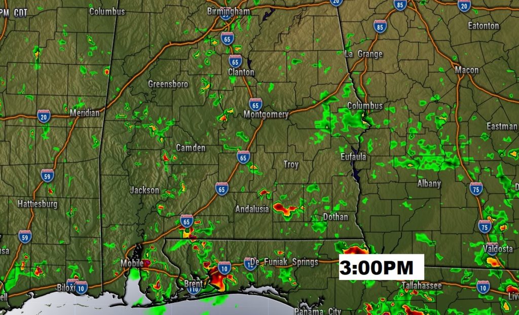
No surprises in the forecast for the next few days. Temperatures will be reasonable for this part of the world, during this time of the year. Spotty random “hit or miss” storms will dot the radar screen each day.
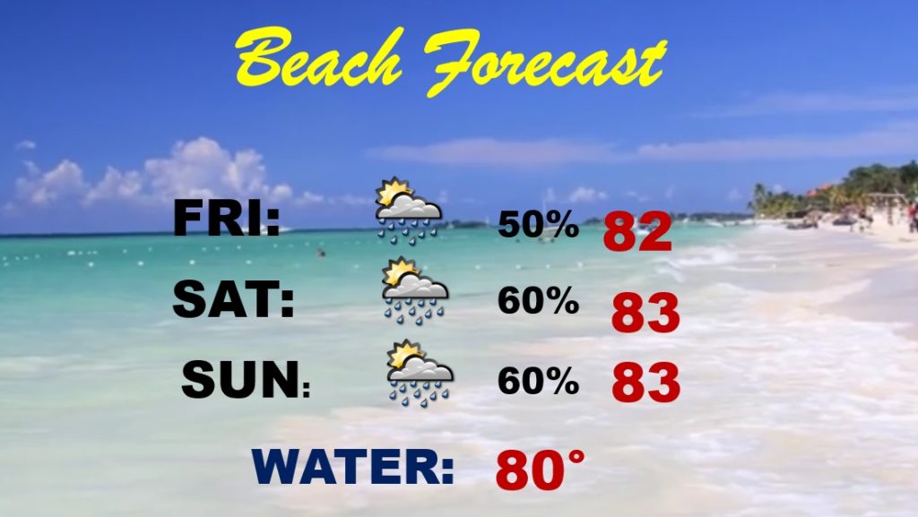
Unfortunately, I had to take the rain chances higher down on the coast this weekend. It won’t rain all the time, but showers and storms will be in much better supply, just like the last few days. The Rip Current risk is HIGH today, but it is forecast to be lower Friday and this weekend.
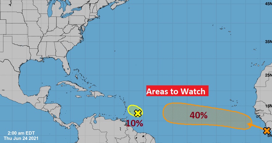
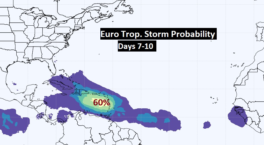
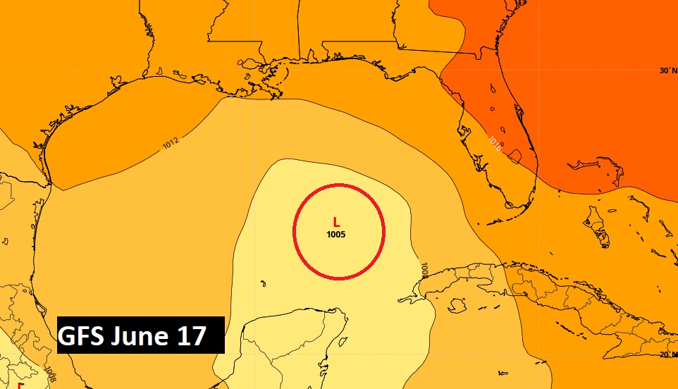
It’s quite unusual for the tropics to be busy way out in the Tropical Atlantic in June. (that normally happens MUCH later in the season) BUT, things are certainly heating up out there. Implications for the Bahamas and the United States down the line? Maybe. Stay tuned. I’m still also worried about the western Gulf next week.