Good Morning! I don’t have to be overly “wordy” today. Our standard summertime pattern continues. Yesterday was “text-book”. High 90. Spotty storms on the radar. Sun/cloud mix. Today and tomorrow will be a carbon copy. Rinse and repeat.
The daily rain chance will get better by the middle of this week as the atmosphere becomes a little more “juicy”. Meanwhile, in the Tropics, we have a new X on the map, off the southeast US coast, inbound.
TODAY: Lots of sun, mixed in with those puffy white cumulus clouds. High today 91. Humid. (Dewpoints will be in the lower 70’s) Random, scattered hit or miss storms, most likely in the afternoon & evening. Low tonight 72. That’s about as standard-formula as our summertime forecast get.
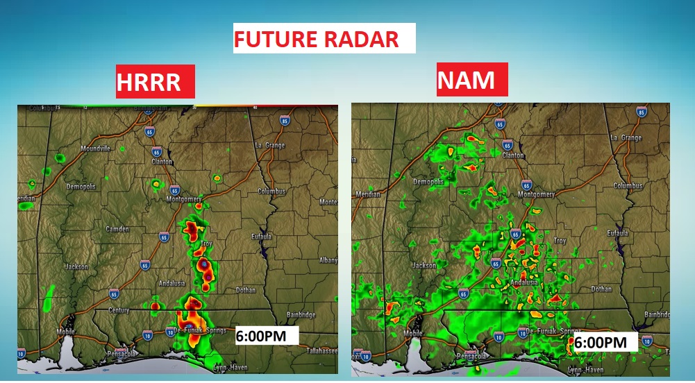
Take a look at the two Future Radar examples I have below. It shows you how variable the models can be in “guessing” on radar storm coverage. The model on the left is the HRRR (high resolution rapid refresh). The model on the right is the NAM (North American model). The NAM is much more aggressive on the rain chance at 6PM. The truth may be in between.
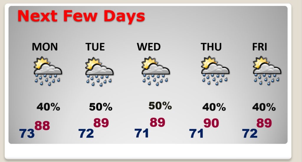
NEXT FEW DAYS: Scattered PM storms Monday and Tuesday. Storms get a little more numerous by Wednesday & Thursday and through the end of the week.
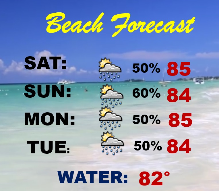
BEACH OUTLOOK: Moderate rip current risk (yellow flag) from the Alabama coast to the Florida beaches around 30-A today. Higher rip current risk (RED flag) closer to Panama City and beyond. Low rip current risk today on the Alabama coast. Higher than normal rain chance next few days. Risk you will encounter an occasional shower or storm. Gulf water now 82.
TROPICS: That system in the Tropical Atlantic, INVEST 95-L now has a 30% of tropical development next 5 days. There is a new X on the Map. An Area to Watch off the southeast US coast, inbound. NHC gives it a 20% chance of development next 5 days.
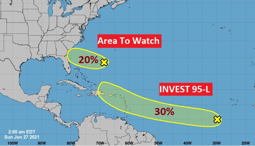
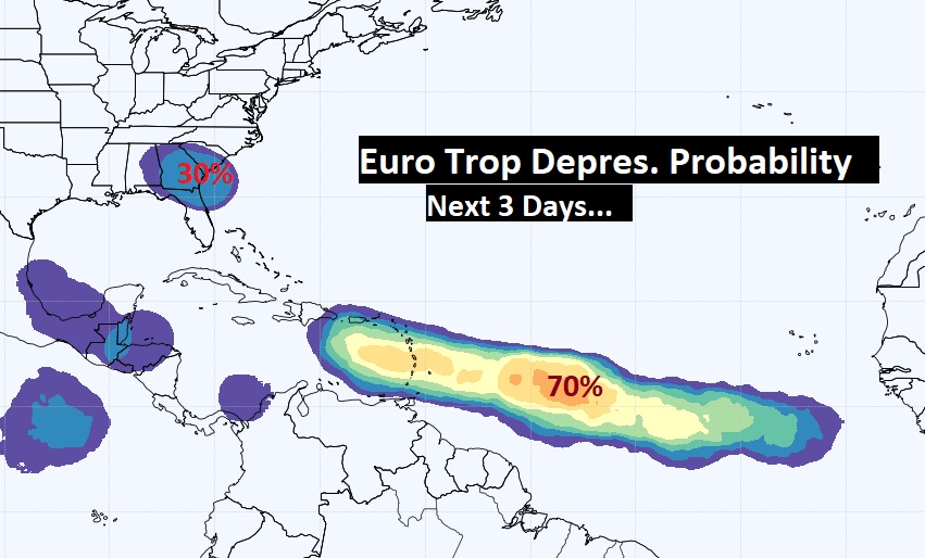
The Euro model ensembles now give Invest 95-L a 60% chance of becoming a depression in the next 3 days. And, the EURO says that disturbance off the SE US coast has about a 30% chance of development.
.
I’ll have a complete video update tomorrow morning. Enjoy your Sunday!
–Rich
