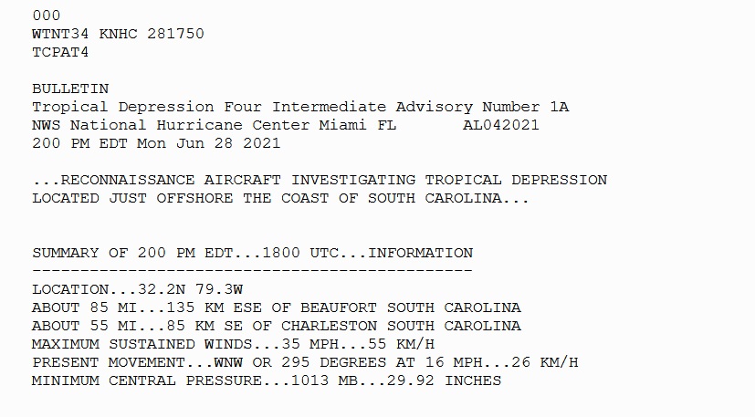
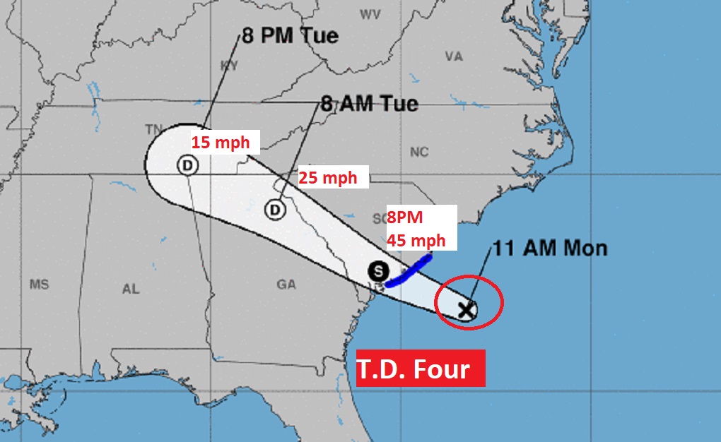
BULLETIN 2:05PM CDT: …DEPRESSION STRENGTHENS TO A TROPICAL STORM… Air Force Reserve reconnaissance aircraft, indicate that the depression has strengthened and is now Tropical Storm #Danny . The maximum sustained winds are estimated to be 40 mph with higher gusts.. Now located about 45 miles off the SC coast.
945 AM UPDATE:
Tropical Depression Four has formed off the SE US coastline. forecast to become a tropical storm Danny before it makes landfall. Rapid weakening is forecast after landfall occurs. Tropical Storm Warning issued for the South Carolina coastline.
EARLY MORNING UPDATE:
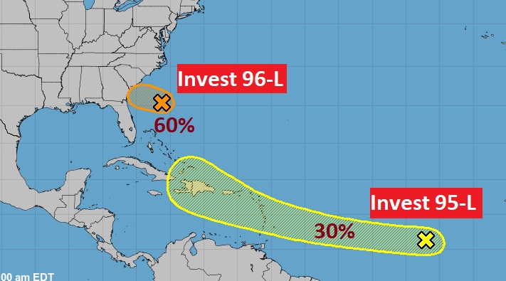
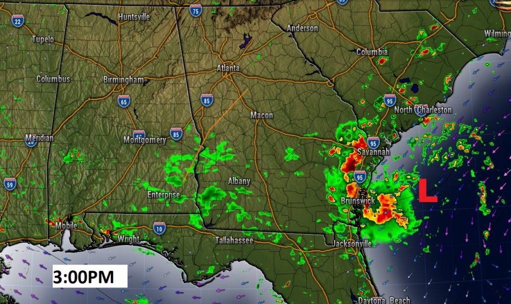
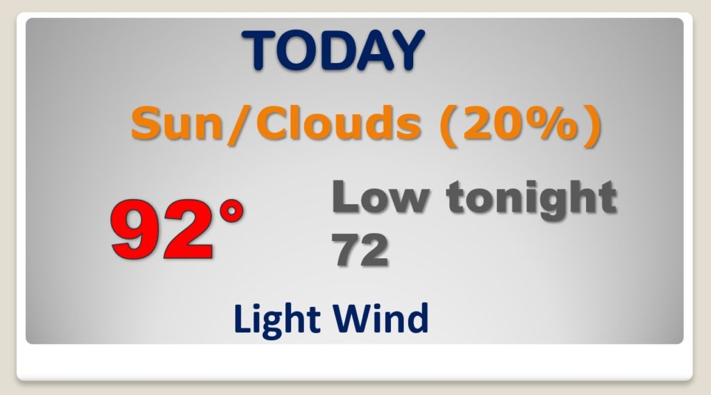
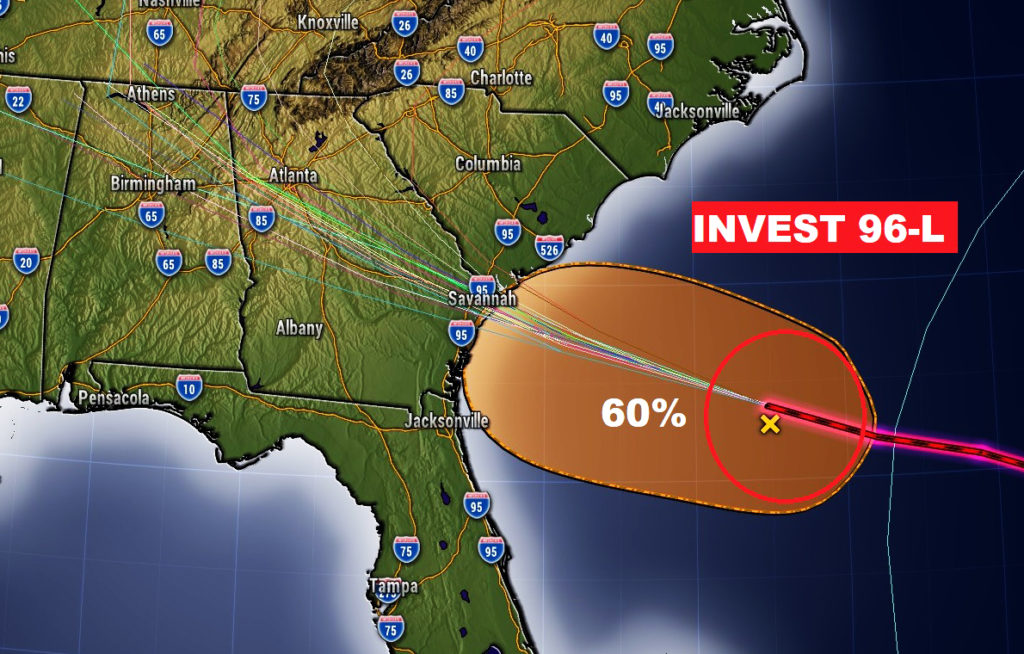
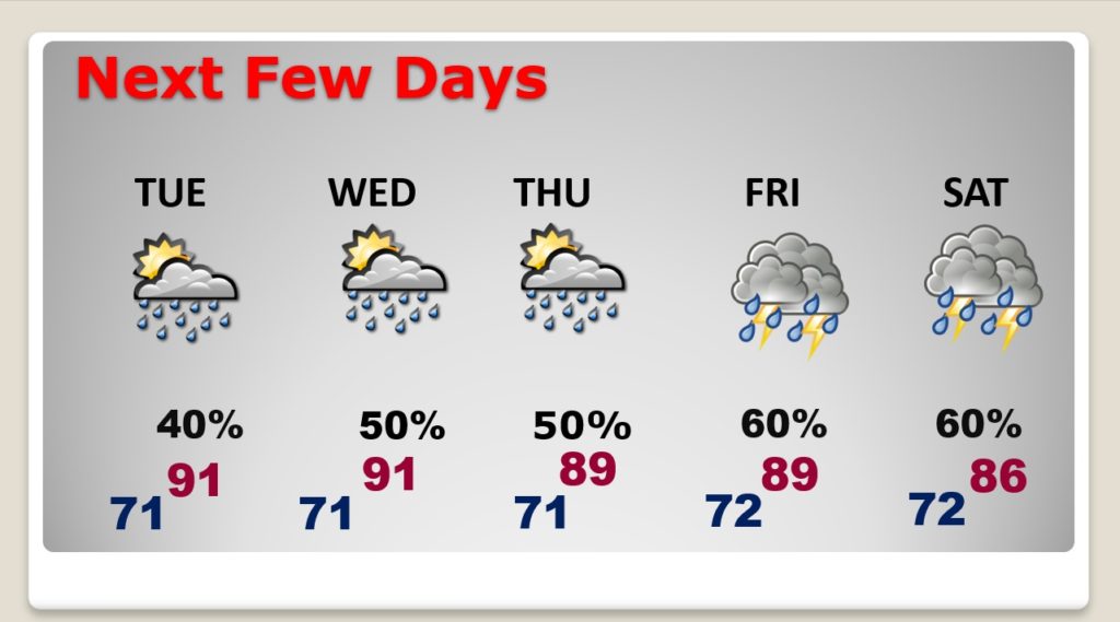
Good Morning! Those random storms will be few and far between today. But, the big story this week… rain chances will be on the way UP. By mid to late week, your odds of getting wet will be a lot better. And, spoiler alert. Showers and storms will be quite numerous over the Holiday Weekend. And, then there’s the tropics. Invest 96-L off the Southeast United States Coast is heading inbound It is now likely that this system will become a Depression or a Tropical Storm. Will Alabama have yet another tropical encounter?
Invest 96-L off the southeast US coastline now has a 60% chance of becoming a Depression or Tropical storm as it heads inland towards the Georgia coast. The models take this system into Alabama,
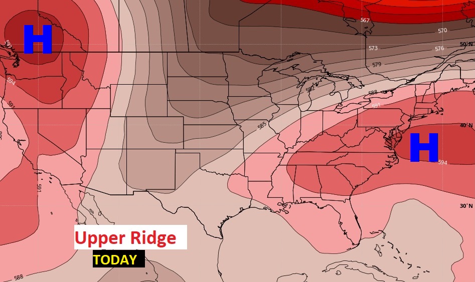
Later in the week, rain chances will get a lot better. That upper ridge of high pressure over us now will shift. It will be replaced by an upper trough.
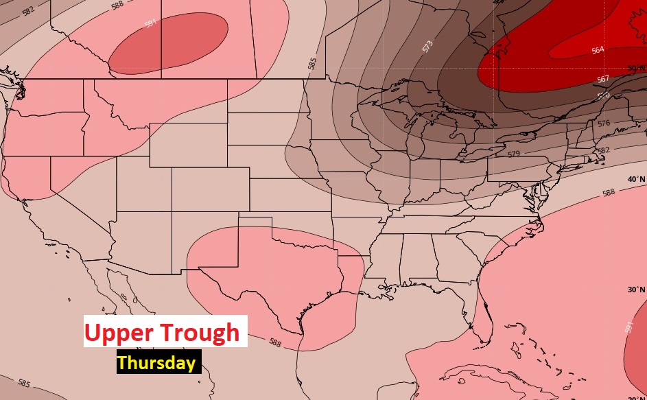
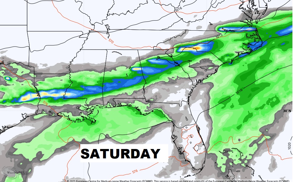
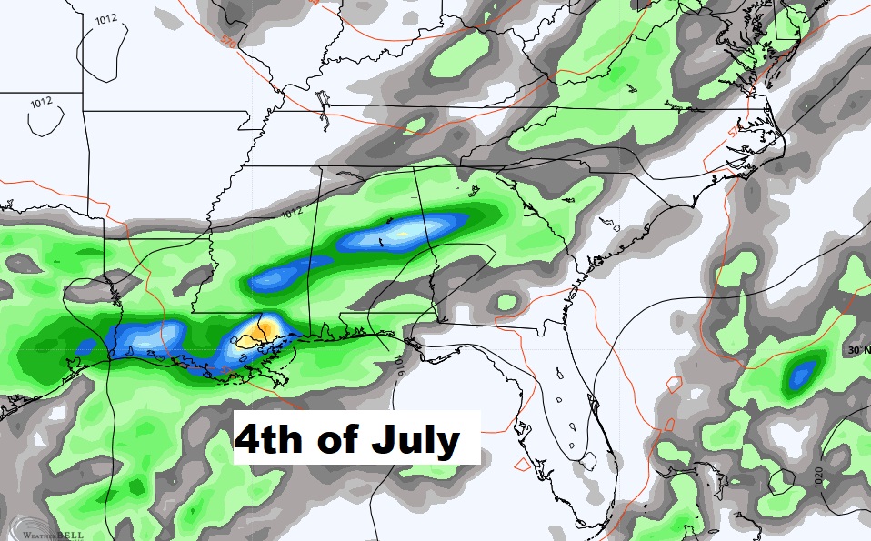
Rain chances will get a lot better by mid to late week and over the Holiday Weekend, too.
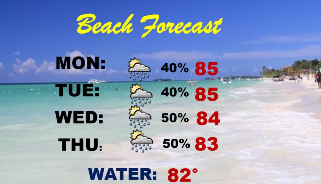
Beach forecast…scattered showers and thunderstorms at times.
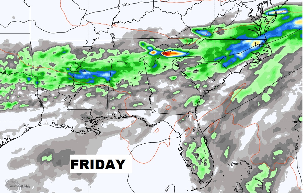
The holiday weekend could be wet at times. Better than normal rain chance as a frontal system moves into the region.
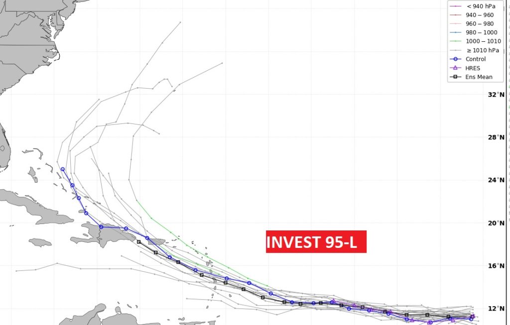
Elsewhere in the tropics, we are still watching Invest 95-L