
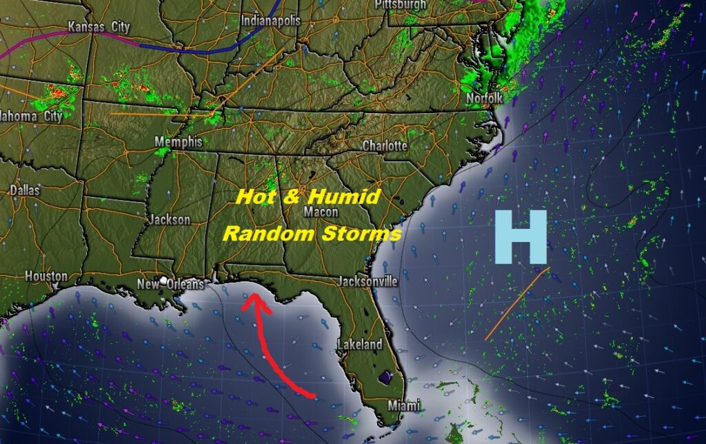
Good Morning! It’s a new day with the same story. The biggest story this weekend is the heat and humidity. For the fourth day in a row, the heat index will reach triple digit level today, and we’ll be close to that level on Sunday.
But, like the last few days, some towns will get lucky. Those familiar summertime random storms will be scattered across the Alabama landscape this afternoon, and well into the evening hours. Some towns could get a lot of rain. Most towns will stay bone-dry. Big heat sometimes produces Big Storms. Some of the storms will put on quite a show again today and Sunday. Lots of lightning & gusty winds.
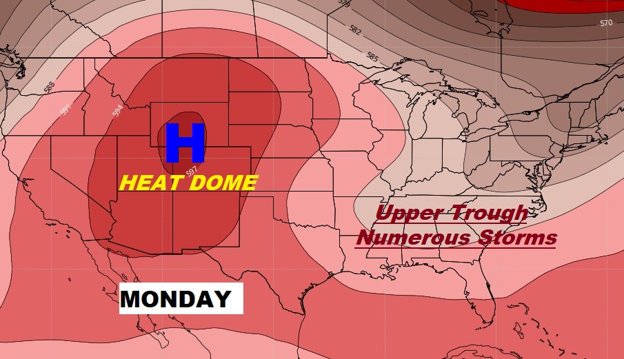
If the storms have been missing your location, your odds of getting wet will dramatically improve starting Monday. Showers and storms will be rather numerous, especially Monday and Tuesday, as a trough of low pressure will be in control.
For now, high pressure is in control off the SE US coast at the surface and aloft.
TODAY: Rinse and Repeat. Today will be much like Thursday and Friday. Sun & cloud mix. Considerable cloudiness with a few sun breaks. Hot & Humid. High near 90. Scattered “Hit or Miss” storms will cool down a few lucky towns. Many cities and towns will get skipped. The storms continue well into the evening, and then fade out overnight. Low tonight 73.
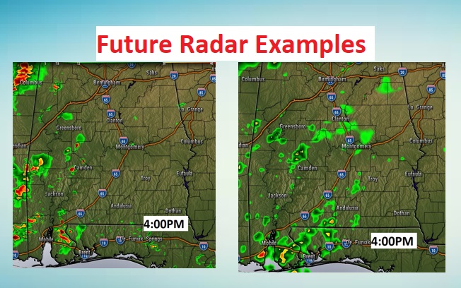
Here’s an example of two of the hi-res models late this afternoon. While the models look different, the point is…the storms will be widely separated.
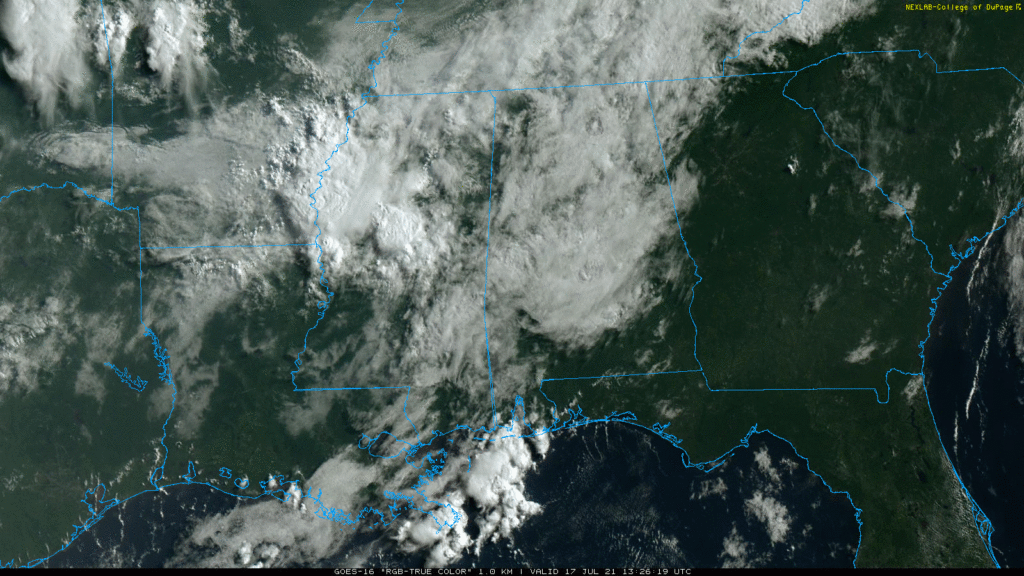
Cloudiness has been a little more extensive than anticipated so far. Hopefully that’s going to help keep the temperature down just a bit, after some brutally hot days this week.
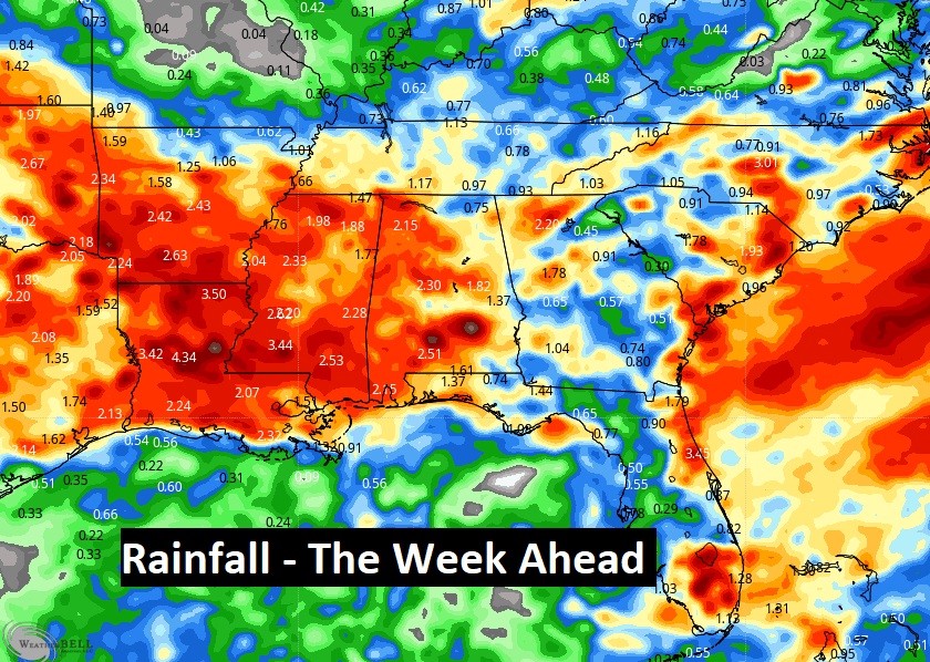
NEXT FEW DAYS: I’ve bumped up the Sunday rain chance slightly. 50/50 coverage on the random storms. Notice a dramatic increase in the number of storms Monday & Tuesday. Widespread showers and storms. That will take the temperatures down a few degrees.
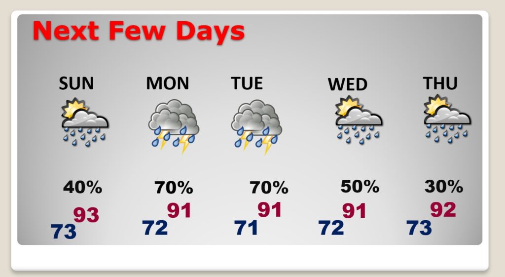
The upper trough, which will develop, will make for wet times in the week ahead, from Texas across the Southeast US.
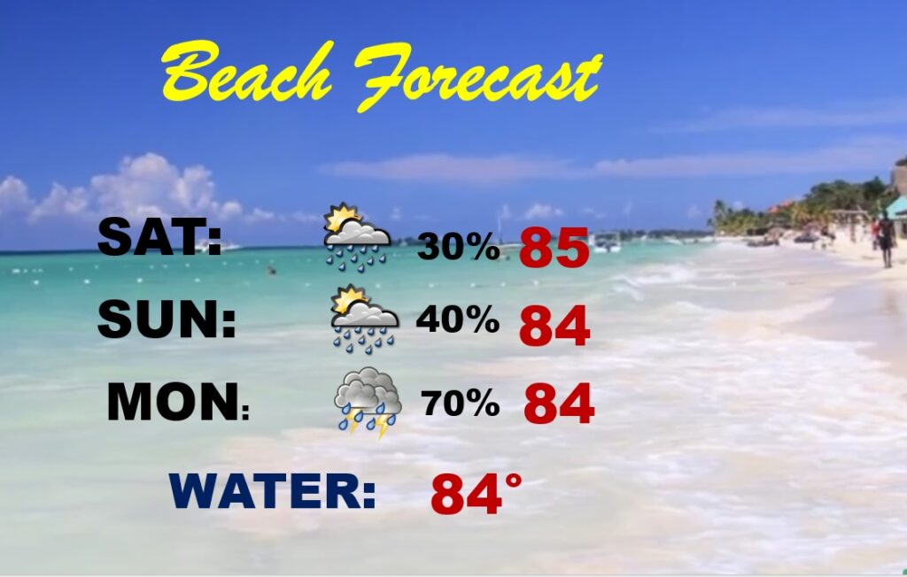
BEACH OUTLOOK: Routine weekend. Scattered storms. High in the mid 80’s. Showers and storms become numerous Monday. Gulf water temperature at a season high of 86. Moderate rip current risk from about Destin through Panama City.
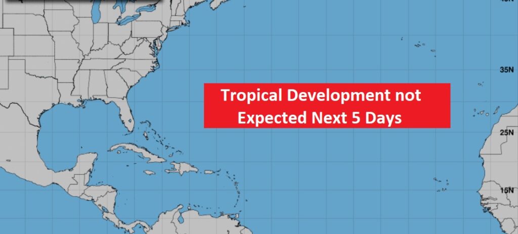
TROPICS: Fortunately, at least for now, the tropics are quiet as a mouse. This current “null” pattern could last for at least another couple of weeks. Enjoy the quiet pattern. We know this won’t last.
Yesterday, at my house in East Montgomery, we got SO close to getting a nice downpour. We had thunder and lightning, but not ONE drop of rain. Four miles northeast of me, there was 1.41″! That’s what I’m talking about when I say feast or famine. It’s a neighborhood by neighborhood thing in the summer.
I’ll have another Blog update tomorrow morning. Enjoy your weekend!
–Rich