Good Morning! This second week of August is likely to be hotter than last week. Middle 90’s, with triple digit heat indices are likely each day through Friday. Random scattered afternoon & evening storms will cool down some lucky tows. Storms will become a little more numerous than over the weekend. Meanwhile, all eyes on the tropics. We now have two Invests in the Tropical Atlantic. The lead Invest could potentially have implications down the road for the United States and the Gulf of Mexico.
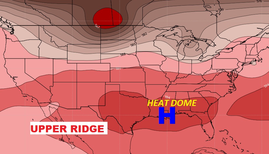
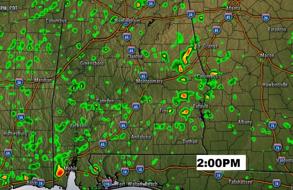
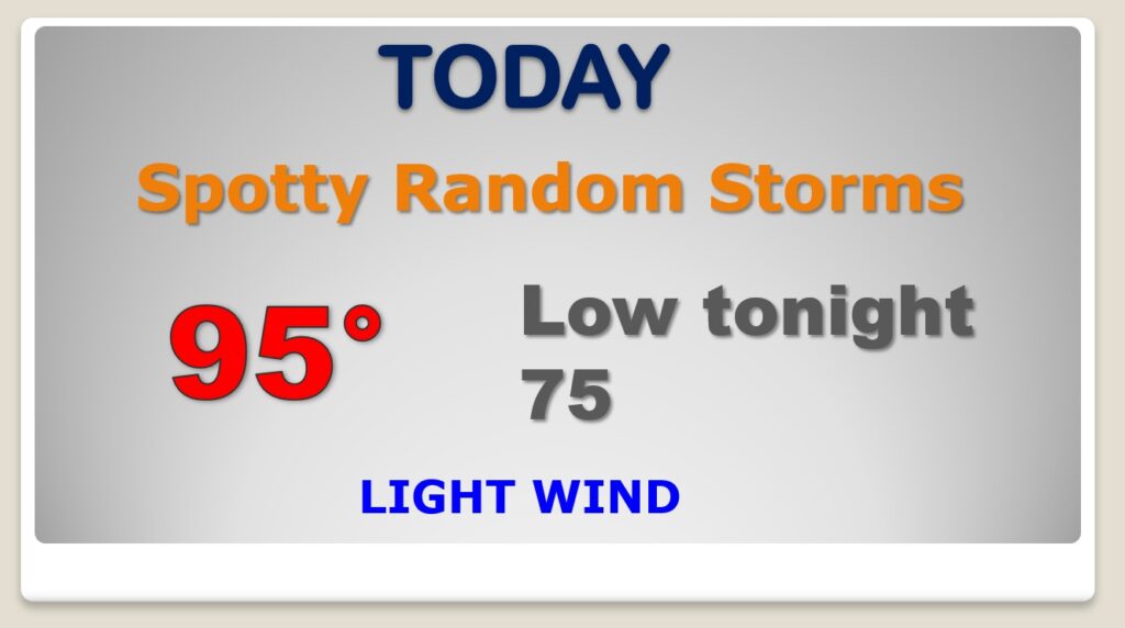
As a big Upper Level High builds over us, the big story today will be the Heat. With highs in the mid 90s, the Heat Index could easily reach 100-103. Spotty PM storms will be a little more numerous than over the weekend.
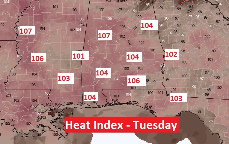
Hot all week. Each day through Friday, the heat index will tease the 105 danger range. Here’s a sample of Tuesday an 1PM.
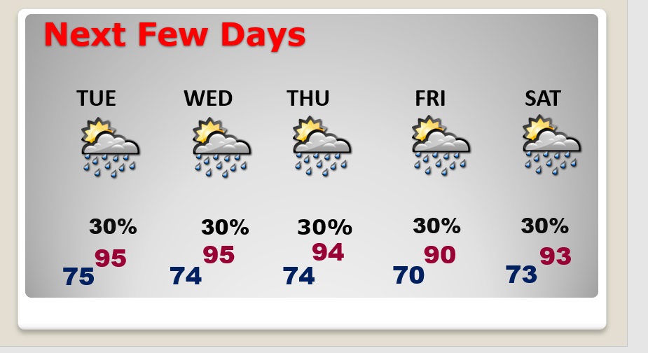
Very little day to day change. Highs in the middle 90’s. Lows in the middle 70’s. Scattered random storms each day.
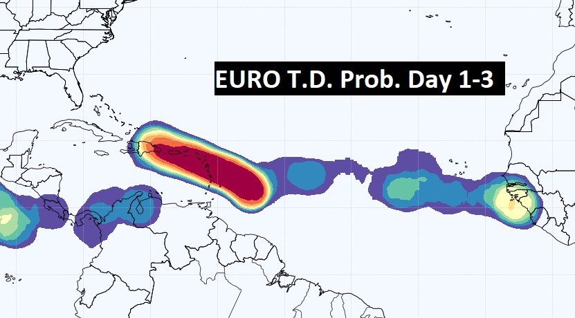
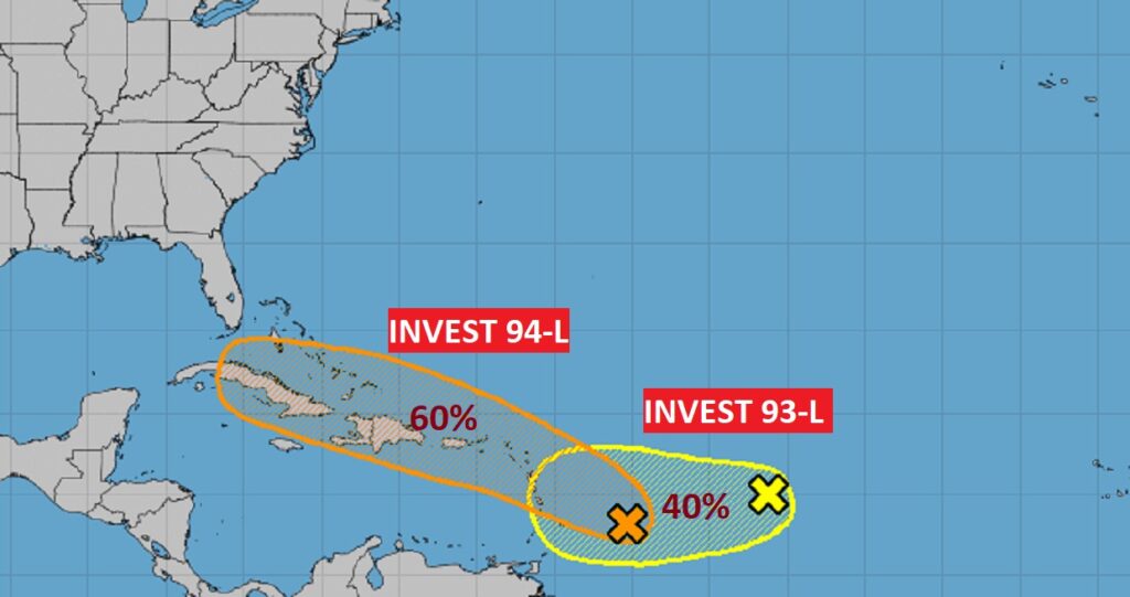
The Tropics continue to look more interesting. NHC is tracking Invest 93-L and 94-L. It appears the one we really need to monitor, Invest 94-L, the lead system, which could have future implications, in a few days for the Bahamas, the southeastern US and ultimately, perhaps the Gulf of Mexico.
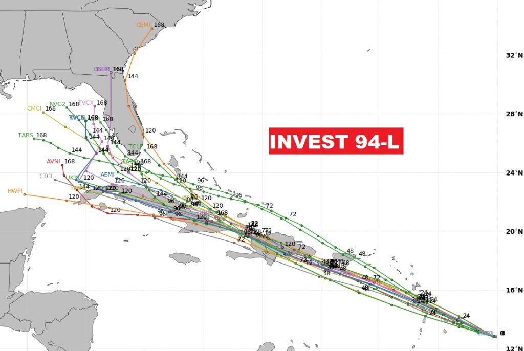
The Euro Model gives 94-L a 90-100% chance of becoming a depression in the next 3 days.
