
Good Morning! Happy FOOTBALL SATURDAY.. I think, all things considered, the Labor Day weekend forecast is pretty good. Dry through Sunday. Yes, it will be HOT, but, humidity levels will be fairly reasonable for this part of the world in the summer. Showers and thunderstorms return to the forecast on Labor Day, Monday.
Meanwhile, all of sudden, Invest 91-L has our attention. Could we see a Tropical Storm in the Gulf next week? Details below.
DEWPOINT AND COMFORT: Dewpoints mean everything, during the hot summer, as far as our comfort level. In the summertime, here in Alabama, our dewpoints, everyday, are in the awful 70’s. Terrible. Typically 72 to 77 everyday. Oppressive to miserable. Yesterday at 4PM, Montgomery’s dewpoint was 63. (Actual high was 90). Today at 4PM, model guidance suggests the dewpoint will be 59. That’s pretty good! Tomorrow, Sunday, the 4PM dewpoint will be 66. We go backwards. But, that’s still not awful. Do you follow me?

TODAY: Abundant sunshine. Rain chance near zero. High near 90, but relatively tolerable humidity. East wind 4 to 8 mph. Relatively comfortable tonight. Low near 70.
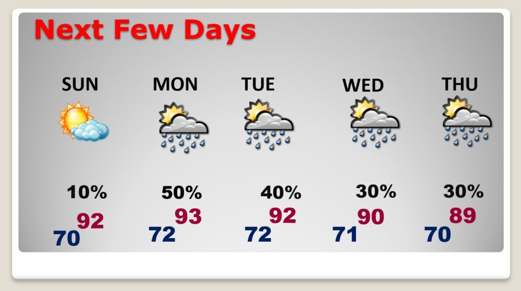
NEXT FEW DAYS: Dry Sunday. Hot, but a nice day. Low 90’s. Labor Day Monday—A line of Showers and thunderstorms will move southward ahead of a front. Beyond Tuesday, we’ll have to monitor the Gulf very, very carefully.
GULF TROPICAL TROUBLE SOON?: Invest 91-L is near the Yucatan now. Broad low pressure. It’s destined for the Gulf of Mexico. Will it develop? It’s in a hostile environment over the next couple of days, but environmental conditions will improve in a couple of days. Could it develop into Mindy? Some models say yes. We’ll see. Elsewhere, in the Atlantic, Larry is a major Cat. 3 hurricane which could have a big impact on Bermuda.
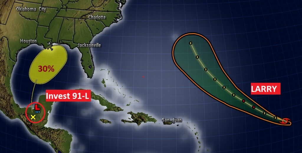
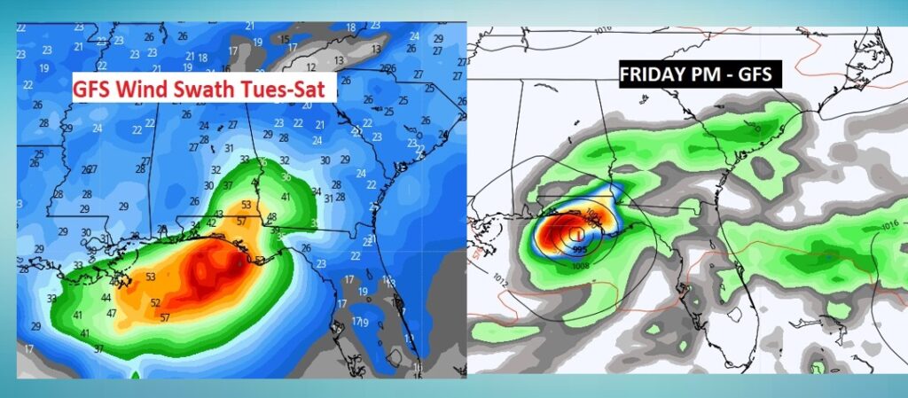
Uh oh. Here’s a sample of some of the models and future potential intensities. Some models have Invest 91-L near or beyond Tropical Storm intensity by mid-week. Stay tuned. The PEAK of the hurricane season, statistically, is September 11th.

Could Invest 91-L become a tropical storm in the Gulf this week? It’s not completely out of the question. Don’t take this to the bank, but here’s what the GFS does to the tropical system’s future Tuesday PM through Saturday. We’re just looking. Mindy is the next name. #ALWX
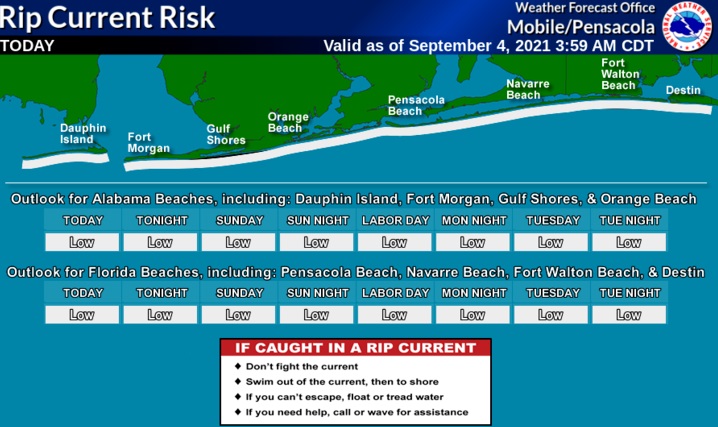
BEACH FOREAST: Pretty good Beach Forecast. Dry through Sunday. Risk of thunderstorms Monday. Rip current risk is now listed as low for the Alabama coast to about Fort Walton Beach. Moderate Rip Current risk, yellow flags east of Destin through Panama City.

I’ll have another Blog update tomorrow morning. Have a great FOOTBALL SATURDAY.
–Rich