
Good Morning! Early this morning, a “Real-deal” Cool Front is sweeping through the state. When the front passes your location, winds will shift to the west, and then northwest. Winds will be quite gusty, as high as 20 to 25 mph.
Today’s high will be about 17 degrees cooler than yesterday. Tonight will turn dramatically cooler. Jacket Weather. Temperatures will fall into the 50’s this evening and into the mid & upper 40’s by Dawn. We could see three nights in a row in the 40’s. This will be the coolest air of the season so far. Coolest morning, so far this season, was September 25th with 52 degrees.
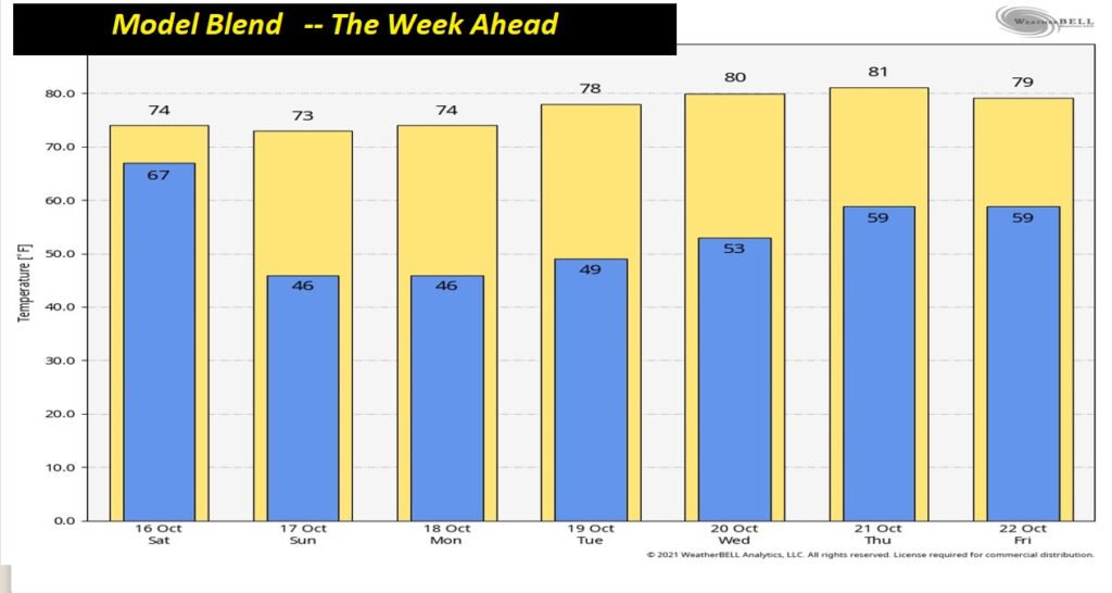
TODAY: Sunny, windy & cool today, behind the front. Northwest to north wind will increase to 15 mph, gusting, at times 20 to 25 mph later. Yesterday’s high was 90. Today’s high 73. Mainly clear and sharply cooler tonight. Jackets will be needed. Evening temperatures in the 50’s Overnight low, by dawn, perhaps as low as 46.
The col front has already cleared the state. By 7PM tonight, it will be near Tampa. Coolest air of the season will filter in behind the front.
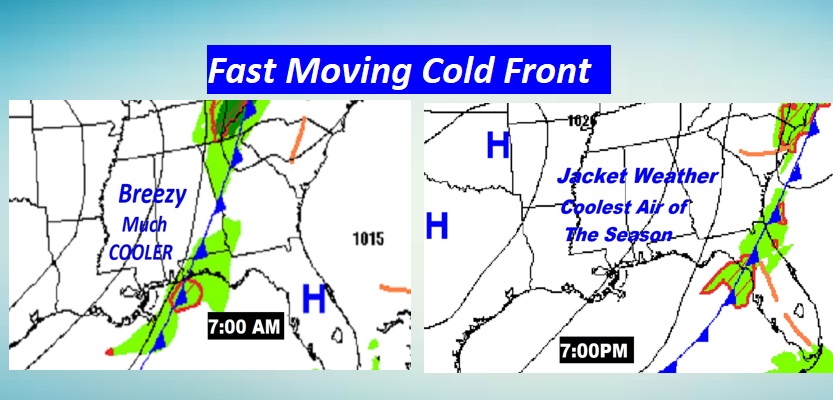
By Dawn Sunday morning…Lows will be in the 40’s just about statewide. Coolest so far.

NEXT FEW DAYS: Perfect Fall Day Sunday. Jacket weather start. Sunny, breezy, comfortably cool. Chilly mornings through Tuesday. A little warmer Tuesday through Thursday afternoon. Chance of late week showers.

Series on Jacket Weather Nights. Warmer days and nights by mid and late week.
TROPICAL UPDATE: For the first time since August 2nd, the Atlantic has a completely empty five-day Tropical Weather Outlook.

.
I’ll have another Blog update tomorrow morning. Have a great SATURDAY. I will be broadcasting from the Alabama National Fait today from 2 to 4PM, and Sunday from Noon to 2PM. I’ll be in the Bluewater Broadcasting booth in the center of the Midway. Come by and say hi! Enjoy your weekend.
–Rich