Good Morning! We’re batting a thousand on the weekend weather. While clouds will increase today, there will be a good bit of sun filtering through, especially early. It will be another warm, comfortable October day.
Enjoy today. We’re getting into a more active part of the year. Two fronts will sweep through the state in the week ahead. The mid-week front in particular could bring strong/severe storms, including a potential tornado risk. Brisk Fall Air will sweep in at the end of the week, toward the weekend.
TODAY: Increasing high clouds. Becoming mostly cloudy. Warm & dry. High 83. (Normal high 78 Low 51… yesterday we had 78/51, exactly normal). Southeast winds 5 to 10 mph. Very mild tonight. Mostly cloudy. Low 64.
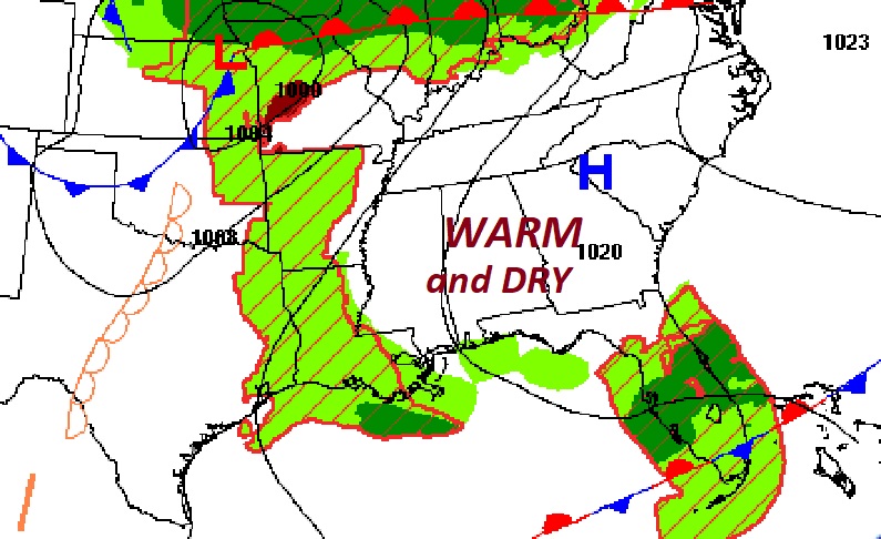
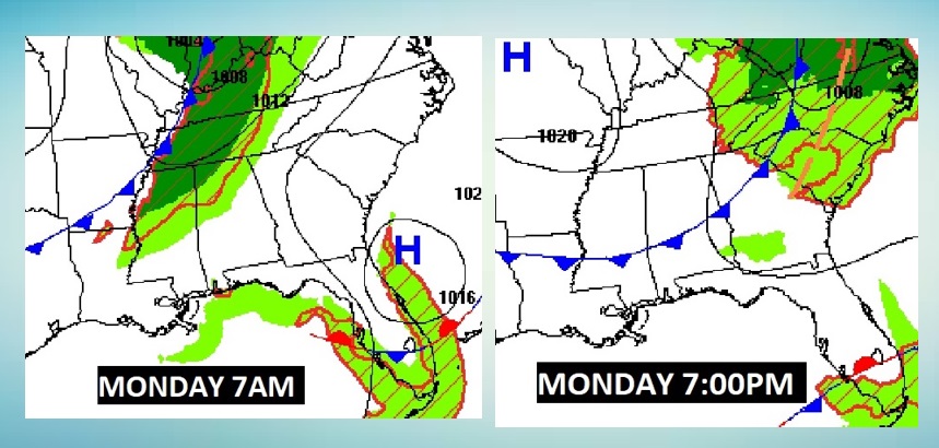
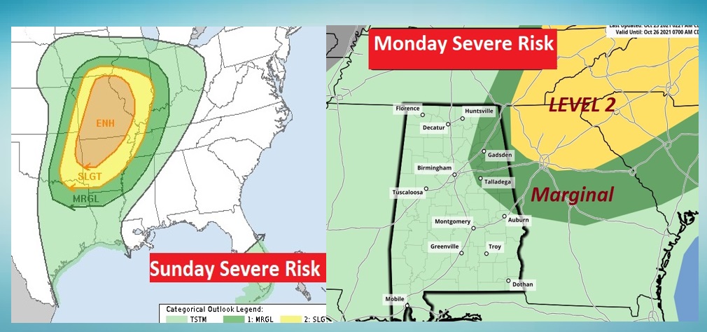
MONDAY: Today, the cool front in the Midwest today will bring a significant severe weather threat to mid Mississippi valley, however, when the front reaches Alabama, most of the “dynamics” for severe weather will be well north of our state. The front will much calmer as it moves through our state.
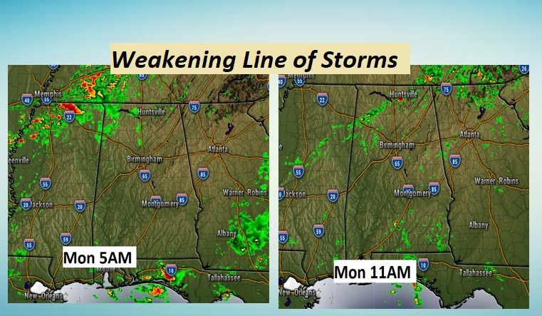
Here’s a sample of hi-res Future Radar. It shows a weakening band of showers and storms sweeping southeastward. I have lowered the rain chance to about 20 to 30% locally.
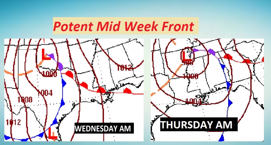
Mid-Week STORM SYSTEM: A rather potent storm system/frontal system in Oklahoma/Texas Wednesday will bring a band of showers/and storms to Alabama, especially Wednesday night into early Thursday.
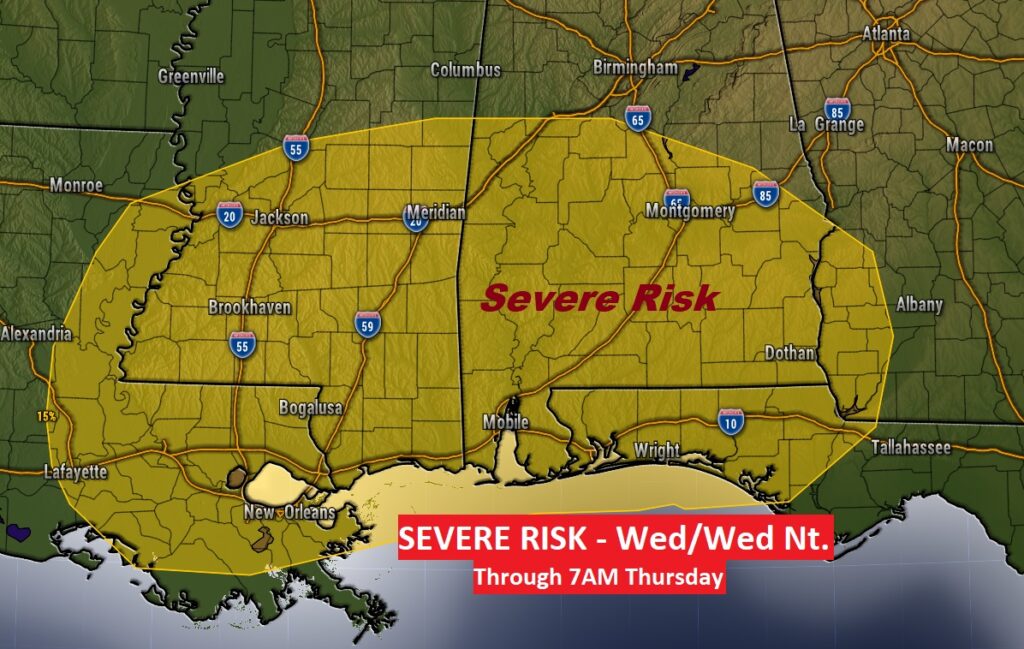
SPC has outlined a Severe Weather Risk which now covers most of the southern half of the state. This will include a tornado risk. We’re still a few days out. This threat area will be adjusted as we get closer to this event. The fact that the main band of storms moves through in the overnight hours, could limited the severe potential a bit. More on this as we get closer.
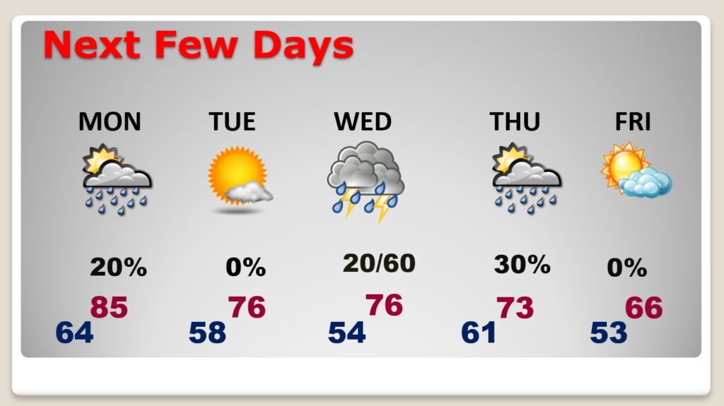
NEXT FEW DAYS: Small Risk of thunderstorms Monday with the weakening front. Cooler and nice Tuesday behind the front. Much of Wednesday could be dry, before strong to severe storms overspread the area overnight Wednesday into Thursday. Brisk Friday. Windy and cooler.
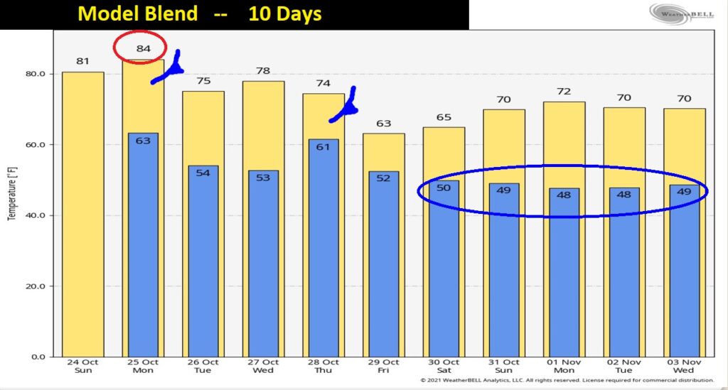
Take a look at the Real Nice Fall Air which sweeps in Thursday night and beyond.
.
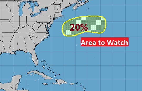
TROPICAL UPDATE: Quiet in the tropics. One Area to Watch in the north Atlantic with a small chance of development.
.
This morning’s Blog update is slightly later then usual. I was watching the amazing Braves last night, advance to the World Series for the first time in 22 years. Big deal to me. I am a part of every Braves game all year, and there were some very dark days earlier in the season. But, I digress… 😊
I’ll have a complete video in the morning. Enjoy your Sunday!
–Rich
