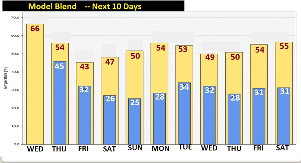
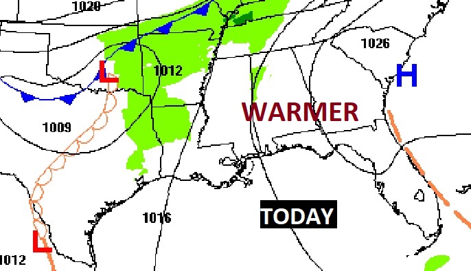
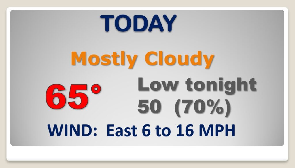
Good Morning! Get ready for more significant weather changes as another Cold Front approaches. Today will be quiet and milder. We’re headed for the middle 60’s for perhaps the last time in January. Rain arrives late tonight ahead of the Cold Front. The rain continues on Thursday, primarily through mid-day, as temperatures begin to tumble by afternoon. Another batch of precipitation arrives in the wee hours of Friday morning. Will it be all liquid, or could there be a Wintry mix? It depends on which model you’re looking at. On this video, I’ll bring you up to date on the potential scenarios. Get ready for yet another taste of some Arctic Air for Friday and over the weekend. Another visit from Old Man Winter.
Today will be dry, quiet, and milder. We’re headed for the 60’s. Rain arrives in the wee hours late tonight.
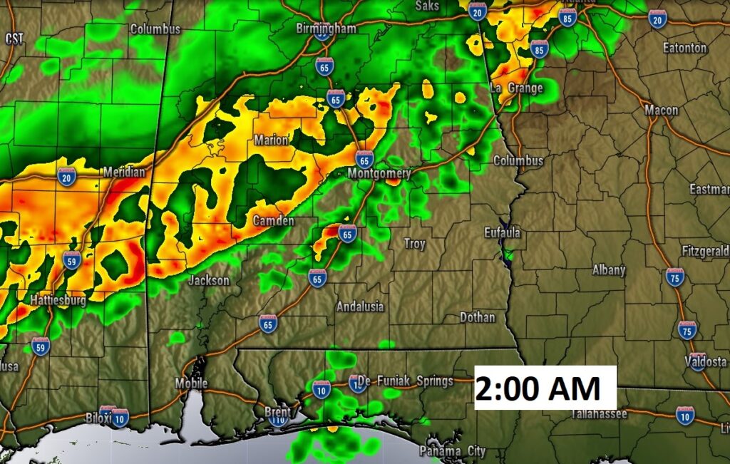
Rain through Mid Day Thursday. Falling temps. in the afternoon behind the cold front.
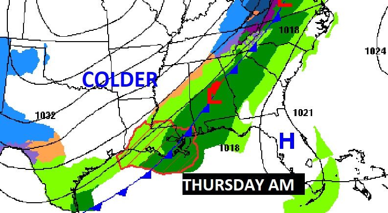
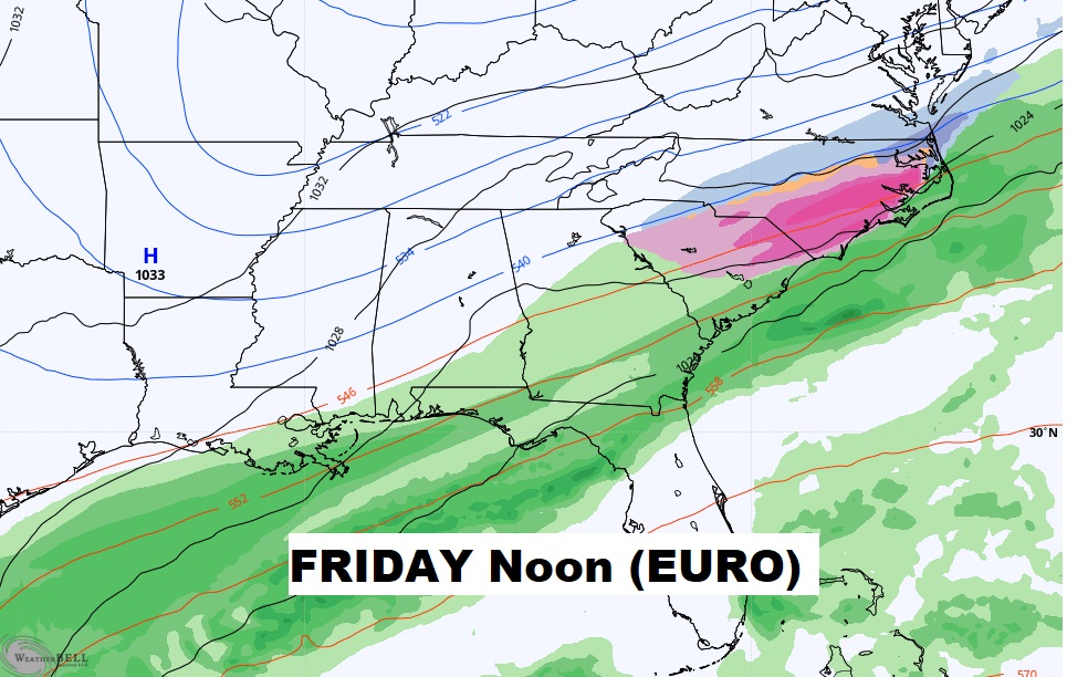
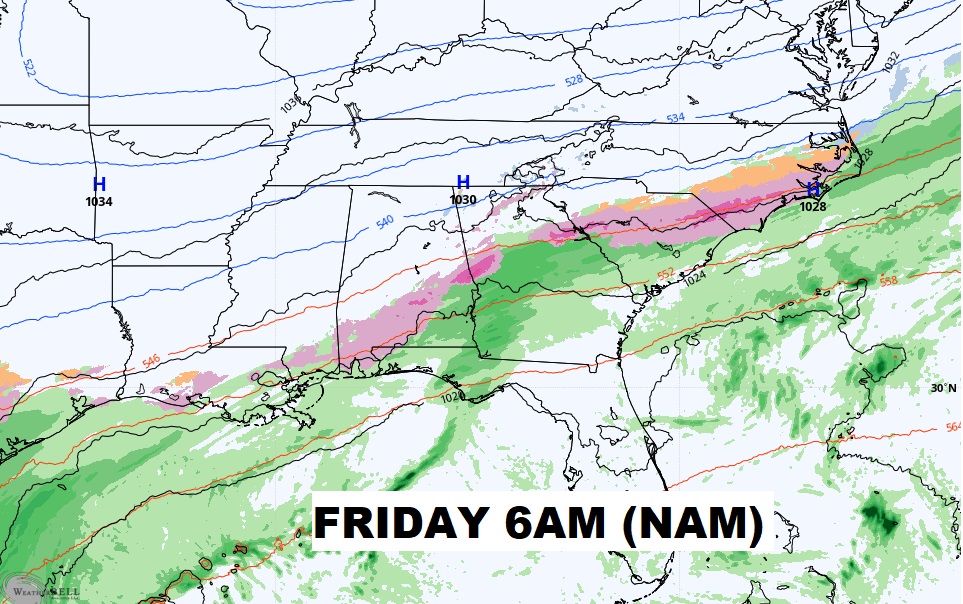
Question marks about the next batch of precip Friday, as a wave of low pressure moves along the cold front it the Gulf. Will just be rain? Or something else. The EURO and GFS model suggests raun for most of us. The NAM model warns of an icy mix on the northern edge of the precip shield.

Whatever falls from the sky, expect falling temperatures Thursday PM. Friday, Saturday and Sunday will be quite cold during the day and very cold at night. Slight recovery Monday.’
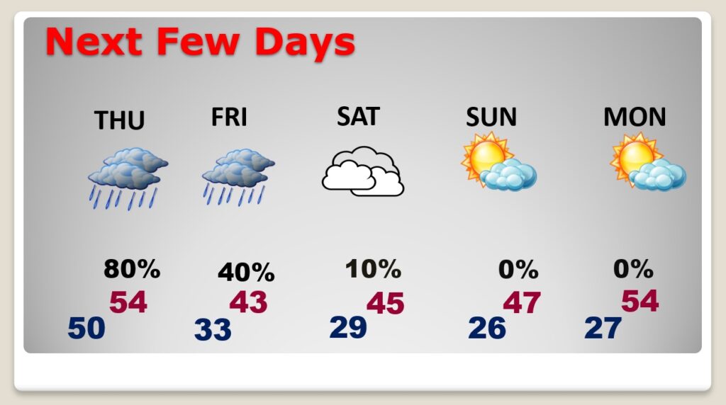
We may not see the 60’s again in the month of January after today.’