
Good Morning! Are you ready for a warming trend? Today will be a rather remarkable day. Morning temperatures in the lower 20’s will recover to 60 or above this afternoon. So, we’re talking about a nearly 40 degree turn-around.
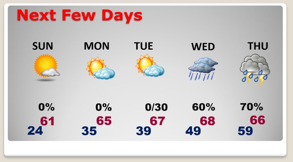
And, that’s not all. The warm-up continues Monday through Thursday, as January ends and February begins. The week begins on a beautiful note. Rain holds off until Wednesday. The highest rain chance is Wednesday night through Thursday. It will turn sharply colder by Friday.
High pressure is in control today.
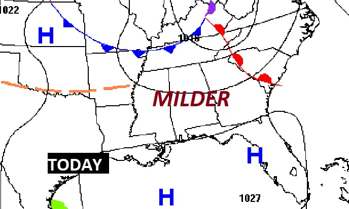
TODAY: Sub-freezing, low to mid 20’s at Dawn. Quick warming. Sunshine. High 61. West wind 5 to 15 mph. Mostly clear, not quite as cold tonight. Low 33.
NEXT FEW DAYS: Nice Monday & Tuesday. Mid 60’s Monday, upper 60’s Tuesday. Two-part storm system. Part one Wednesday. Scattered showers, becoming likely late Wednesday & Wednesday night. Part two Thursday, as a cold front approaches. Showers and thunderstorms. Sharply colder Friday.
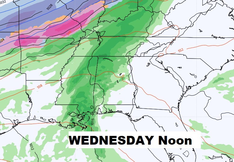
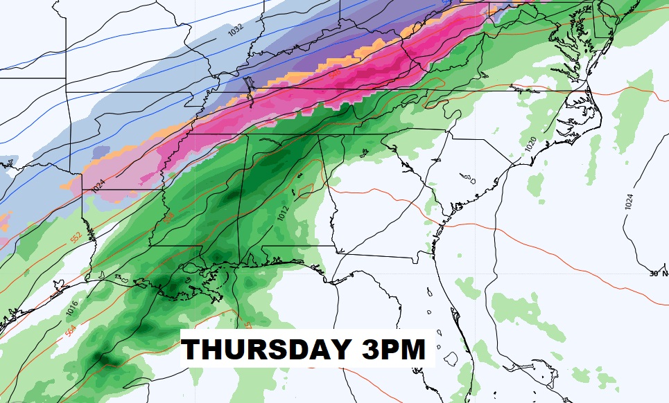
NEXT STORM SYSTEM: While this week’s two-part storm system will be just rain for us, notice the nasty ribbon of snow and ice from the mid-Mississippi valley the mid-south and the Ohio valley. We could see some thunderstorms Thursday, but no severe weather is expected.
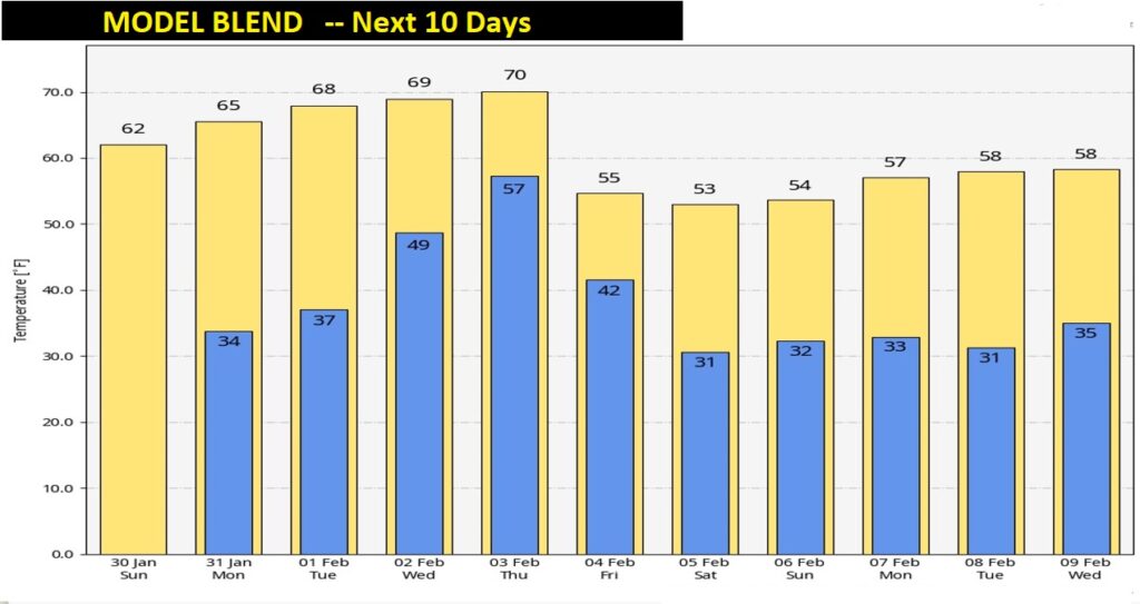
MODEL BLEND, NEXT 10 DAYS: Nice warming trend today through Thursday. Sharply colder again by the end of the week and the weekend.
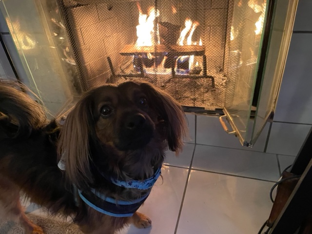
This morning, Chase has the right idea. He’s staying warm by the fire.
.
Have a Nice Sunday. Enjoy the afternoon warm-up…and the Football today.
I’ll have a complete video in the morning, online by 4:45 AM.
–Rich