
Good Morning, on another sub-freezing Sunday morning. This is the 21st freeze of the season so far. Normal freezes in one season is 40. We’re running behind because December was so warm. We only had one freeze. January was a complete turn-around with 13 freezes. Too much arctic air in January and February so far.
Today will be chilly, but not as cold as Saturday. It will continue rather cool through Tuesday. But, hang on, our temperatures will moderate into the 60’s Wednesday through Saturday. And, here’s the BEST news. We’re expecting a very quiet, storm-free pattern for an extended period of days. In February, that is great news indeed. Below, I’ll share some long range thoughts. I think you maky like what you read,
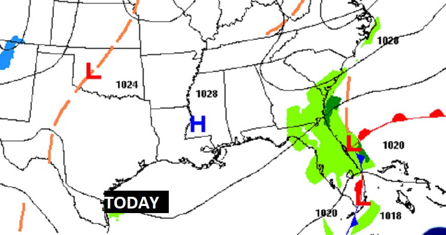
TODAY: Cold AM. Upper 20’s at Dawn. Sunshine, then partly cloudy. Not as cold as Saturday. (Saturday high was 50) Today’s high 57. Not as windy. East wind at 5 to 10 mph. Increasing clouds tonight. Not as cold. Low 36.
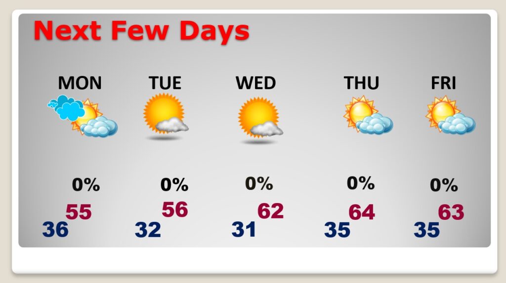
NEXT FEW DAYS: Mostly cloudy Monday. Cool Monday & Tuesday. Roughly 8 or 9 degrees below normal. Warming trend starts Wednesday. Looks like we will be near or above normal Thursday through Saturday. Extended period of quiet, storm-free days.
A minor disturbance will increase clouds tonight. Monday will be mostly cloudy as this disturbances drifts eastward. The air is too dry for any showers.

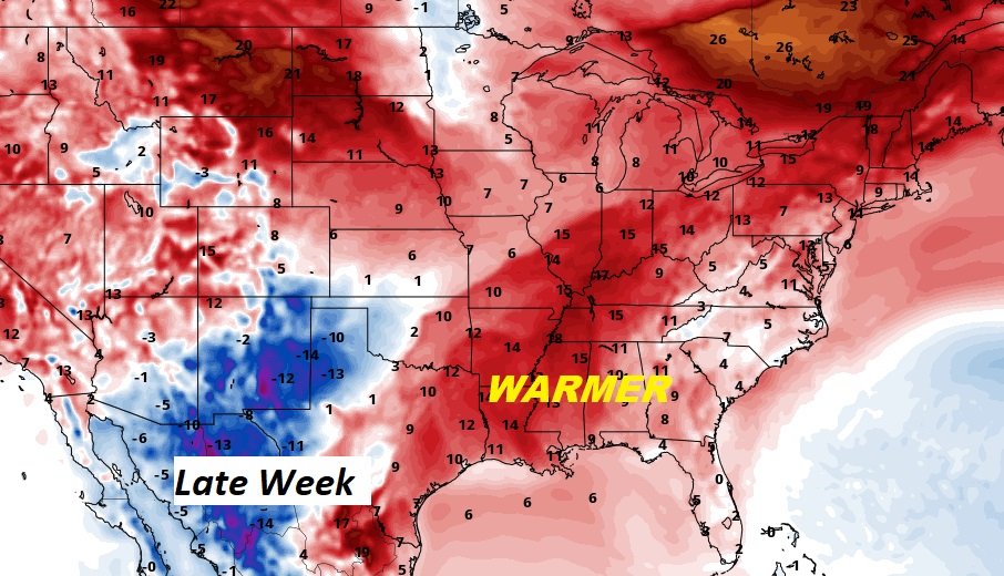
Late Week Warming. We’ll reach the 60’s for highs Wednesday through Saturday. In fact Saturday, we could reach the upper 60’s. Normal high is 63.
LONGER RANGE (16 DAYS): Here’s a peek at the GFS model Ensembles. When I say Ensembles, this is the US model run with 21 different versions, blended together. It delivers a smoother final solution.
On this temperature output, I see roughly 4 Temperature Set-backs. Cold Fronts. But, what I don’t see are any Arctic intrusions. Are we starting to see the evolution of new pattern? Are the Arctic Floodgates about to close for an extended period? I like what I’m seeing. Perhaps, light at the end of the tunnel. Fingers crossed.
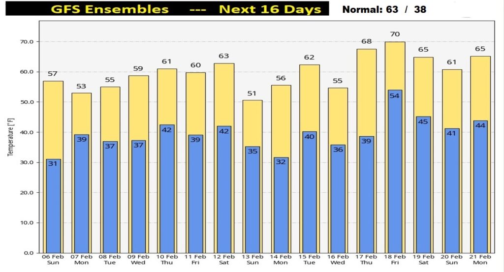
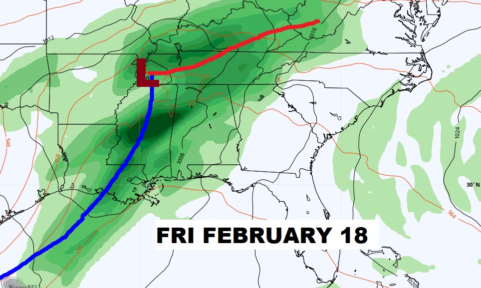
It looks like MOST of the next 16 days will be devoid of any significant storm systems. In February this GREAT news. The one exception could be about 12 days away….roughly.
TORNADO SURVEYS: A National Weather Service surveyed two more tornadoes yesterday, both in Elmore county, from Thursday’s storm system. Both were EF-0’s. So, there were FIVE tornadoes in Alabama Thursday. Three in west Alabama. Two in central Alabama. Click on this link for details of the surveys.
https://nwschat.weather.gov/p.php?pid=202202052252-KBMX-NOUS44-PNSBMX
.
Have a Nice Sunday!
I’ll have a complete video in the morning, online by 4:45 AM.
–Rich