Good Morning! Today will be much warmer than Monday. In fact, the next 3 days will feel more like late April or May. The chance of a shower will be small today. Scattered showers are possible Wednesday. But, the better rain chances will arrive by Thursday night/Friday morning as a Cold Front moves southward. It’ll be much cooler by Friday night & Saturday. On this video, I’ll walk you through the day to day details through the weekend and beyond.
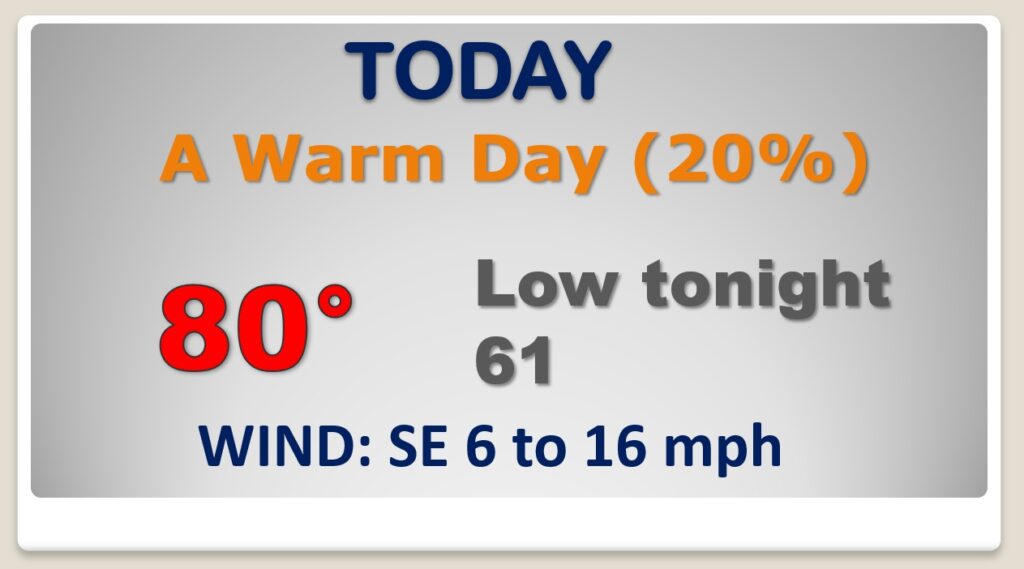
It’ll feel like a Spring Day today. High temperature near 80. Partial sunshine. Rain chance not zero…but very small. Very mild for February tonight.
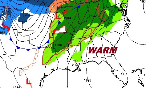
The big, and strong Upper Ridge of High pressure from the Gulf to the Bahamas will not only allow us to warm-up, it will keep most of west & active weather well northwest of us.
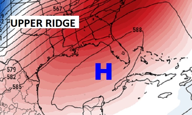
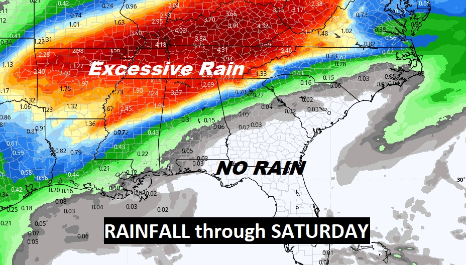
The projected rainfall map shows how the upper high will act as a protective dome, keeping flooding rainfall closer to the Tennessee border.
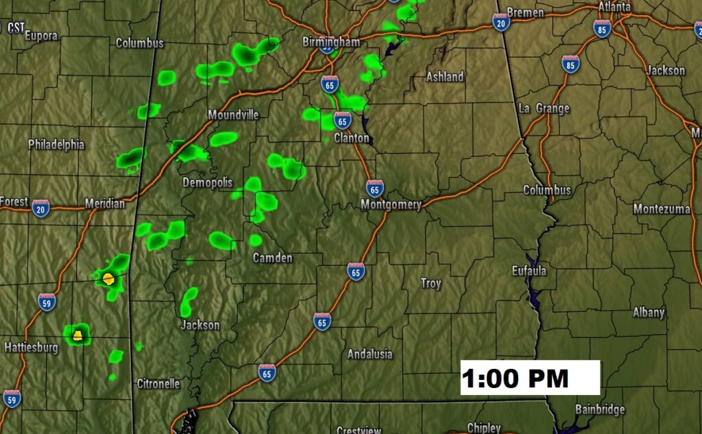
The cool front tries to reach us Wednesday, but fails. Scattered showers. The front will eventually push through Thursday night and early Friday. Much cooler air will follow.
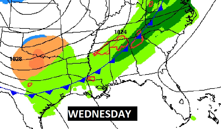
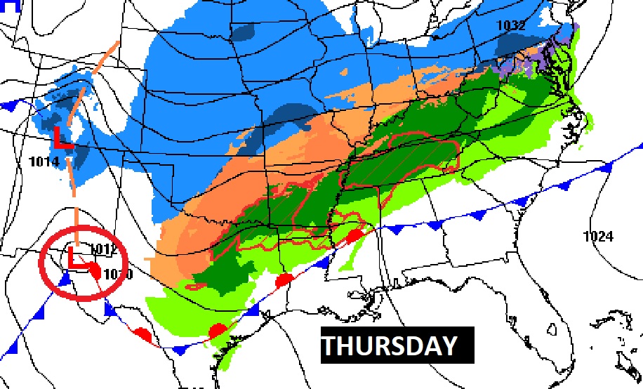
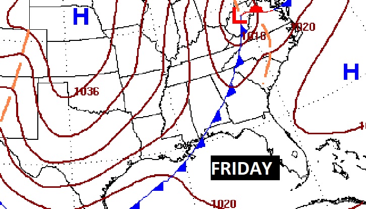
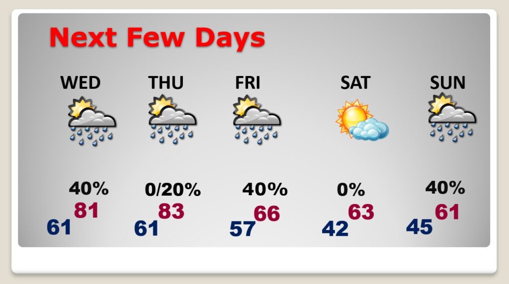
Unusually warm Wednesday and Thursday. Scattered showers Wednesday. More showers Thursday night and early Friday as the front moves through. Dry & cool Saturday. Another surge of moisture Sunday. More showers.