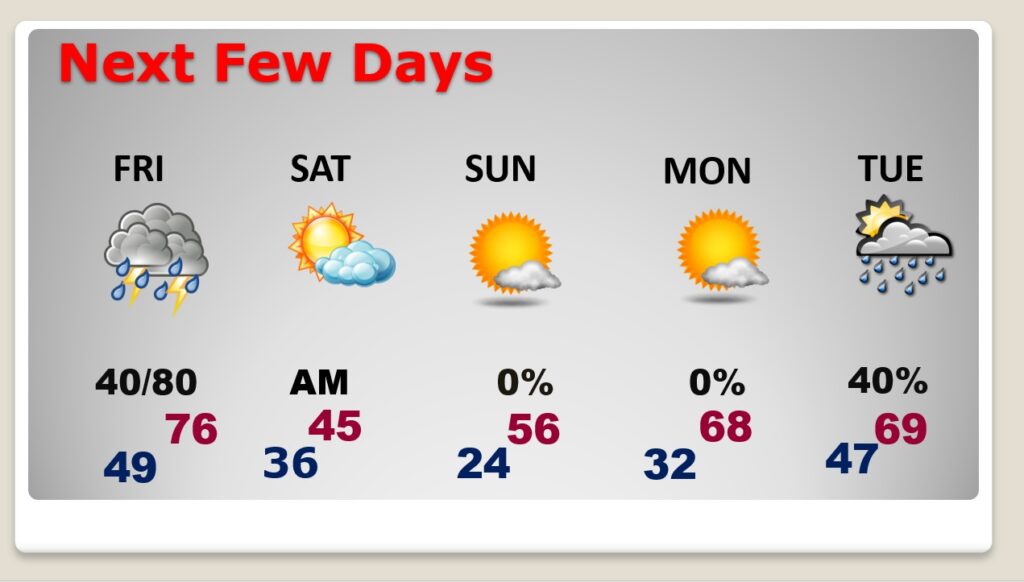
Good Morning! Today will actually be a pretty nice day in between storm systems. But, get ready. Drastic changes are right around the corner. Showers and storms will be likely by Friday evening ahead of a strong cold front. There’s even a risk for some severe storms, especially in the southern half of the state. Sharply colder air will funnel in late Friday night and Saturday. Then, get ready for a Hard Freeze Saturday night. By Dawn Sunday, many towns will bottom out in the low to mid 20’s. On this video, I’ll fill the details of a very complicated forecast.
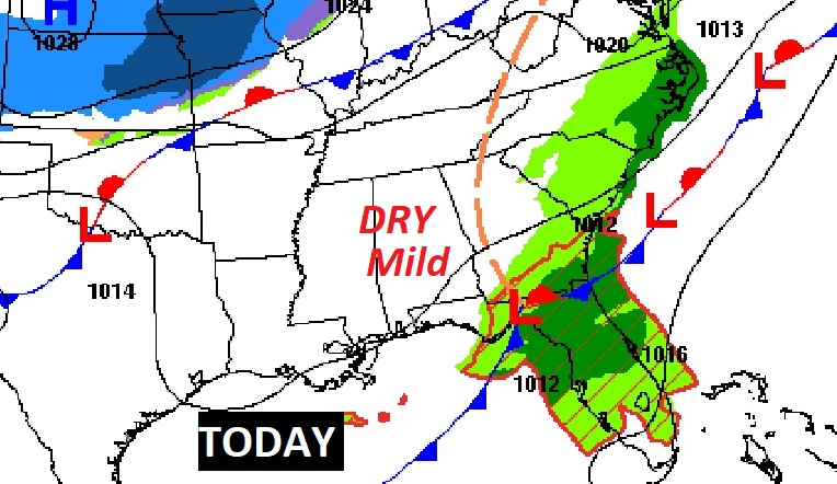
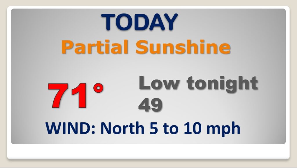
Pretty nice day today in between storm systems.
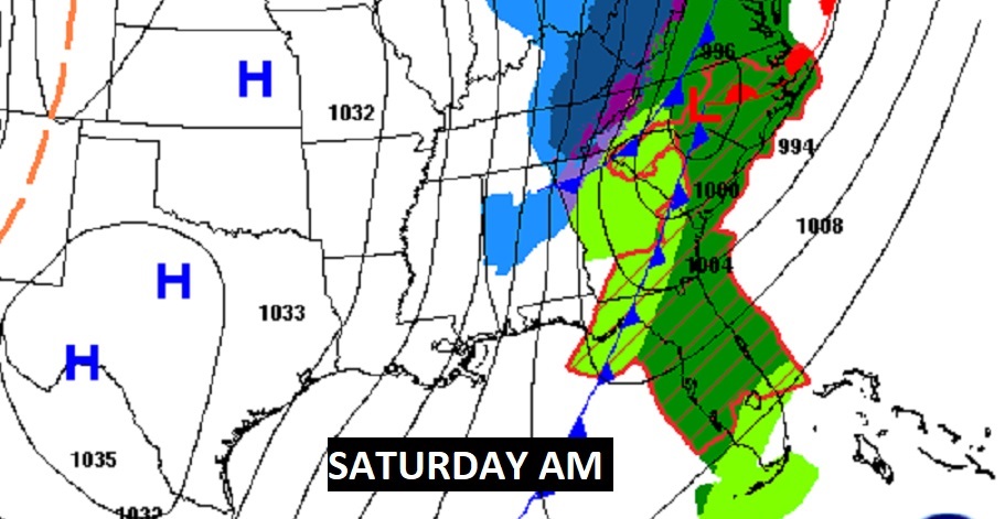
Big changes are on the way as a strong cold front approaches Friday night.
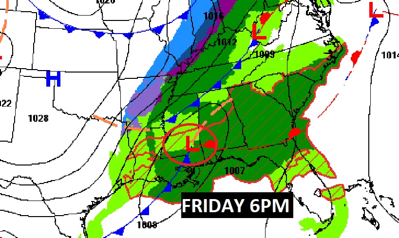
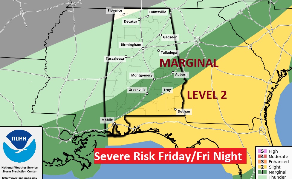
There could even be some severe storms across SE Alabama by Friday night. Even a Level 2 risk in the SE counties. A few spin up tornadoes can’t be ruled out.
Hard Freeze Saturday night. Drastically colder Saturday and Saturday night.
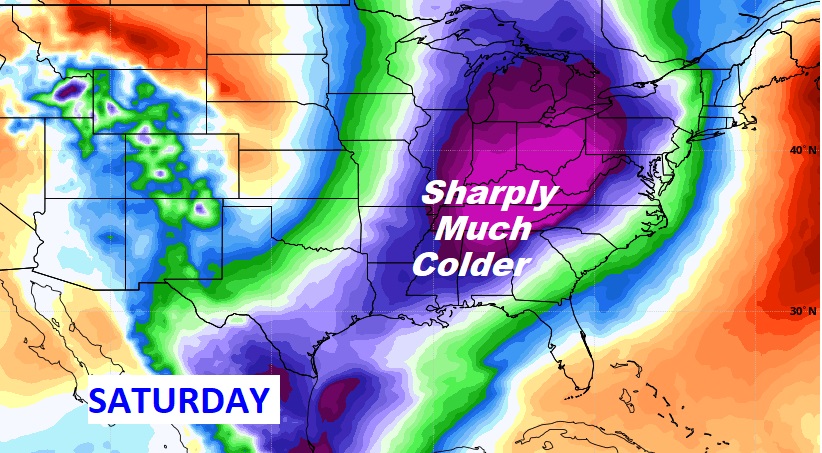
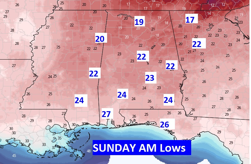
Get ready for the return of Old Man Winter late Friday night. Hard Freeze Saturday night. And, a good chance of a freeze Monday AM before temperatures recover.