
Good Morning! Obviously, a very abbreviated update this morning, after hours of tracking severe storms. The storm threat will edge out of Alabama today. Ahead is a series of storm-free days through the weekend. Chilly nights ahead, and cooler days.
Today the Severe Weather Risk area begins to shift out of Alabama as the frontal system moves eastward, into Georgia, Florida and the southeast coast.
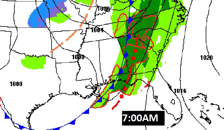
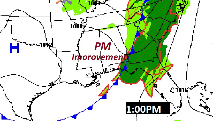
TODAY: Risk of scattered left-over showers will linger till roughly lunchtime. Clearing later. Breezy. High 76. Partly cloudy, chilly tonight. Low 48..
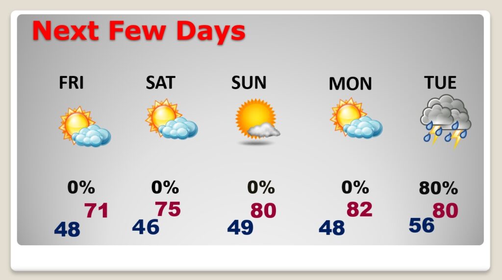
NEXT FEW DAYS: Nice days. Cooler Friday. Low 70’s, Chilly nights. Lows in the 40’s. Storm-free for several days. Could be a couple of isolated showers Saturday through Mid-day, otherwise the rest if the weekend looks great – especially Sunday. Monday, too. Looks like another concerning storm system by next Tuesday.
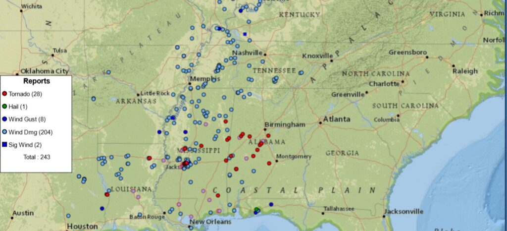
It was bad enough, but it could have been far worse. There were NUMEROUS tornadoes in Alabama overnight. Perhaps more than a dozen tornadoes to be surveyed. Damage in many places. Fortunately, not many injuries and no fatalities. But, lots of damage in places like: Pickens, Tuscaloosa, Marengo, Wilcox, Perry, Bibb and Shelby counties. Also in Choctaw, and in Lowndes county around Lowndesboro. Damage at Lowndes Academy. That’s the cell that prompted the Montgomery metro tornado warning. Plus, more tornado damage in Baldwin county where it’s been a tough couple of weeks. Many tornadoes. The details are yet to unfold. At one point, 60,000 customers were without power. It was a historic, significant severe weather outbreak.
—
Thanks for reading this very brief Blog this morning. We’ll get back to a video update tomorrow morning. Tomorrow everything will return to normal.
–Rich