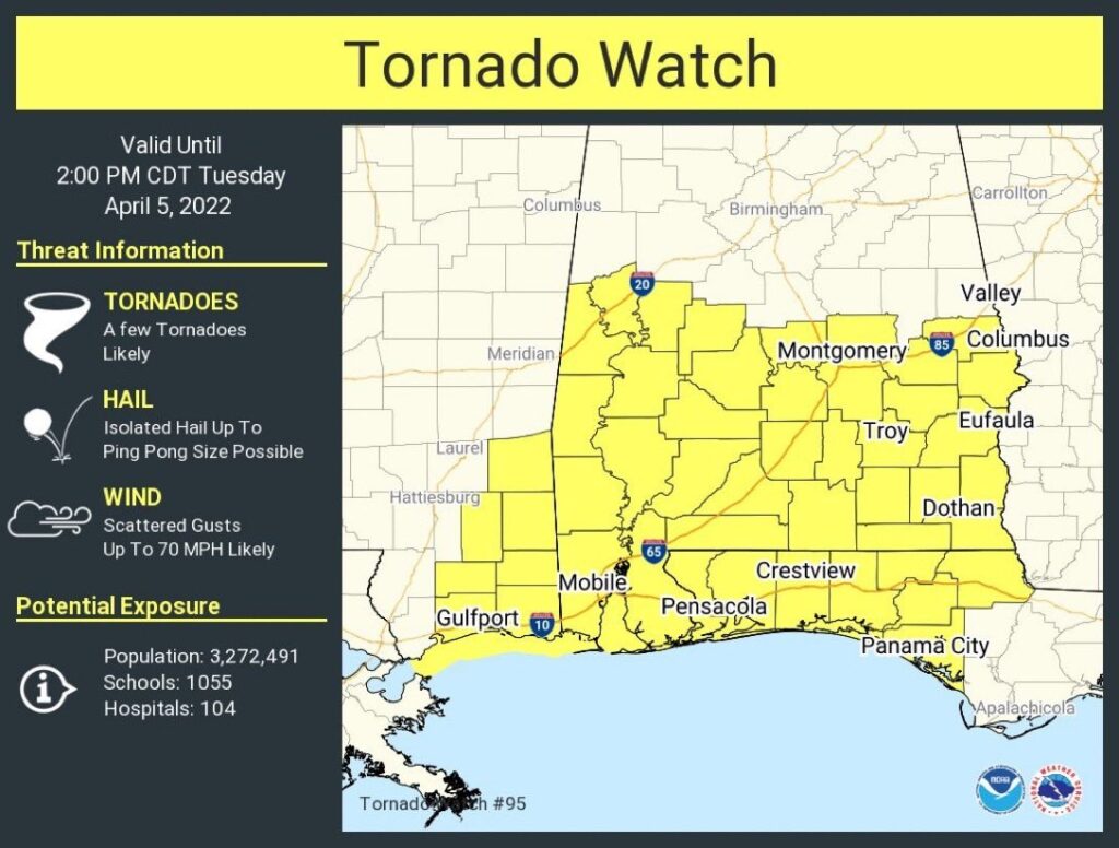
New tornado watch for all of us until 2PM. Damaging wind gusts to 60 mph, large hail to ping pong size, a few tornadoes likely.
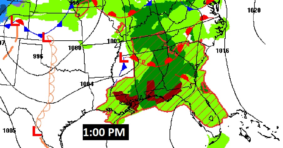
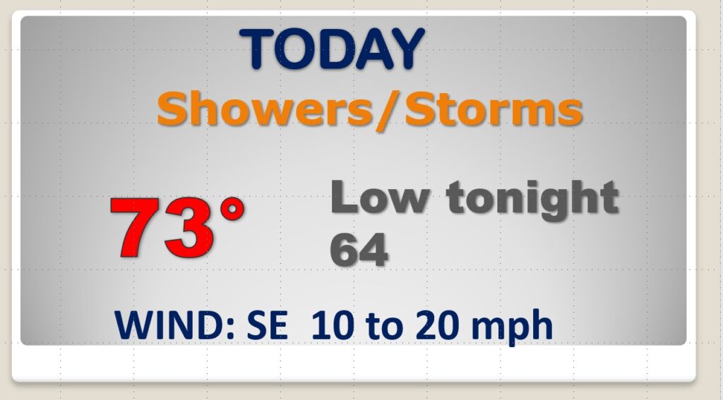
Good Morning. Alabama is dealing with yet another significant Spring Severe Weather threat, for the third week in a row. Today’s Severe weather threat begins early and continues into this afternoon. Damaging wind gusts will be the main threat. A few tornadoes are also possible, along with some very heavy rainfall in spots. Today is just round one. Locally severe storms will return by late Wednesday afternoon and Wednesday night as a strong cold front approaches. Again Wednesday evening, all modes of severe weather are possible, including damaging winds and a few tornadoes. Much cooler air will follow the cold front. Expect a very late season COOL snap, especially by Friday, Friday night and Saturday. The coldest morning will be Sunday.
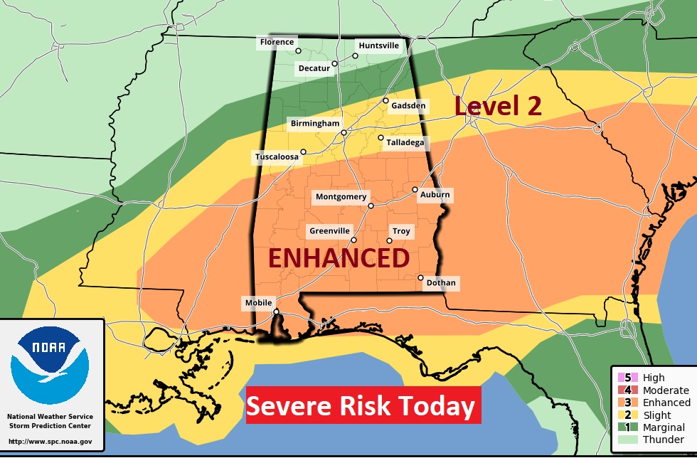
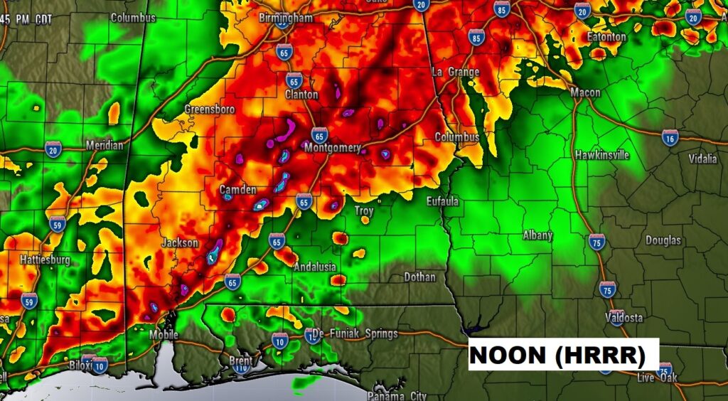
Today’s Severe weather threat begins early and continues into this afternoon. Damaging wind gusts will be the main threat. A few tornadoes are also possible, along with some very heavy rainfall in spots. Today is just round one. Most of us are in a Level 3 ENHANCED Severe Risk.
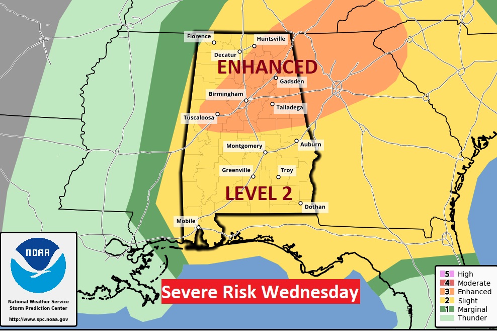
Locally severe storms will return by late Wednesday afternoon and Wednesday night as a strong cold front approaches. Again Wednesday evening, all modes of severe weather are possible, including damaging winds and a few tornadoes.
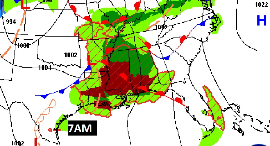
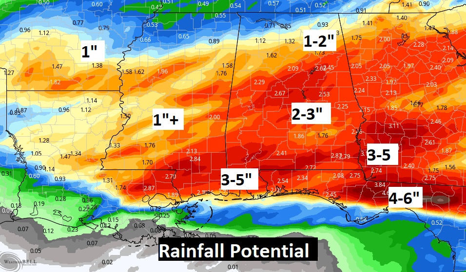
Locally heavy rainfall could cause flooding in spots. Rainfall will be heaviest with today’s even especially.
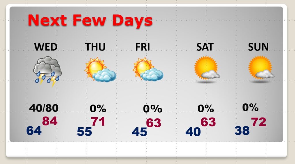
Much cooler air will follow the cold front. Expect a very late season COOL snap, especially by Friday, Friday night and Saturday. The coldest morning will be Sunday.