
Good Morning! The Heatwave is over. Today, thankfully will be not as hot. Today’s expected high of 91 is closer to the seasonal normal. But once again, showers and thunderstorms will be rather numerous by this afternoon and this evening.
CLIMATE DATA: Saturday’s high in Montgomery was 95, with a Heat Index of 111. Normal high/low 93 and 72. Rainfall: .57”
TODAY: Not as hot. High 91. But once again, showers and thunderstorms will be rather numerous by this afternoon and this evening. Low tonight 74.
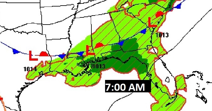
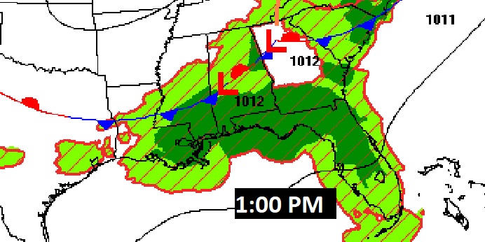
The Front that brought yesterday’s storms is in extreme south Alabama this morning. It will oscillate back northward later today. It’ll be the focus for showers and storms.
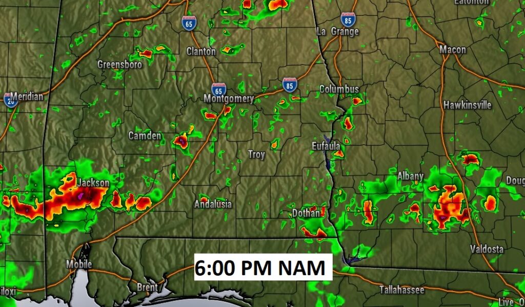
Future Radar example early this evening.
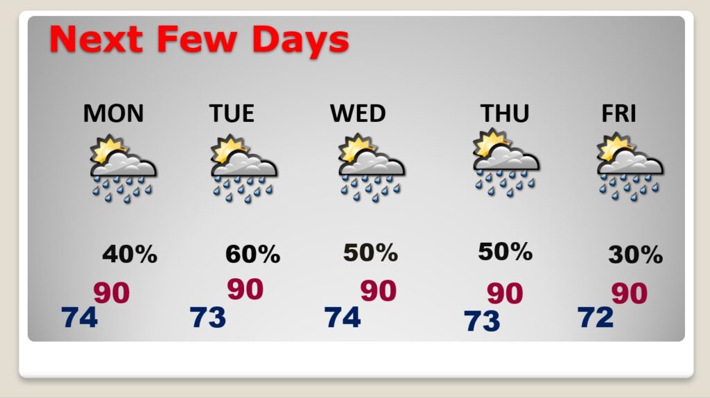
NEXT FEW DAYS: Not as hot. Scattered to numerous afternoon and evening showers & storms each day. Little day to day change. Highs mostly near 90. Lows at night lower 70’s.
.
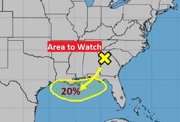
TROPICS: UPDATE: There’s a new X on the map from the National Hurricane Center and that X happens to be near Atlanta. NHC has highlighted an area in the northern Gulf with a 20% chance of tropical cyclone development in the next 5 days #alwx
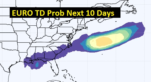
The EURO model also indicates the potential for development in the next 5 days.
.
I’ll have another update for you in the morning. Have a nice Sunday!
–Rich