
Good Morning! Here’s my brief video forecast discussion.
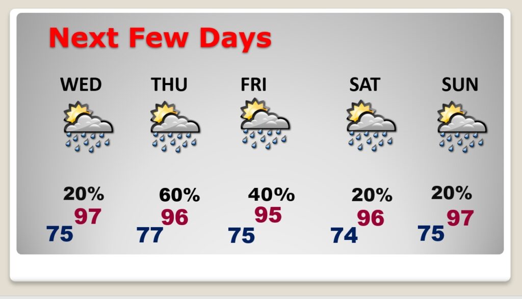
TODAY: Sun/cloud mix. High in the mid 90’s. Heat index 100-105. Scattered random showers & thunderstorms just about anytime today. well into the evening hours. Risk of Showers and storms will continue tonight. Low tonight 75.
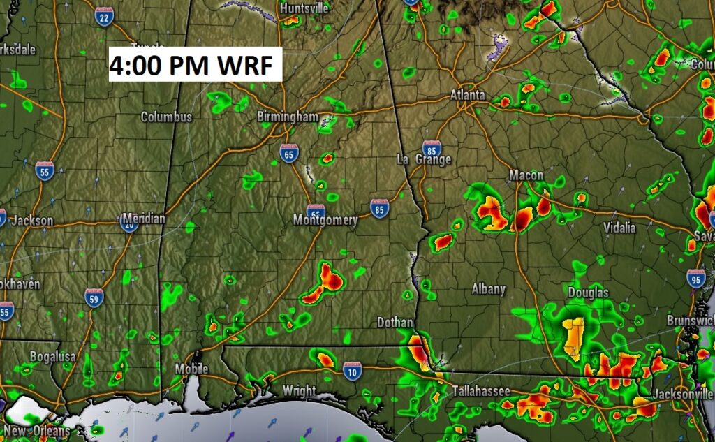
RADAR TRENDS TODAY: The hi-res models suggest a potential morning round of storms…and more scattered random storms this afternoon. Any hour is fair game today. Radar will be more active than yesterday.
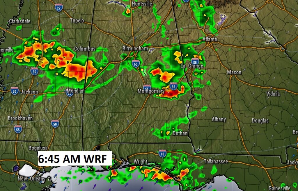
Some storms across NW Alabama could reach severe limits. Damaging wind gusts in the main threat.
TROPICAL OUTLOOK : The tropics continue quiet for now. We know that will change The peak of the season is in August and September.
.
NEXT FEW DAYS: Scattered showers & thunderstorms, each day, most numerous in the afternoon & evening hours. Storms reach a peak by about Thursday & Friday. Some strong storms area a good bet. Storms thin out a bit by the weekend. Highs mostly mid 90’s. Triple digit heat index. Low at night mid 70’s. Little day to day change.
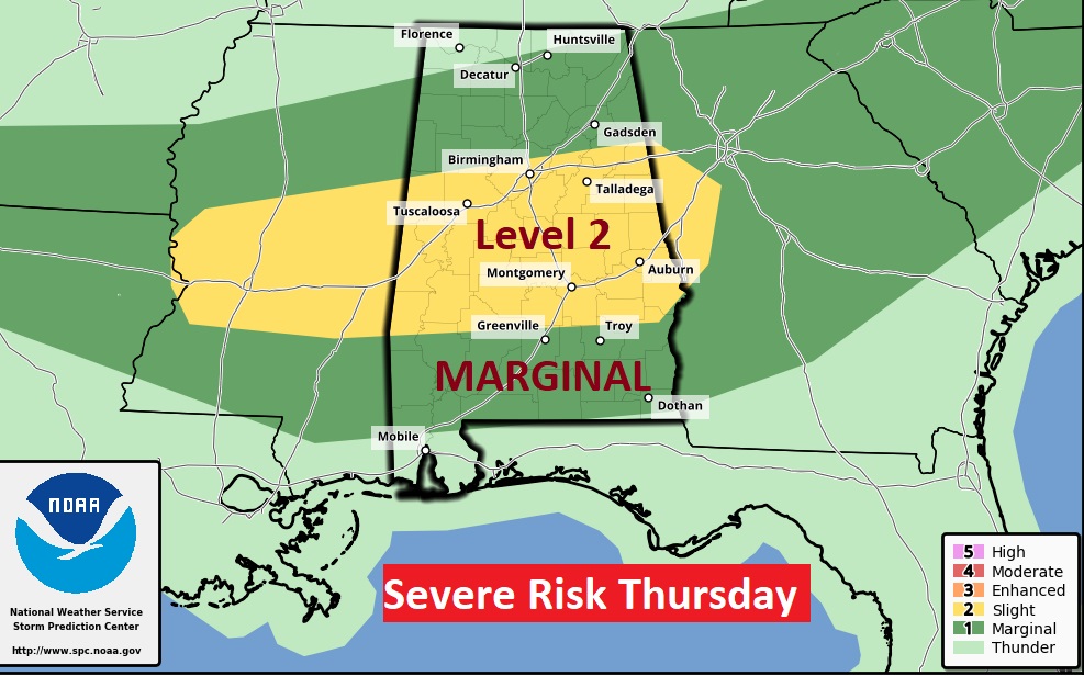
Some storms could reach severe limits, especially by Thursday. Level 2 Severe Risk in central Alabama. Damaging wind gusts in the main threat.
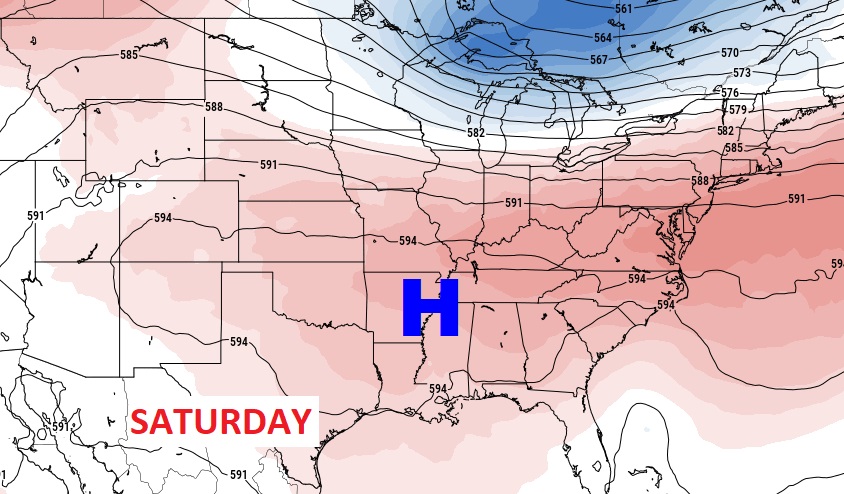
Some of the hottest days might be over this coming weekend as upper level high pressure builds.
—
Thanks for reading this Blog this morning! This morning we are LIVE on the radio from 6 to 9 on NewsTalk 93.1. Watch us on TV on CBS 8 and ABC 32. I’ll have another update for you in the morning. Have a nice day.
–Rich