
Good Morning! This morning’s update is short and sweet. We are into a “typical” pattern for this last week of July. Hot & humid. High in the mid 90’s. Triple digit heat indices, again. Not many storms. Scattered random afternoon & evening storms.
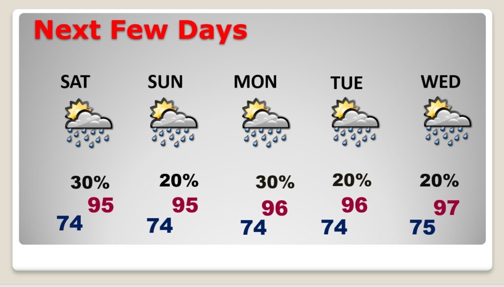
Hot & humid this week. We should be in the middle 90’s most days this week. Lows at night in the middle 70’s. Somewhat better rain chances by Friday & Saturday. Otherwise, no big surprises. And, for now, the tropics are shut-down.
TODAY: Hot & Humid. High 95. Heat index 102 to 105. Any random storms today will be few and far between by this afternoon and this evening. Low tonight 74.
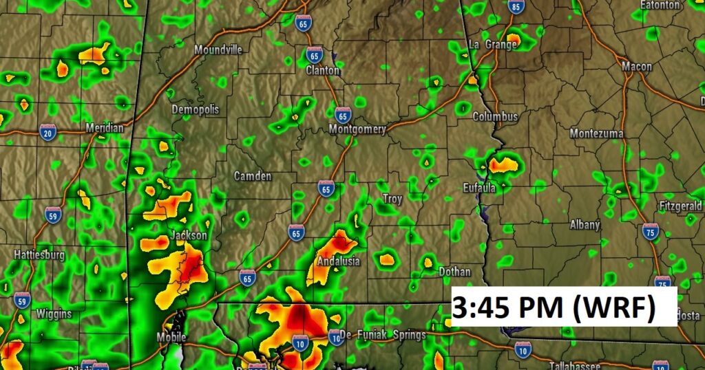
Here’s a Future Radar example this afternoon. Showers and storms will widely scattered.
NEXT FEW DAYS: Not much day to day change. Very typical for July. Generally mid 90’s each day. Scattered Random storms every day. Daily rain chance in the 20-30% range. Rain chances get better near the end of the week… Friday & Saturday.
.
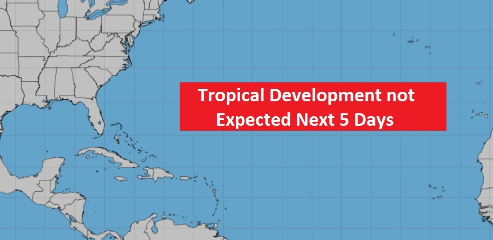
TROPICS: The Tropics are as quiet as a mouse…for now.
.
I’ll have another update for you in the morning. Have a nice Sunday!
–Rich