
Good Morning! Here’s my brief video forecast discussion.
CLIMATE DATA: Montgomery had a high of 93 yesterday, after a morning low of 73. Normal Hi/Lo: 93 and 70. Airport rainfall: 0.16” Sunrise: 6:23, Sunset 7:10.
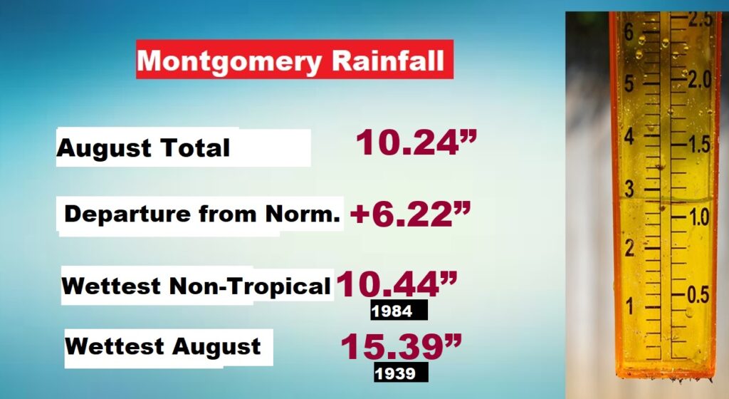
EXTREMELY WET AUGUST: Montgomery’s August Rain total was 10.24”. (East Montgomery 14.26) Normal rainfall 3.90” It was the second wettest Non-tropical August. Only 1984 was wetter. Wettest August ever was 1939 with 15”+. But that year there was many tropical systems targeting Alabama. Details below.
TODAY: Today, once again, Any random “pop-up” storms will be very isolated in nature. The Better rain chance today will be near the coast, near that stalled weak front. High in the low to mid 90’s. Low tonight 73.
Tomorrow that stalled front will migrate northward, and elevated rain chances will return for the holiday weekend.
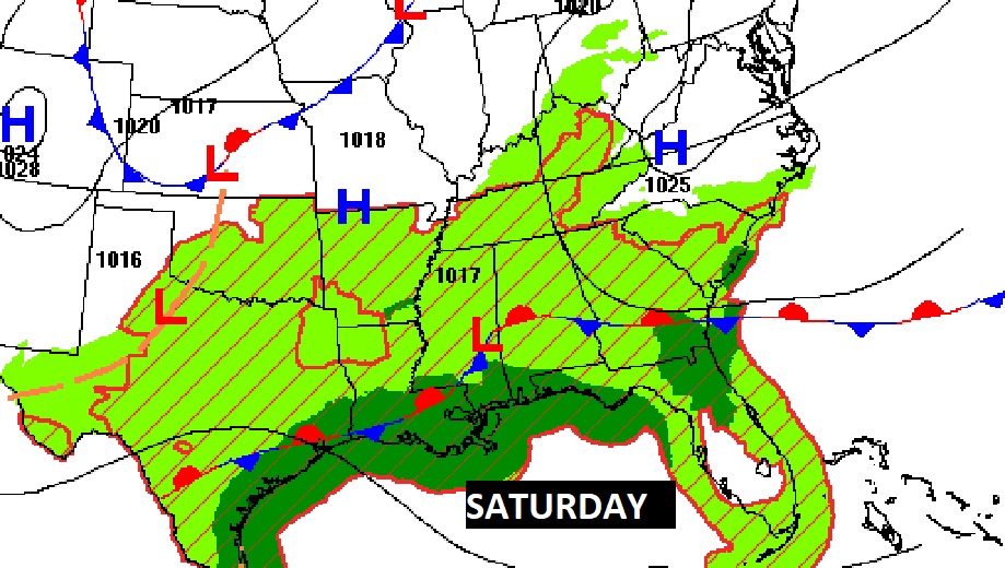
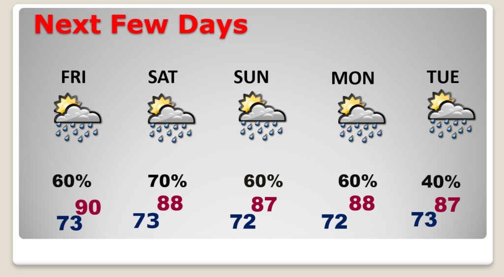
NEXT FEW DAYS: Unfortunately, the elevated rain chance returns Friday and will be here through the holiday weekend. Scattered to numerous storms each day. Be flexile. Have a Plan B. Highs mainly in the upper 80’s to near 90. Lows at night in the low 70’s. Not much day to day change through Tuesday.
.
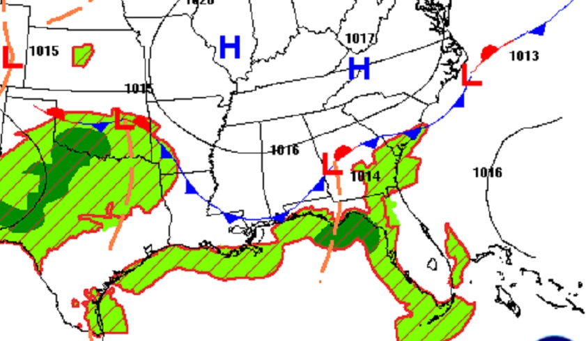
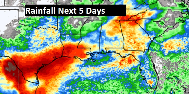
Wet rimes will continue across the Gulf South for the next few days.
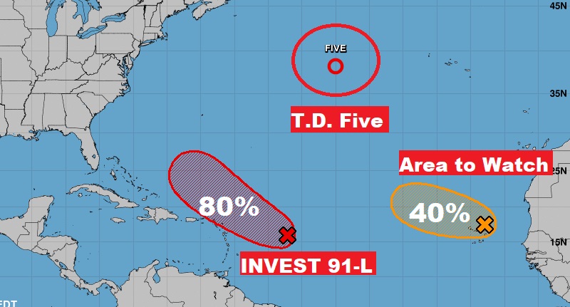
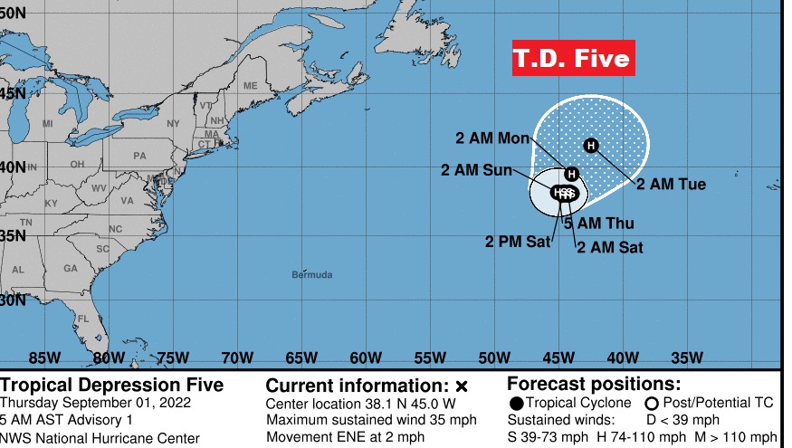
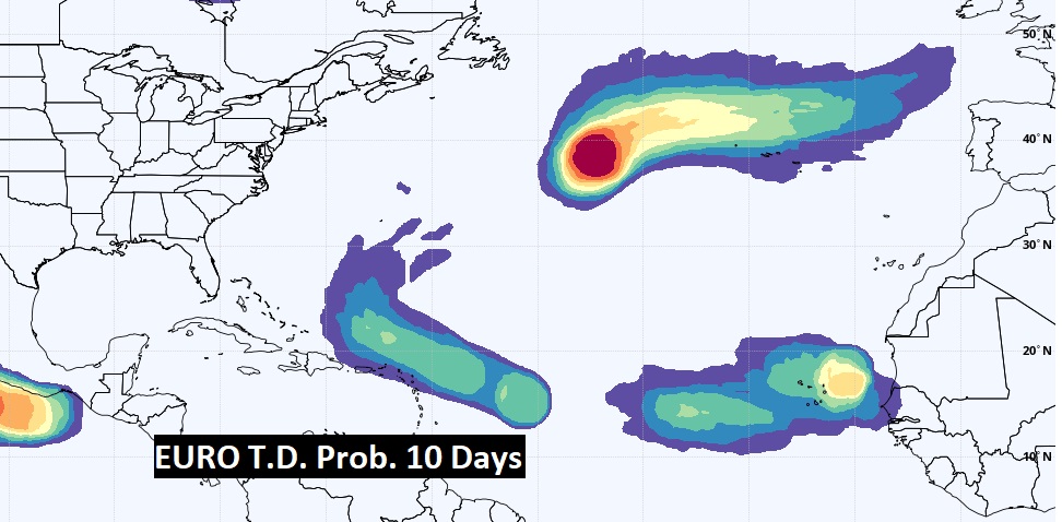
TROPICAL OUTLOOK: NHC is tracking three systems in the Atlantic. Invest 91-L has an 80% chance of development in the next 5 days. Late breaking.. Invest 93-L has just been promoted to Tropical Depression Five in the North Atlantic. The other Area to Watch, in the far eastern Tropical Atlantic will very likely eventually become a tropical cyclone. It will probably curve into the east Atlantic.
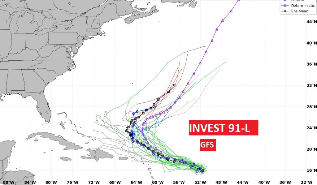
Most models curve Invest 91-L into the Atlantic. Here’s the GFS Ensemble tracks.
Here’s the Euro Tropical Depression Probabilities over the next 10 days. Looks like trouble in the Atlantic will keep North America quiet through the Labor Day holiday weekend.
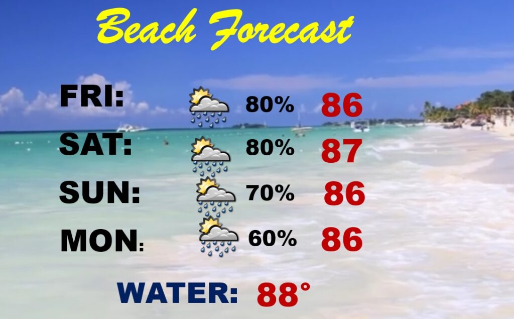
BEACH FORECAST: The coast will be rather wet at times through the Labor Day holiday weekend, due to that stalled front. Elevated rain chance. Scattered to numerous storms. Highs in the 80’s. Gulf water temperature at a season high of 88. Moderate rip current risk from Destin to Panama City.
Thanks for reading this Blog this morning! This morning we are LIVE on the radio from 6 to 9 on NewsTalk 93.1. Watch us on TV on CBS 8 and ABC 32. I’ll have another update for you in the morning. Have a great day!
–Rich