
Good Morning! Happy Labor Day! Be flexible with your plans today.
Here’s a brief hello and intro from my couch this morning!
CLIMATE DATA: Yesterday’s high in Montgomery was 89. Morning low 75. Normal High/Low 92 and 69. Rainfall at the Airport: .15”. (East Montgomery .25”) Sunrise at 6:24 AM. Sunset 7:03 PM.
TODAY: Once again…Clouds will dominate much of the time. High near 89. Scattered to numerous random showers and storms will be most common in the afternoon & evening hours. Locally heavy downpours. Low tonight 73.
Again today, the atmosphere is primed for action. This is getting so old. Depressing. Some improvement tomorrow.
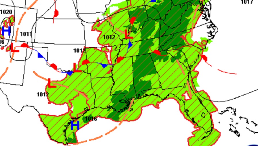
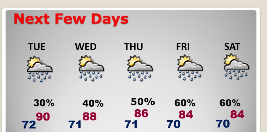
NEXT FEW DAYS: Storms will tend to “thin out in number” Tuesday through Thursday. Not as many storms. Tuesday’s high near 90. For the rest of the week highs mostly in the 80’s. Lows in the low 70’s. Storms will become more numerous again by Friday & Saturday.
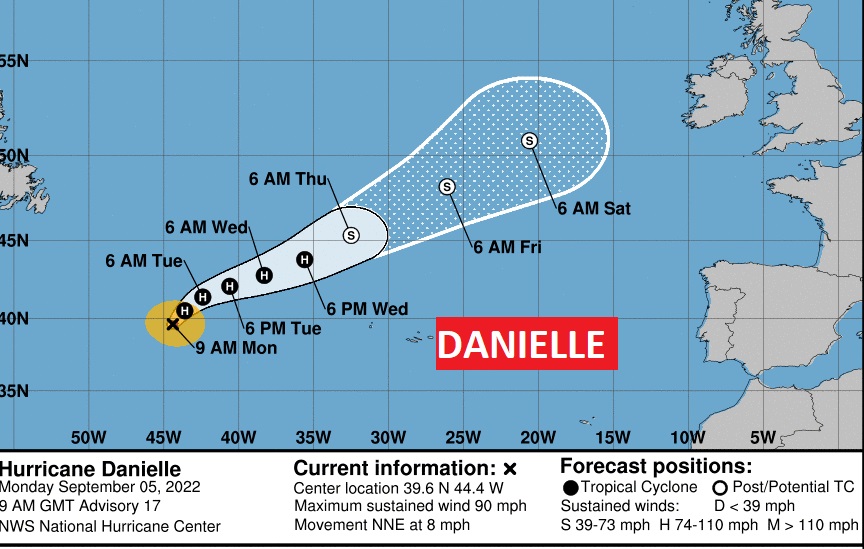
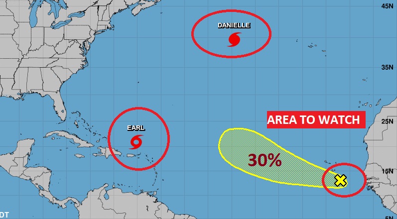
TROPICS: Danielle is a Hurricane in the far north Atlantic. In the Tropical Atlantic. Max winds now 90 MPH. Heading in the direction of the UK.
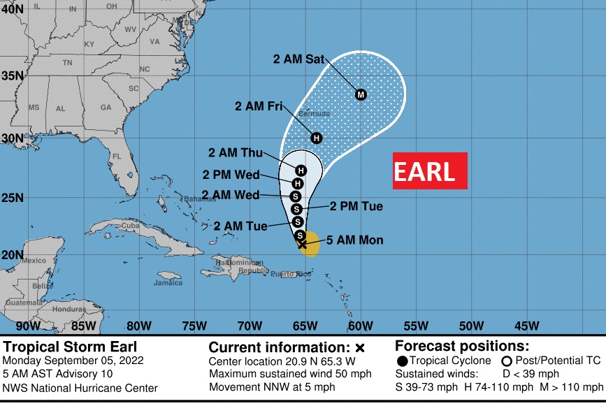
Tropical Storm Earl, wind winds of 50 mph. It is expected to curve into the open Atlantic, and eventually become a hurricane by mid week. It will not affect North America.
There is also a new Area to Watch in the far eastern Atlantic with a small 30% chance of development.
.
I’ll have another Blog update in the morning. Have a nice Labor Day weekend!
–Rich