
Good Morning! Here’s my brief video forecast discussion.
CLIMATE DATA: Yesterday’s high in Montgomery was 91, after a morning low of 71. Rainfall: .20” Sunrise 6:24 AM, Sunset 6:59 PM.
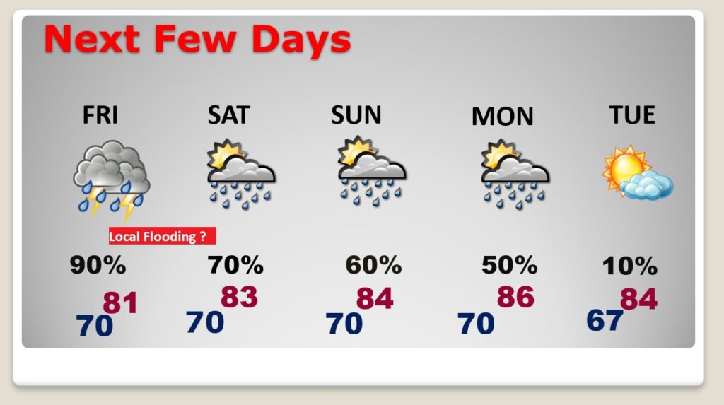
TODAY: Still routine today. Partial sunshine. Random “hit or miss” scattered & storms especially in the afternoon and evening hours. High in the upper 80’s. Low tonight 72.
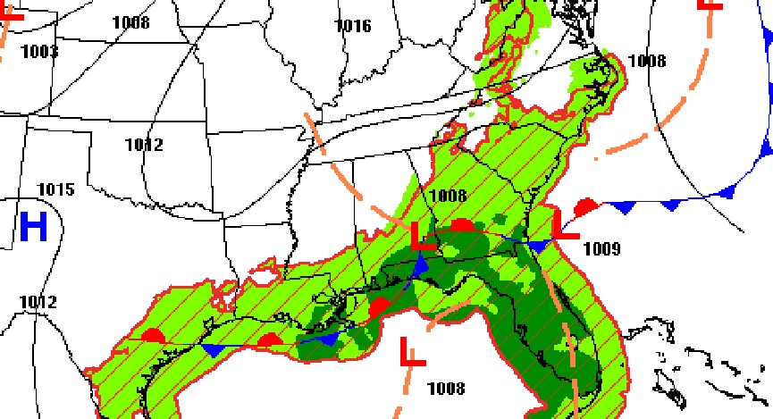
A weak front near the coast. Best rain chance today will stay south. Most of us locally will have about a 40% chance of getting wet.
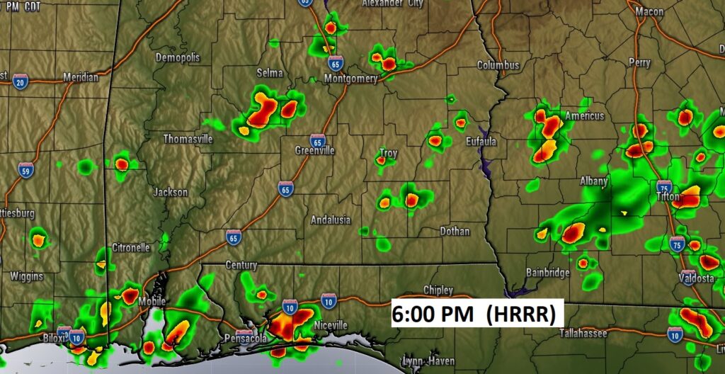
Future Radar. The HRRR model at 6PM. You get the idea. Scattered random storms here and there.
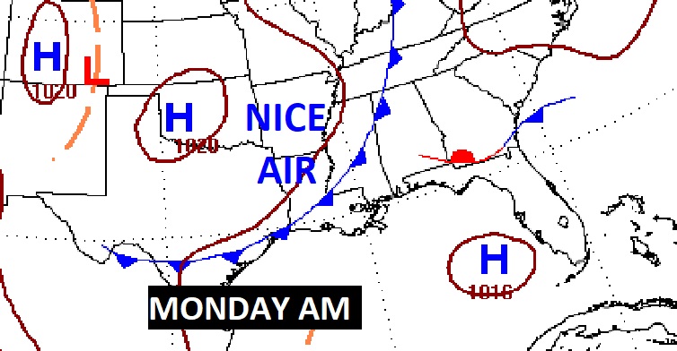
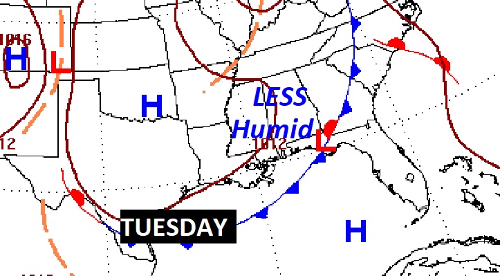
NEXT FEW DAYS: Showers and storms will be scattered to numerous again by Friday & Saturday. Locally heavy rainfall amounts possible. High temperatures will come down. Mostly low 80’s Friday through Sunday. The rain chance will trend downward again by Monday. More scattered storms Monday as a Nice “Cool” front slips through the state. NICE AIR behind the front on Tuesday. Lower humidity. I think much of next week will be great. Sunshine. Comfortable days and cooler nights. I’m excited.
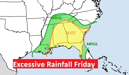
The best rain chance will be Friday & Saturday. We will be on the wet side of a Upper Low. We are in a Level 2 Excessive rainfall Outlook from WPC
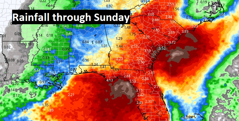
The Southeastern U.S. will be a very wet region over the next 5 days, especially I Florida, Georgia and the Carolinas.
FRONTAL RELIEF!: More scattered storms Monday as a Nice “Cool” front slips through the state. NICE AIR behind the front on Tuesday. Lower humidity. I think much of next week will be great. Sunshine. Comfortable days and cooler nights. I’m excited.
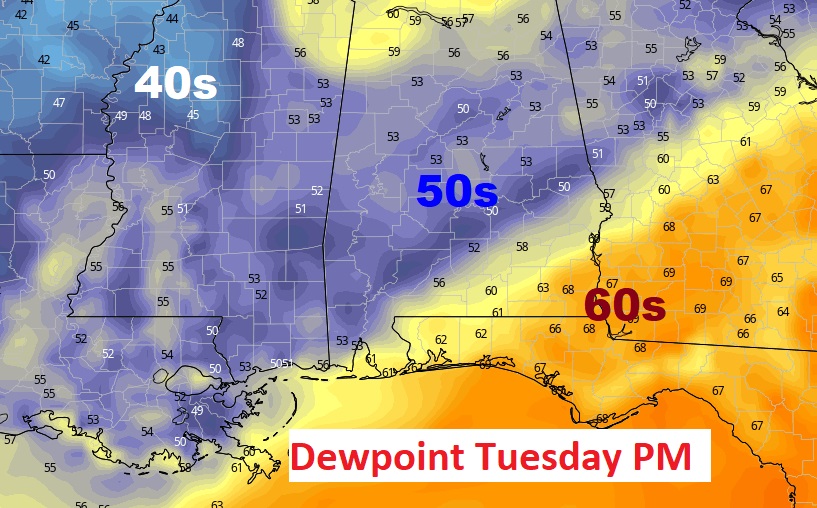
Wow. Here’s a sample of dewpoints Tuesday afternoon. This will feel GREA!
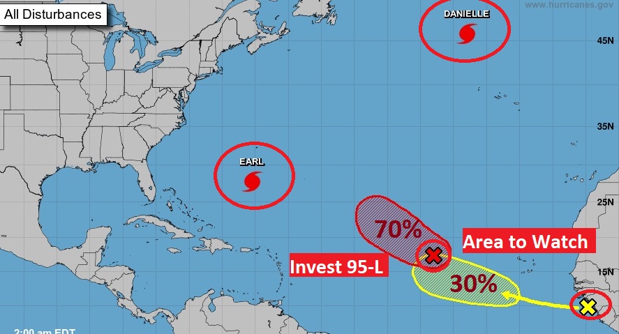
TROPICAL OUTLOOK: Danielle is still a Hurricane in the North Atlantic.
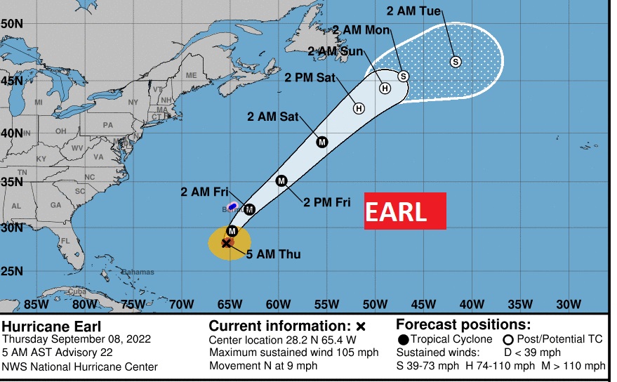
Earl is almost a major hurricane, with 105 mph winds. In fact it could reach Category 4 strength in 36. hours. It will pass just southeast of Bermuda, causing Tropical Storm Force winds.
Invest 95-L is likely to become Fiona over the next few days as it curves into the the open Atlantic. An Area to Watch in the eastern Tropical Atlantic, has a 30% chance of development in the next 5 days.
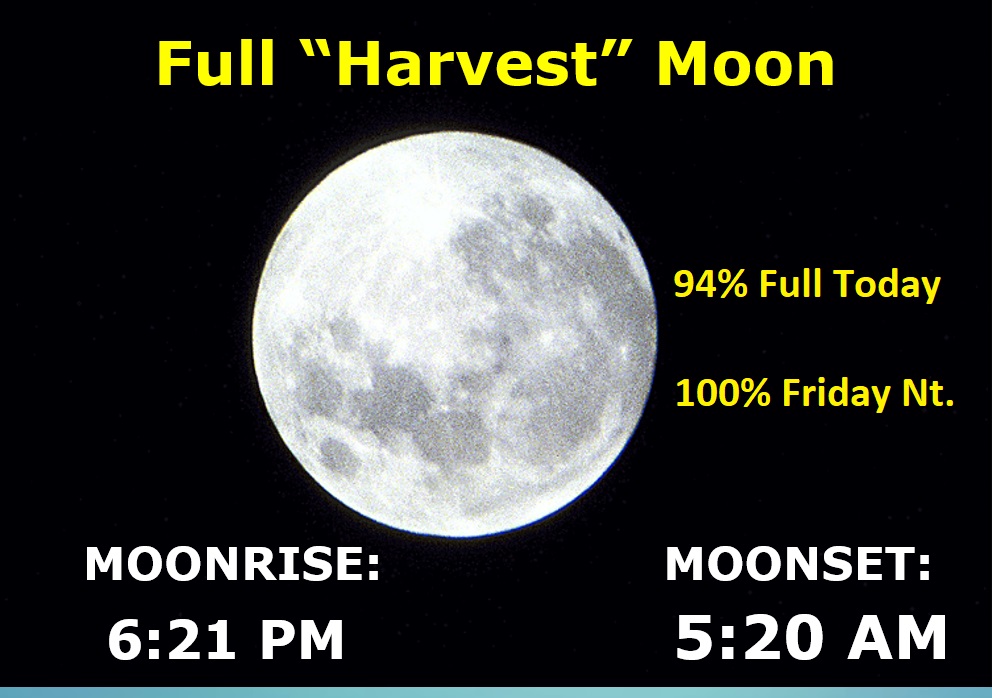
FULL MOON: The moon is 94% full today. The Full Harvest Moon is Friday night.
Thanks for reading this Blog this morning! This morning we are LIVE on the radio from 6 to 9 on NewsTalk 93.1. Watch us on TV on CBS 8 and ABC 32. I’ll have another update for you in the morning. Have a great day!
–Rich