
Good Morning! Get ready for a rather wet Saturday at times. More scattered storms Sunday. But, that NICE Air we’ve been looking forward to arrives Monday. Here’s my brief video forecast discussion.
CLIMATE DATA: Yesterday’s High in Montgomery was only 84, after a morning low of 62. Heavy rainfall at the airport. Rainfall: 1.39.
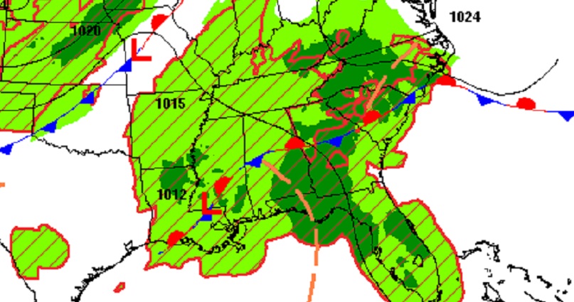
TODAY: The better than normal rain chance continues today. Periods of showers, and perhaps a few storms, about anytime today, but especially in the afternoon and evening. Hight temperature in the mid 80’s. Low tonight 71.
.
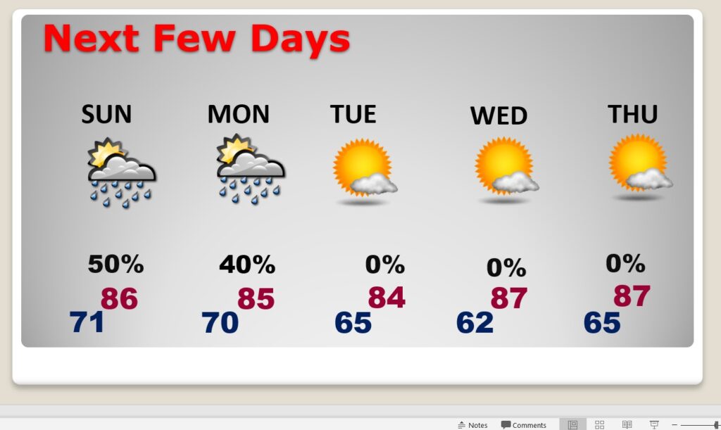
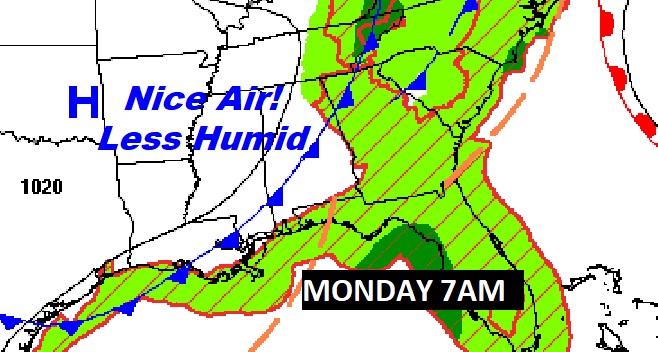
NEXT FEW DAYS: Showers and storms will be scattered across the area on Sunday. High’s in the mid 80’s. Saturday and Sunday. More scattered showers perhaps early in the day Monday as a “Cool” front slips through the state. NICE AIR behind the front on Tuesday. Lower humidity. Most of next week looks great. Sunshine. Comfortable days and cooler nights. This is exactly what we’ve been waiting for all summer. I’ll mention a tiny chance of an isolated shower by late week. Overnight lows in the 60’s will feel great!
The front swings through early in the day Monday. Expect an extended period of nice comfortable days and cooler nights. Call it a Fall Preview.
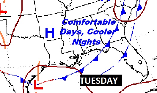
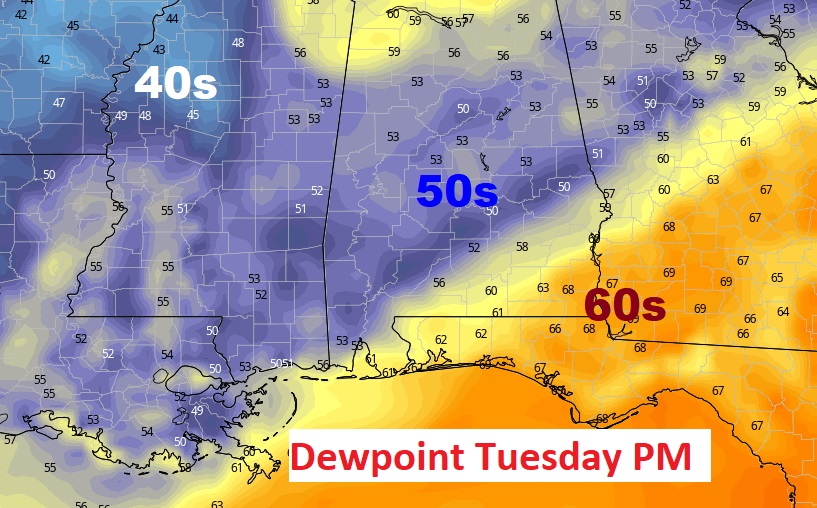
This map looks nice! Here’s a sample of dewpoints Tuesday afternoon. Very comfortable air. When the dewpoint is below 60…the news is GREAT!
TROPICAL OUTLOOK: Today is the statistical peak of the Hurricane season. I’m happy to say the Atlantic is starting to quiet down.
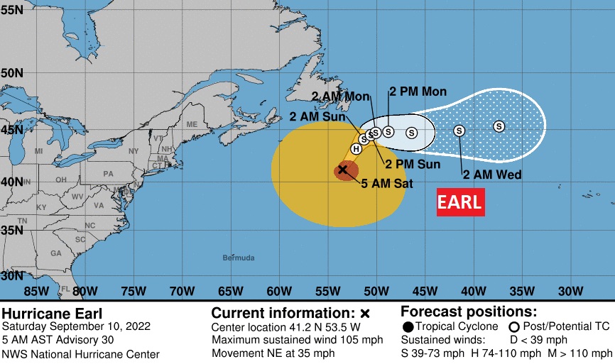
Earl is a 105 mph hurricane curving into the open Atlantic.
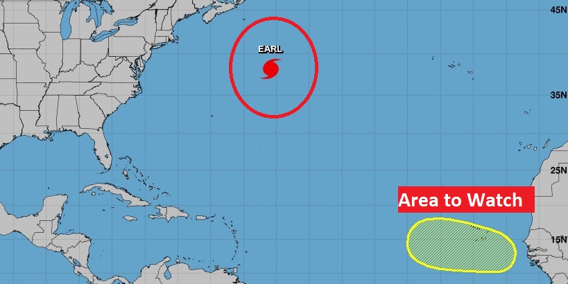
An Area to Watch in the eastern Tropical Atlantic, has a 30% chance of a tropical cyclone in the next 5 days.
Thanks for reading this Blog this morning! I’ll have another update for you in the morning. Have a nice weekend!
–Rich