
Good Morning! Our weather continues. Here’s my brief video forecast discussion.
CLIMATE DATA: Yesterday’s high in Montgomery was a nice, comfortable 88. Morning low 59. Normal high 90, low 67. Rainfall: 0.00”. Sunrise at 6:29. Sunset 6:52.
TODAY: Sunshine. Tolerable humidity. High upper 80’s to near 90. East wind 5 to 10 mph. Comfortable tonight. Clear. Low 64.
NEXT FEW DAYS: Sunny days will continue. Low humidity days and comfortable nights. We should be dry through the week and weekend and well into next week. Highs upper 80’s to near 90 Friday. We’ll be in the low 90’s Sunday and Monday. Mid 90’s will return by next Tuesday & Wednesday. Overnight lows in the 60’s. Dry, storm-free for several days.
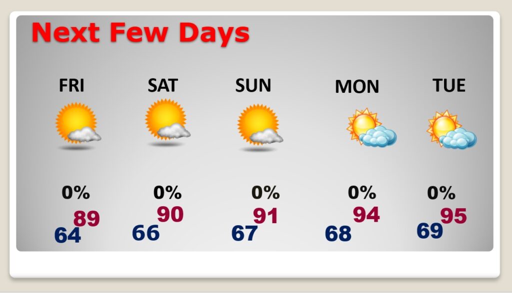
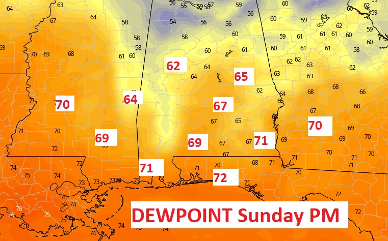
Humidity will still stay fairly tolerable through Friday. It’ll creep up a bit Saturday. Sunday through Tuesday will really start to feel like summer again. Look at the Dewpoints Sunday from the EURO model.
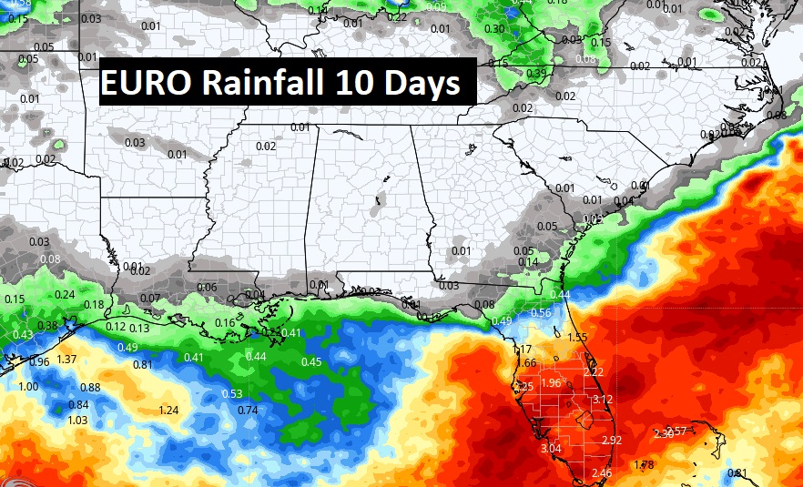
The EURO models still points to essentially dry forecast for about 10 days. Perhaps a couple of showers by the middle of next week.
TROPICAL OUTLOOK:
NHC is monitoring Tropical Storm Fiona in the tropical Atlantic with 50 mph. It’s moving west toward the northern Leeward islands.
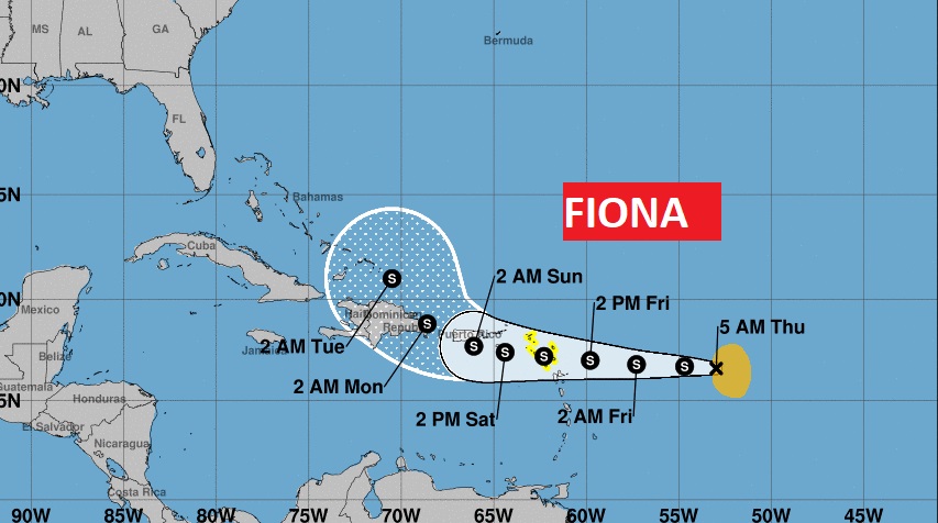
Tropical Storm Fiona, with 50 mph winds, is still moving westward in the Tropical Atlantic. It is a lopsided storm, with all the convection east of the center. Only slow development is expected. Tropical Storm Watch for the northern Leeward Islands.

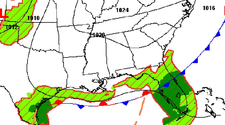
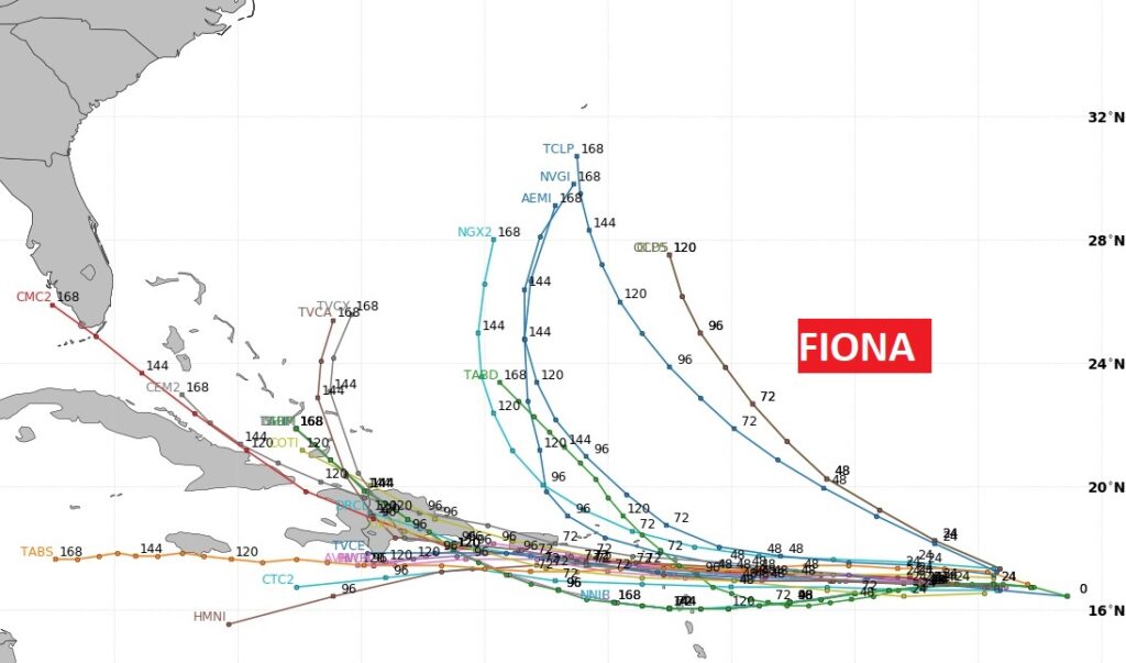
Most models curve Fiona into the open Atlantic. There are a few outliers which point the system towards the Gulf.
FIRT DAY OF FALL: The official Autumnal Equinox is one week from today.
Thanks for reading this Blog this morning! This morning we are LIVE on the radio from 6 to 9 on NewsTalk 93.1. Watch us on TV on CBS 8 and ABC 32. I’ll have another update for you in the morning. Have a great day! –Rich