
Good Morning! Here’s my brief video forecast discussion.
CLIMATE DATA: Yesterday’s high in Montgomery was a nice, comfortable 87. Morning low 63. Normal high 89, low 67. Rainfall: 0.00”. Sunrise at 6:33. Sunset 6:48.
TODAY: Sunshine. A little higher on the humidity. High near 90. East wind 5 to 10 mph. Clear tonight. Low 68.
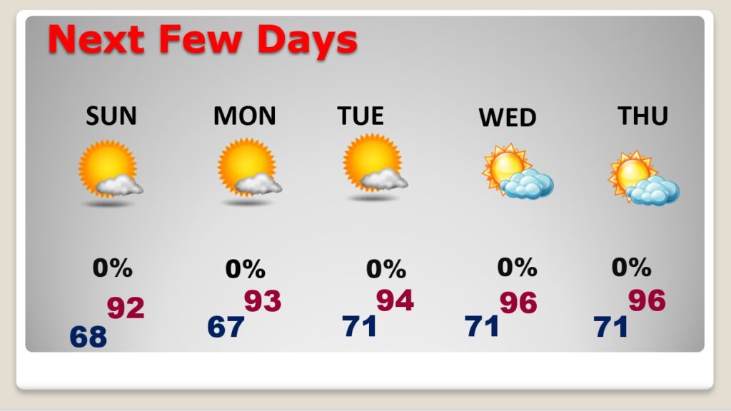
NEXT FEW DAYS: Sunny days will continue. The humidity is creeping up a bit. We should be dry through weekend and through most of next week. We’ll be in the low 90’s Sunday and Monday. Mid 90’s will return by next Tuesday through Thursday. Overnight lows in the 60’s. Dry, storm-free for several days.
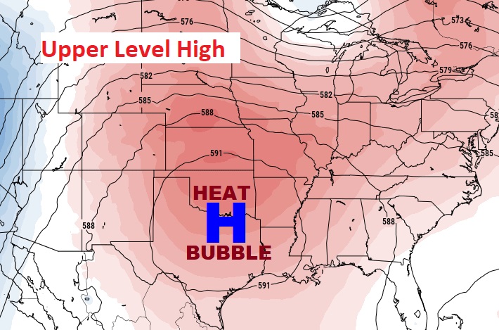
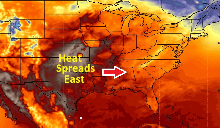
An Upper Level Heat Bubble High is building eastward. The intense heat in the middle of the country is migrating eastward.
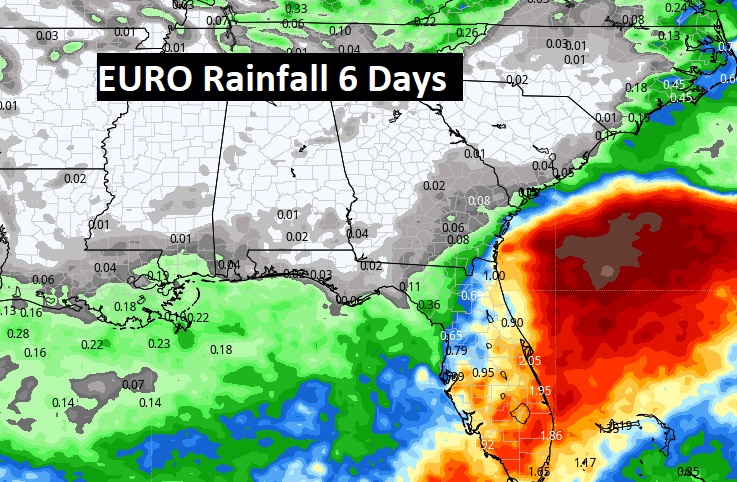
The EURO models still points to essentially dry forecast for about the next 10 days.
TROPICAL OUTLOOK:
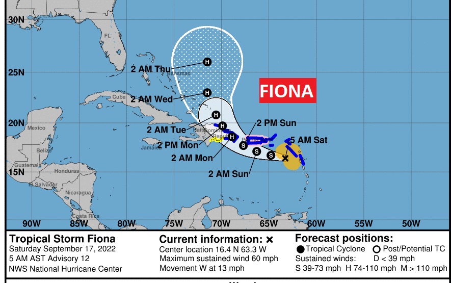
NHC is monitoring Tropical Storm Fiona with winds of 60 mph, moving west at 15 mph. Hurricane Watch for Puerto Rico and The Dominican Republic. Fiona is about to interact with Puerto Rico. Then it will make the curve toward eastern Hispaniola, and head to the Turks and Caicos islands. NHC take it to hurricane intensity, perhaps by Sunday evening.
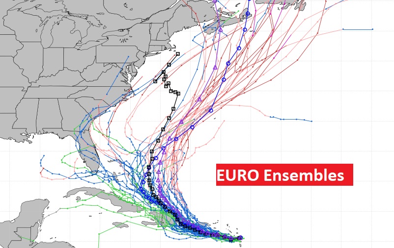
The models simply don’t know what to do with Fiona after 5 days. Most models keep the storm track in the Atlantic. But some models still suggest a more westward track toward Florida and the Gulf. Here’s The Euro Model 51 member Ensemble Tracks.
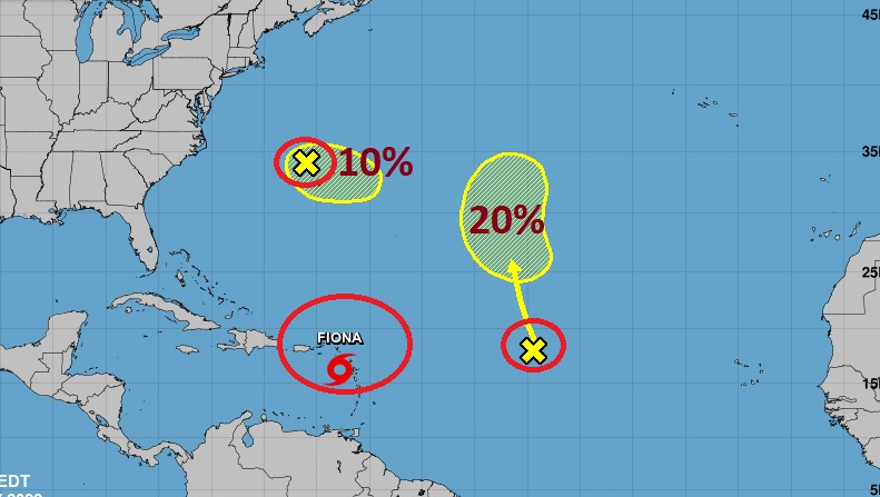
Elsewhere, NHC is tracking two other Areas to Watch, with a low probability of development in the next 5 days.
Thanks for reading this Blog this morning! I’ll have another update for you in the morning. Have a great weekend!
–Rich