
Good Morning! Finally we got substantial rainfall. In fact, early morning as I create this, a line of strong storms is moving through the area. Here’s my brief forecast discussion.
TODAY: Early morning, pre-dawn drama as a line of strong storms race through the area with gusty winds, heavy rain and lots of lightning. This is ahead of a cold front. By about 7AM this area of rain and storms will be in southeast Alabama. These storms area ahead of a cold front. It will be cloudy this morning, with gradual improvement later in the day as clearing occurs in the afternoon. High near 80. Winds shifting to the NW in the afternoon behind the front at 10 to 15 mph gusting to 20. Clear, Chilly tonight. Low 49.
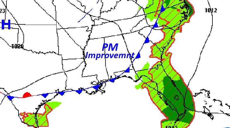
The front moves into SE Alabama by afternoon. Here’s the map at 1PM.
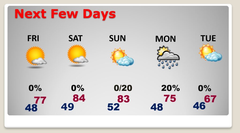
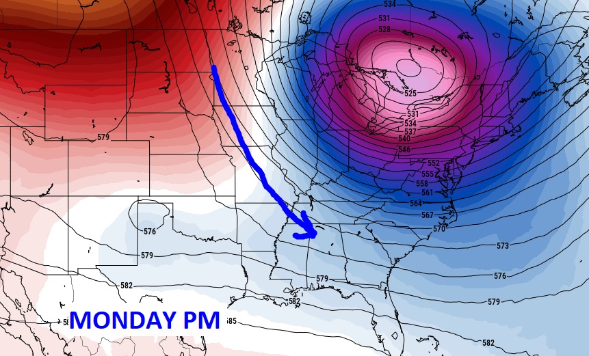
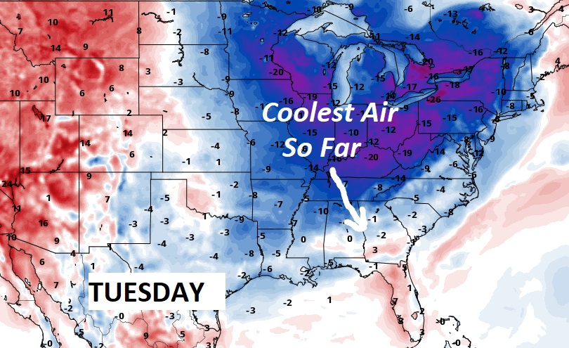
NEXT FEW DAYS: Behind today’s front… The nights will be quite chilly. It will be cooler Friday, but nice with highs in the 70’s. The weekend will be warm and dry but comfortable during the day, and cool at night. As the next front approaches, I have in a small chance of rain in for Sunday night and Monday. The front which moves through Monday will deliver the coolest air of the season so far. Tuesday’s high will only be in the 60’s.
Nice shot of Fall Air early next week.
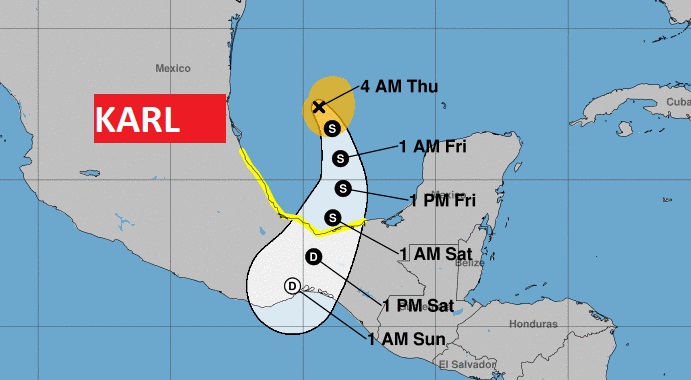
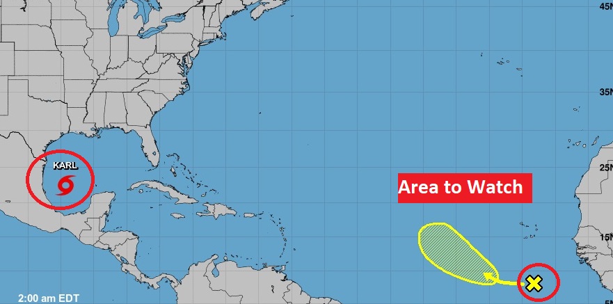
TROPICAL OUTLOOK: Tropical Storm Karl in the southwest Gulf is headed for Mexico.
There is a new area to watch in the southwest Gulf with a 20% chance of development in the next 5 days.
Thanks for reading this Blog this morning! I’ll have another update for you in the morning. Have a nice day!
–Rich