
Good Morning! Take the umbrella. For the first time in 23 days, rain returns to the radar today. Here’s my brief forecast discussion.
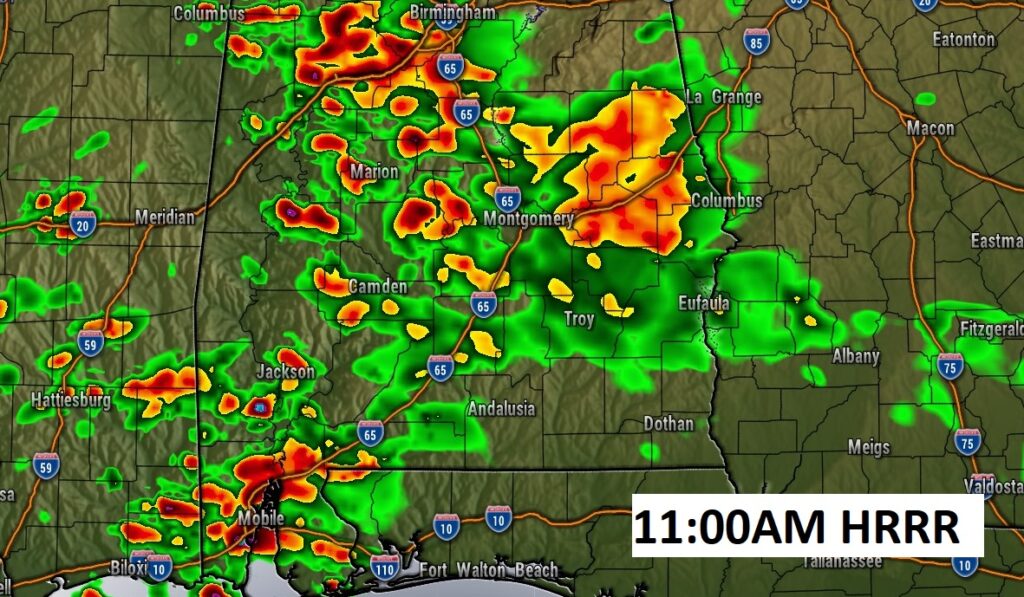
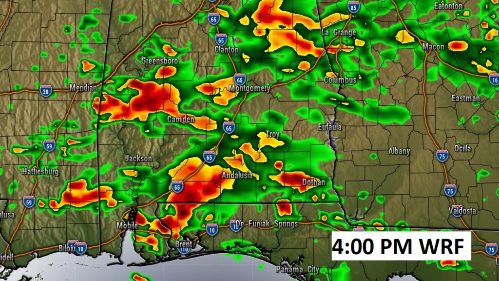
TODAY: Showers and thunderstorms will be scattered to numerous across the area, just about any hour of the day or night today. A couple of stronger storms are not out of the question. High today 83. Low tonight 65. Good luck on the rainfall in your town.
Here’s a couple of hi-res models Future Radar snapshots. The point is….radar will be active. Showers and storms are possible at hour of the day or night today.
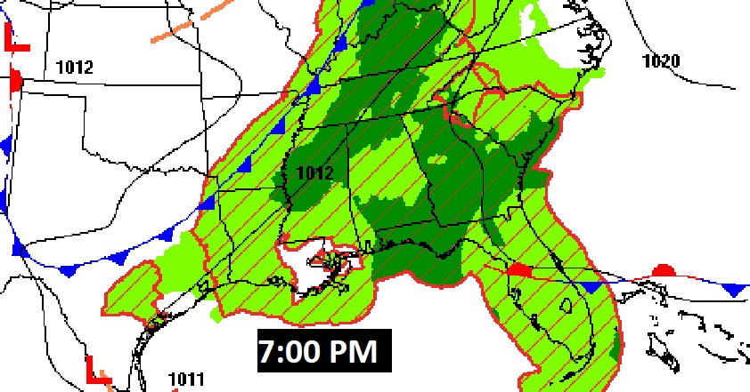
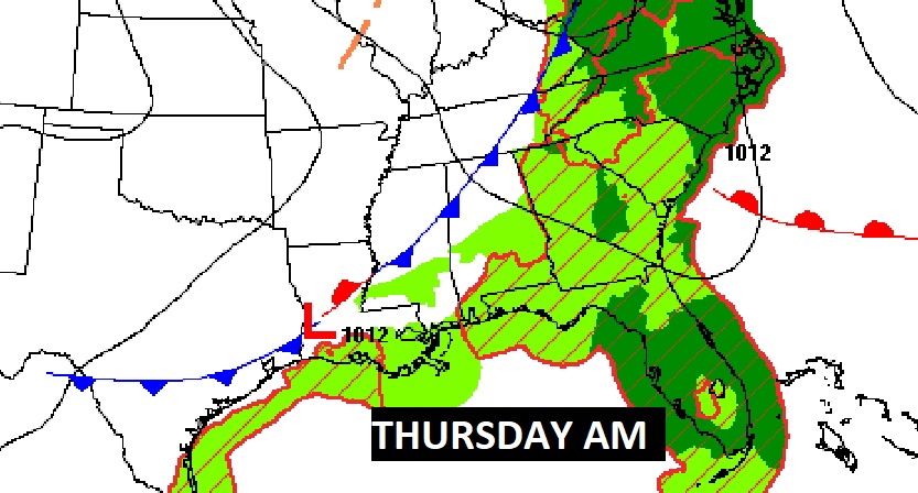
The Cool front moves through early tomorrow, ending the rain threat.
Most towns will get rain today and tonight. Some towns more than others.
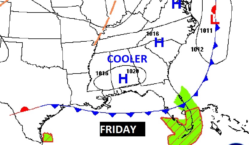
NEXT FEW DAYS: The Cold Front responsible for the rain today, moves across the area early tomorrow. Risk of showers ends early. Expect clouds on Thursday morning. Clearing later. Behind that front, expect cooler air. The nights will be quite chilly. It will be cool Friday through the following weekend. Looks like a nice weekend. Right now I have Sunday dry. But, some models try to being in some showers as a front approaches. I have a small chance of rain in for Monday.
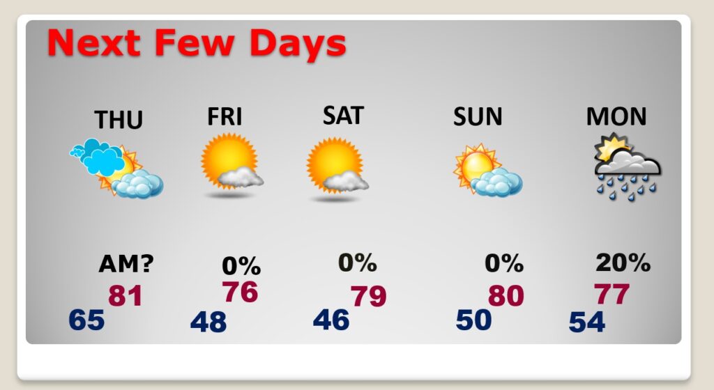
Friday will be sunny and cooler with highs in the 70’s.
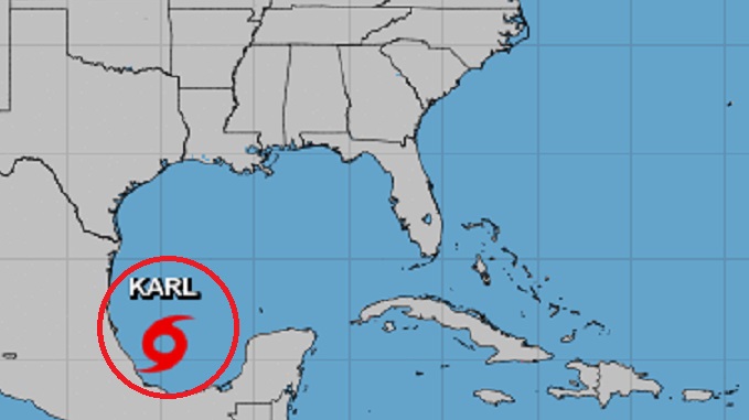
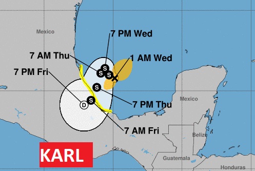
TROPICAL OUTLOOK: NHC is tracking one system in the Tropics. Tropical Storm Karl in the southwest Gulf is not a concern to the United States. It should drift southward into Mexico.
Thanks for reading this Blog this morning! This morning we are LIVE on the radio from 6 to 9 on NewsTalk 93.1. Watch us on TV on CBS 8 and ABC 32. I’ll have another update for you in the morning. Have a nice day!
–Rich