
11:30AM UPDATE:
`1:40 PM Update
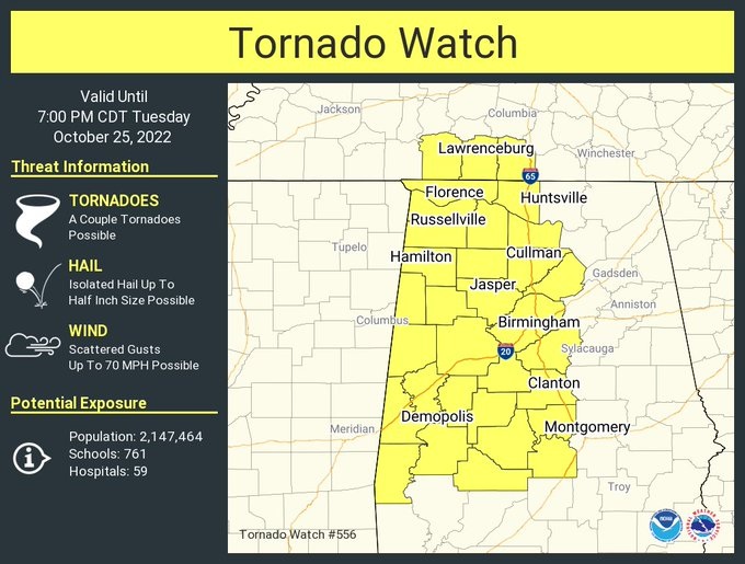
Tornado Watch now covers much of northern, western and central Alabama until 7PM. Damaging wind gusts to 70 mph possible. A couple of tornadoes, perhaps. Hail to 1/4 inch maybe. Stay weather aware. #alwx
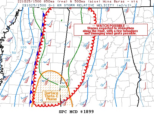
SPC says: Tornado Watch Likely SOON for parts of east Mississippi and west and northwest Alabama. (60% chance) https://spc.noaa.gov/products/md/md1899.html…
EARLY MORNING UPDATE:
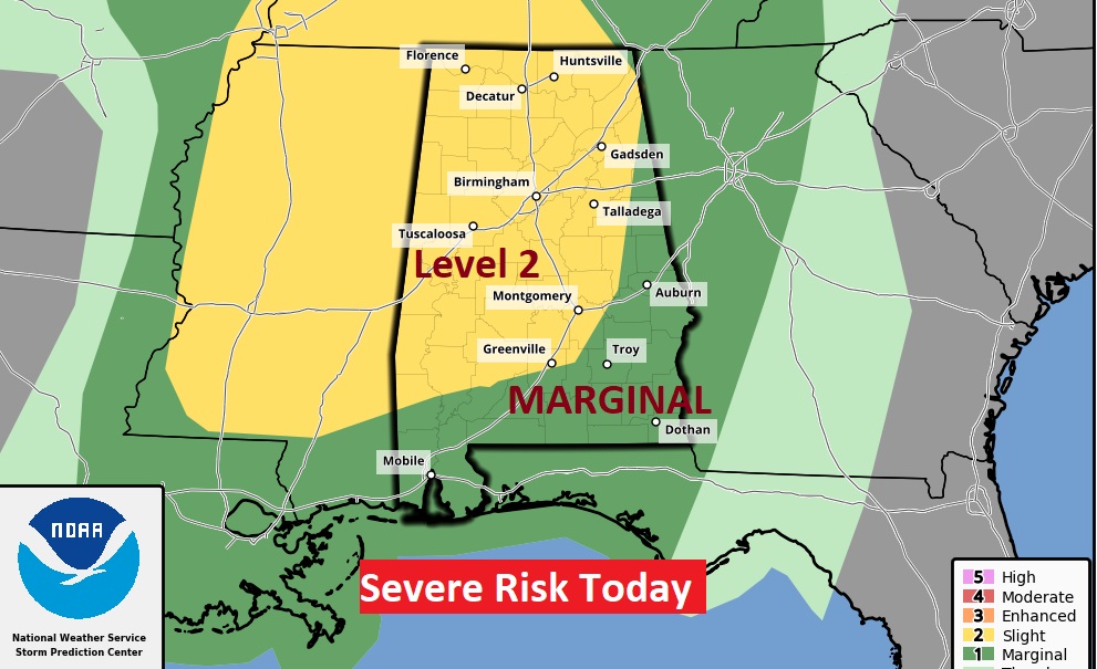
Good Morning! Weather changes on the way as a frontal system approaches. All of the state is in a Severe Weather Risk today & tonight. Many of us are in a Level 2 Risk. Damaging winds would be the main threat, but a spin-up tornado or two can’t be ruled out. Cooler air follows the front tomorrow. Here’s my brief forecast discussion.
TODAY: Another warm day today. High 80-82. Risk of scattered thunderstorms by afternoon. But a more organized line of thunderstorms will affect the area by this afternoon and into the evening. Some storms will potentially be strong, possibly severe. Storms will end by late tonight as the cold front moves through. South winds 5 to 15+ today, gusting as high as 30 mph tonight, Breezy and cooler overnight. Low 52.
All of the state is in a Severe Weather Risk. But, a large chunk is in a Level 2 threat, generally along and west of a line from Alex City to Greenville. Damaging winds would be the main threat, but a tornado or two can’t be ruled out. The main Severe Weather Threat window extends from about 5PM in the far west to about 11PM in the far eastern and SE part of the state.
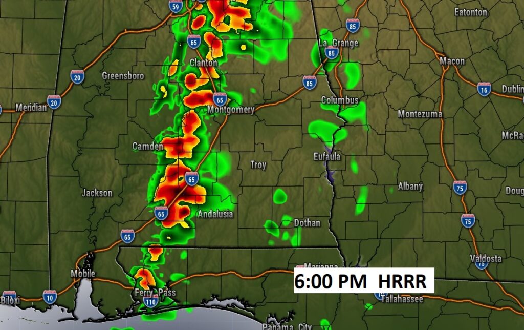
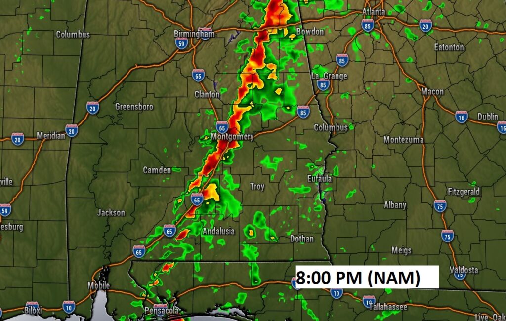
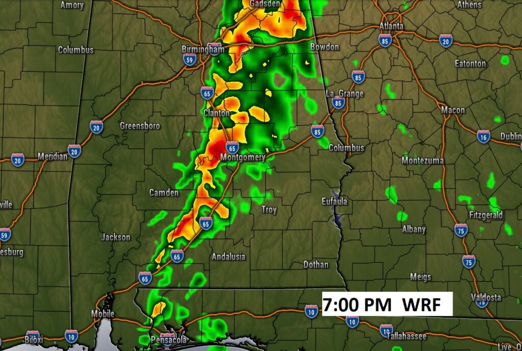
Here’s a couple of Future Radar snapshots showing the main action along a “squall line” Tuesday evening The HRRR Model is fastest, near the center by 6PM. The NAM model is slowest at 8PM. The WRF model is right in the middle at about 7PM. You get the general. Generally in this squall line type situation, damaging wind gusts are possible. Sometimes there could be brief spin-up tornadoes.
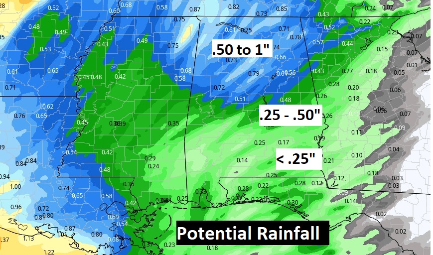
Some towns could get .25 to .50”. Though, many towns may have more disappointing totals.
The front moves through the area this evening and tonight and clears the state by tomorrow.
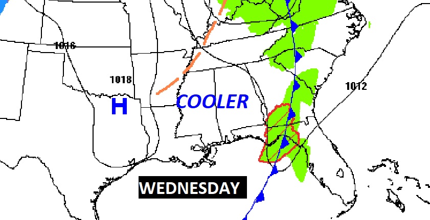
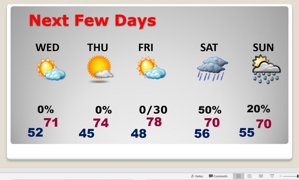
NEXT FEW DAYS: The air behind the Cold front is cooler, but not too cool . Wednesday will be breezy and noticeably cooler with a high in the Low 70’s . Middle 70’s Thursday. Another shower risk pops up around Friday Night and over the weekend.
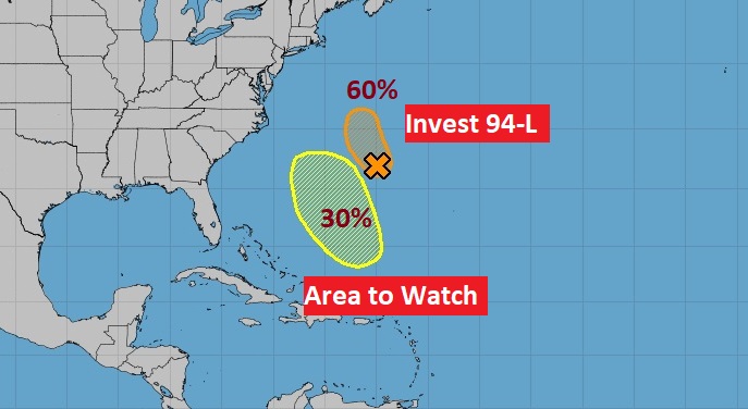
TROPICAL WEATHER: NHC is monitoring Invest 94-L in the central Atlantic with a 60% chance of development. Plus there is a Area to Watch in the central Atlantic with a 20% chance of development in the next 5 days.
Thanks for reading this Blog this morning! This morning we are LIVE on the radio from 6 to 9 on NewsTalk 93.1. Watch us on TV on CBS 8 and ABC 32. I’ll have another update for you in the morning. Have a nice day!
–Rich