
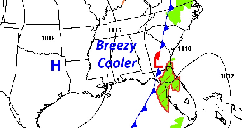
Good Morning! Cooler air is sweeping into the state following the Cold Front last night. Thursday & Friday will be warmer. But, our weekend could be wet at times. Here’s my brief forecast discussion.
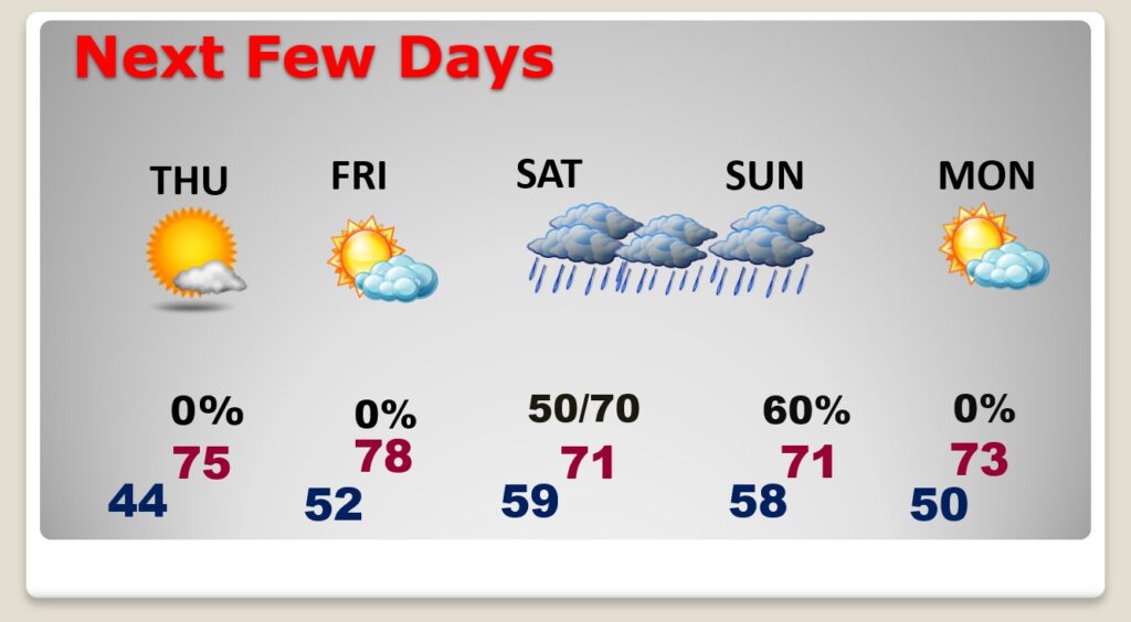
TODAY: A big change. Sunshine, but noticeably cooler. Yesterday’s high was 80. Today will be closer to 70. A few towns will fail to reach 70. A little breezy. North wind at 10 to 16. Clear and colder tonight. Low 44.
The front that brought showers and storms to the state yesterday is moving into Florida.
NEXT FEW DAYS: Thursday and Friday look nice. Lots of sunshine. Mid 70’s Thursday. Upper 70’s Friday. Another shower risk pops up by late Friday Night. The weekend looks wet at times. It won’t rain all weekend, but be flexible with your plans.
A slow moving Gulf Coast storm system will keep the weekend wet at times.
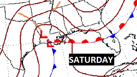
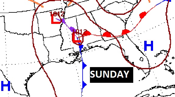
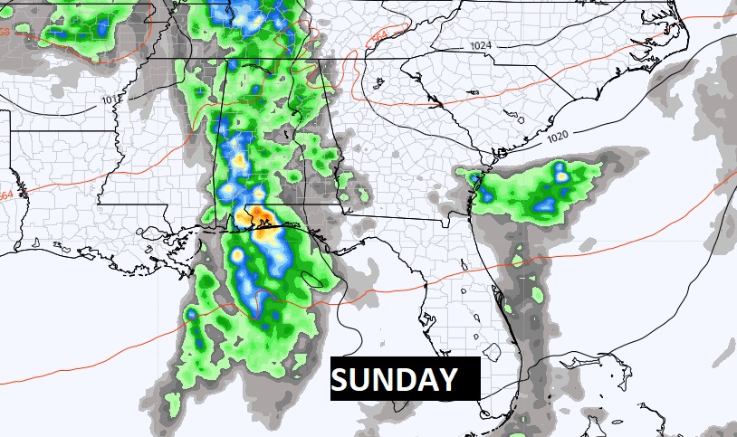
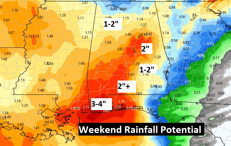
Here’s a computer model blend on potential weekend rainfall. Interesting. Looks potentially wet. Nobody wants rain on the weekend, but we need the rain.
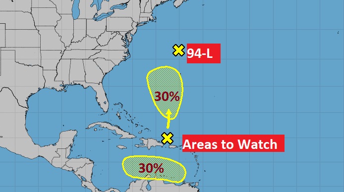
TROPICAL WEATHER: NHC is monitoring two areas to watch – one in the Atlantic and one in the Caribbean. Both with a 30% chance of development in the next 5 days. The potential Caribbean disturbance is something to watch.
Thanks for reading this Blog this morning! This morning we are LIVE on the radio from 6 to 9 on NewsTalk 93.1. Watch us on TV on CBS 8 and ABC 32. I’ll have another update for you in the morning. Have a nice day!
–Rich