
Good Morning! Today will be rather uneventful. Cloudy. Tiny rain chance. Temperatures about average for mid December. Tuesday will be similar. But, as we’ve been discussing for several days, a “big deal” storm system arrives Wednesday. This system will bring severe weather to parts of Alabama, along with the threat of locally heavy rainfall. Much cooler air will follow the storm system, especially by Friday and beyond. A complete change of climate. Here’s my brief forecast discussion.
TODAY: Patchy Dense Fog once again this morning. Visibility will be near or below ¼ mile in spots.
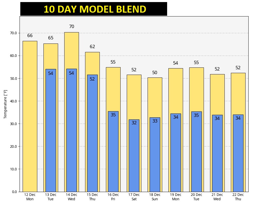
Expect a cloudy day today. Isolated showers are possible today and tonight. High today in the mid 60’s. That’s not too far from the normal high of 63. East wind at 5 to 10 mph. Not too cool tonight. Low 54. (Normal low 39)
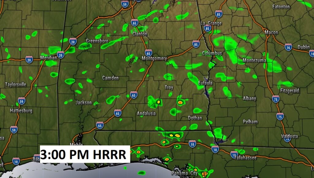
Here’s a Future Radar snapshot this afternoon. Widely scattered showers. Many tows will stay dry.
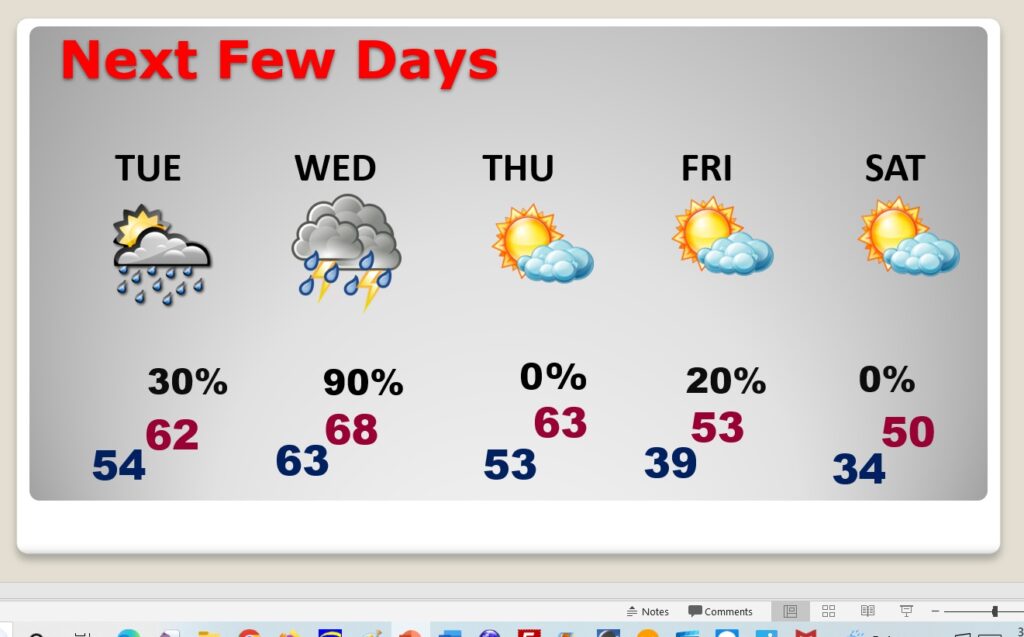
NEXT FEW DAYS: Small rain chance through Tuesday. Cool Tuesday. High 62. Showers and storms likely Wednesday. Potential Severe Weather Threat Wednesday, along with locally heavy rainfall. Quite a bit cooler Thursday. And, Much cooler Friday and Saturday.
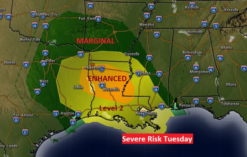
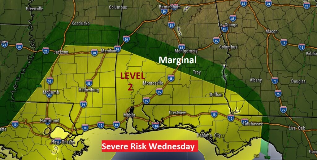
There will be a significant coast to coast storm system crossing our country. We’ve been talking about this storm system for many days. In some states, this storm will produce blizzard conditions. Other places will see flooding rainfall. Across much of the South, Severe Weather will be the main focus. Tuesday’s Severe Risk will be a significant west of Alabama. Across our state, the most likely time for severe weather will be Wednesday and Wednesday evening, particularly across south and SW Alabama. All modes of severe weather are possible, including tornadoes.
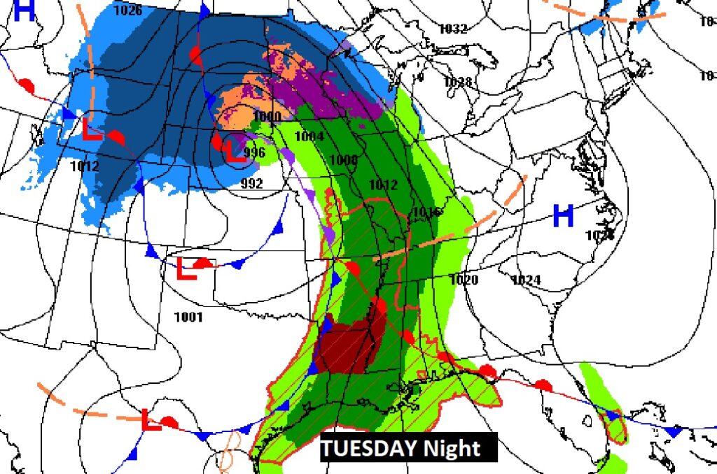
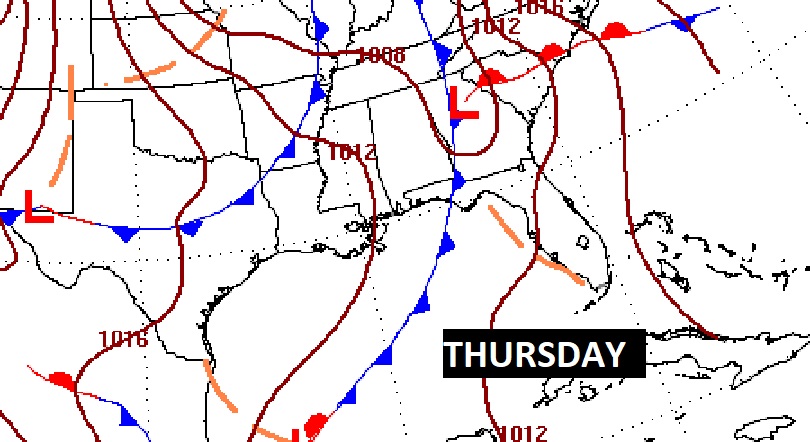
The Storm Prediction Center has outlined a rather significant Severe Risk west of us in Mississippi, Louisiana, Arkansas and Texas on Tuesday, including the threat of tornadoes. On Wednesday, SPC shows the strongest severe weather threat across SE Mississippi and south SW Alabama. We’ll continue to watch for any changes in this threat level as we get closer to Wednesday.
Following the two cold fronts late next week, temperatures will turn sharply cooler (COLDER) from about Friday the 16th and beyond.
Thanks for reading this Blog this morning! This morning we are LIVE on the radio from 6 to 9 on NewsTalk 93.1. Watch us on TV on CBS 8 and ABC 32. I’ll have another update for you in the morning. Have a nice day!
–Rich