
Good Morning! Today will be quiet. A warm front moving through the state could spark an isolated shower. Otherwise, today will be spring-like. But, on the horizon is yet another Severe Weather Threat Tomorrow. The tornado threat is relatively small but not zero. An approaching storm system will bring showers & strong storms with a risk of damaging wind gusts by tomorrow afternoon. Following the storm, get ready for a Temperature Crash. It will turn windy and sharply colder Friday. We’ll sample some very Cold Air for about two days, before temperatures start to recovery. Here’s my brief forecast discussion.
TODAY: I’ll be optimistic and say – Partial sunshine. Warmer today…high 73. An isolated showers or two can’t be ruled out. Most places will stay dry. SE wind 5 to 15 gusting to 20 mph.. Mostly cloudy, very mild tonight. Low 59. (Normal: 59/36)

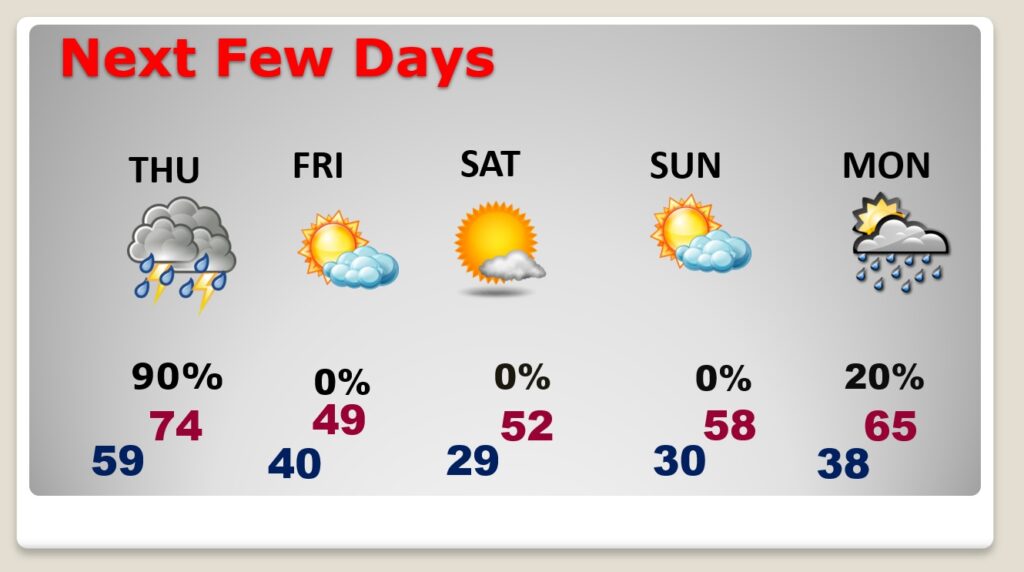
NEXT FEW DAYS: An approaching storm system will bring showers & strong storms with a risk of damaging wind gusts by tomorrow afternoon. Following the storm, get ready for a Temperature Crash. It will turn windy and sharply colder Friday. We’ll sample some very Cold Air for about two days, before temperatures start to recovery.
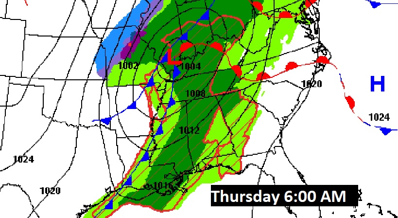
Here’s the map set up Thursday morning at 6AM.
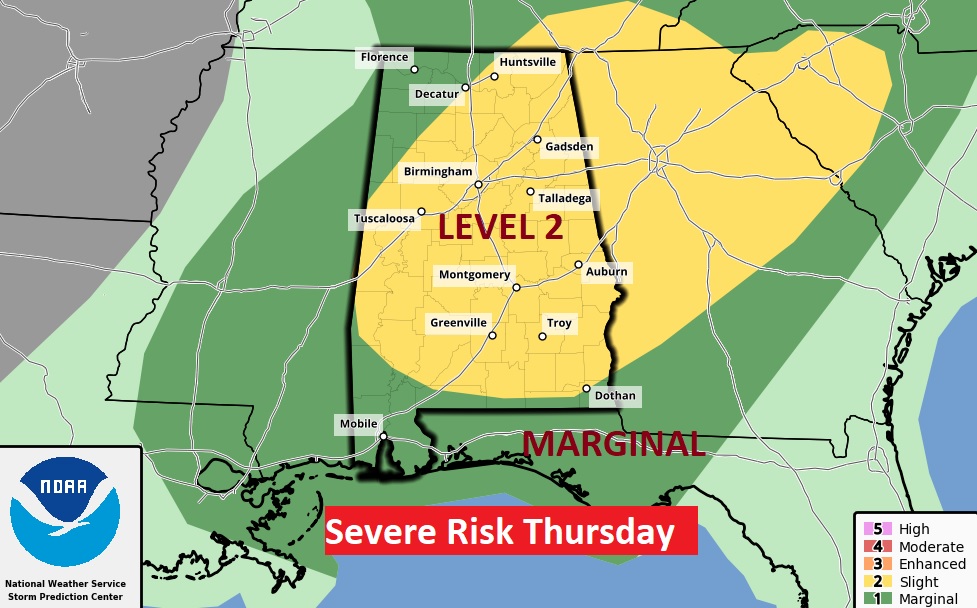
SPC has most of Alabama in a Level 2 Severe Threat tomorrow. The main threat would be damaging wind gusts along a strong line of thunderstorms. The tornado threat appears to be small, but not zero.
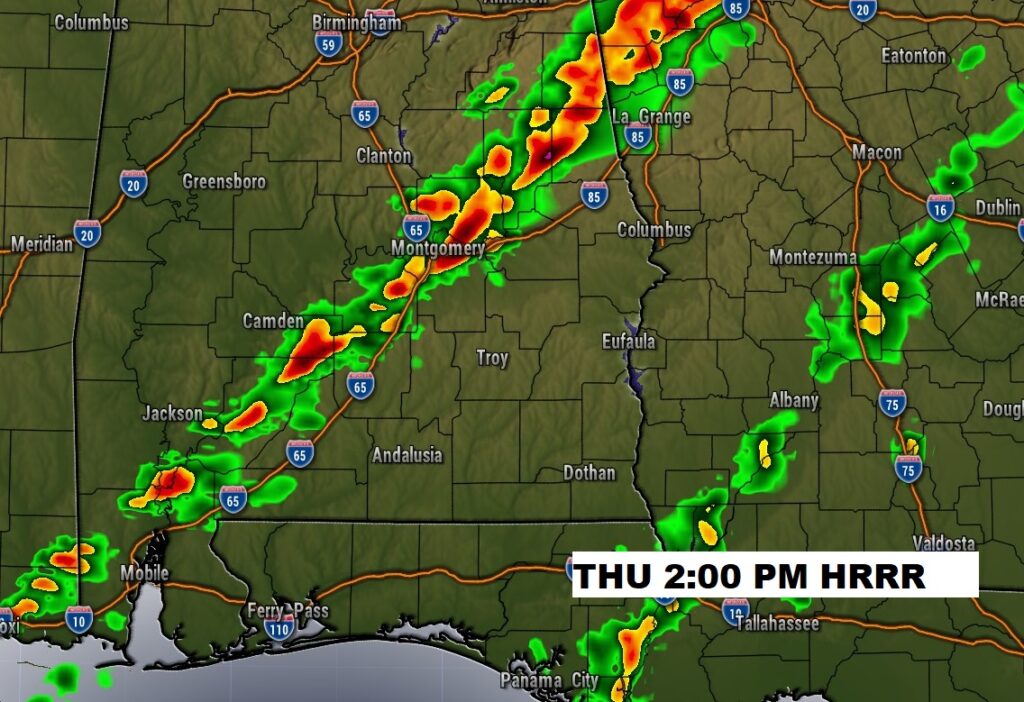
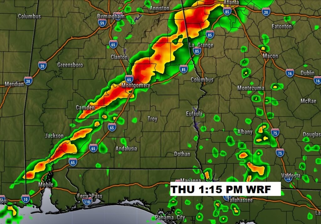
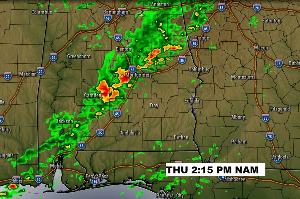
Here’s three Future Radar Snapshots on Thursday afternoon. The greatest threat of damaging wind gusts will be along a squall line. The tornado threat appears to be relatively low, but mot zero. Notice the three hi-res-models have similar timing for the squall line to reach the I-65 corridor. Early to mid-afternoon. Fortunately, this week’s event will be a linear event and not a cellular event. Southwest winds ahead of the front, will help limit the tornado threat.
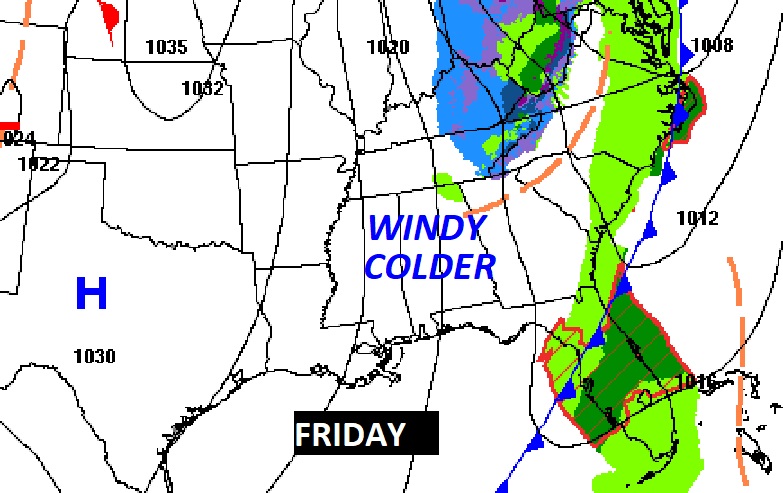
It will turn windy and sharply colder Friday. Get ready for a Temperature crash. Friday’s high may not reach 50. Wind chill by afternoon in the 30’s and then the 20’s after sunset. Low Friday night 29. Cold and Raw Saturday.
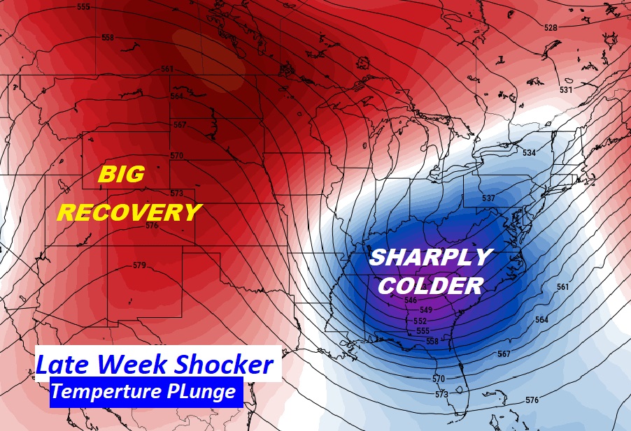
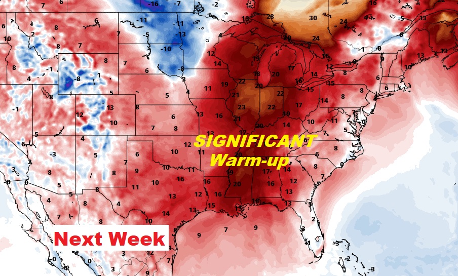
It does not stay cold long…at all. Look for a remarkable warm up next week. We’ll be back in the 60’s and 70’s.
Thanks for reading this Blog this morning! This morning we are LIVE on the radio from 6 to 9 on NewsTalk 93.1. Watch us on TV on CBS 8 and ABC 32. I’ll have another update for you in the morning. Have a nice day!
–Rich