
Good Morning! Showers and thunderstorms become likely today, ahead of a northward moving warm front. Some storms could be strong to severe especially by afternoon. We get a little break in the action Tuesday, before another round of showers and storms moves in by Wednesday afternoon and Wednesday night. As you are going to see in this Blog update, it will be wet at times for the next several days, including Easter weekend. Not a wash out. But, scattered showers & storms each day. Here’s my brief forecast discussion.
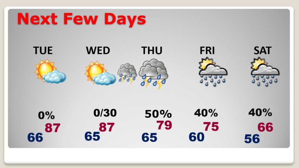
TODAY: Showers and thunderstorms become likely today, ahead of a northward moving warm front. Some storms could be strong to severe especially by afternoon. Breezy & warm today. High 77. Southeast wind 10 to 15, gusting as high as 25 mph. Risk of showers/storms through mid evening, before ending. Mostly cloudy. Low 66.
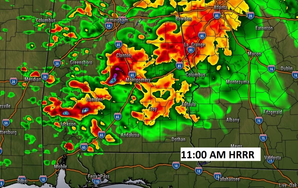
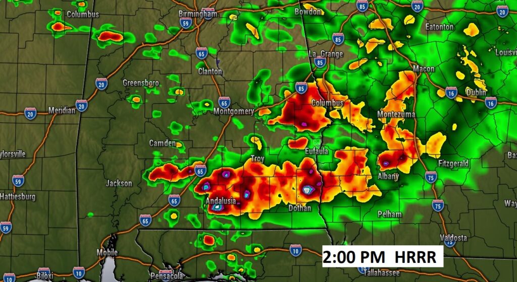
Here’s a couple of Future Radar snapshots. 100% chance of rain.
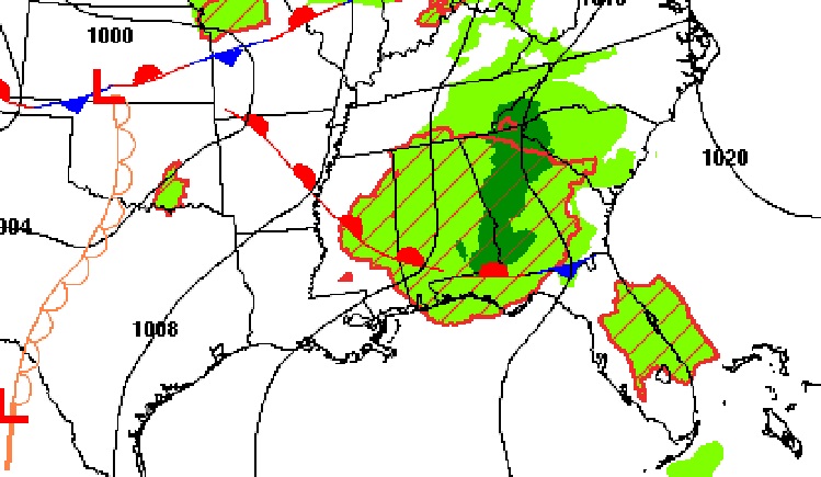
ANOTHER SIGNIFICANT SEVERE WEATHER OUTBREAK: Looks like yet another significant severe weather threat Tuesday for the Nation’s heartland, including another potential significant tornado outbreak. The Severe Threat moves eastward to the Great Lakes region Wednesday.
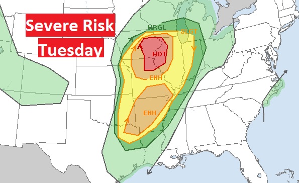
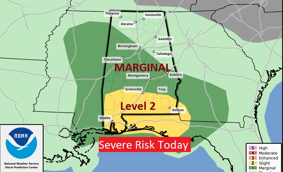
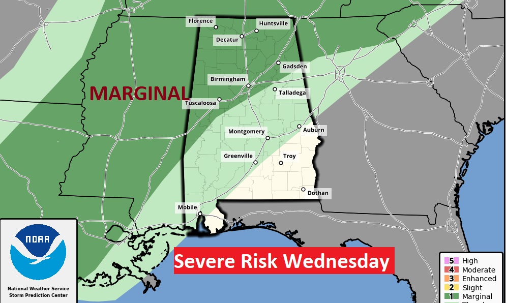
As this storm system gets closer to us, the severe weather will not be nearly as strong. The main Severe Threat will remain well to the north of us. A marginal risk stretches across north Alabama.
NEXT FEW DAYS: Tuesday looks dry and warm. But expect yet another storm system to bring in another round of storms by Wednesday. Once again a few stronger storms can’t be ruled out. The cool front moves through Thursday AM. Bur, the front will take residence along the Gulf Coast. Waves of low pressure will move along the front. That will keep us wet at times Friday through Easter Sunday.
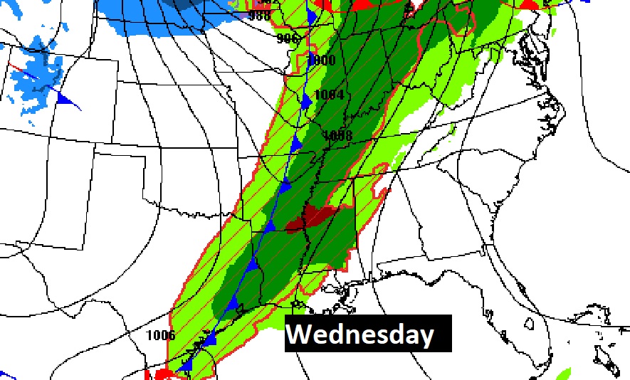
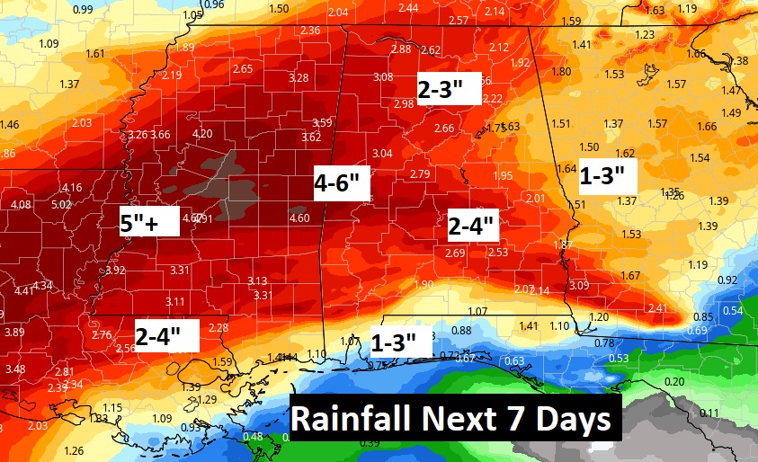
Looks like a wet week ahead across the South. Here’s the expected rainfall.
Not a very bright Easter Sunday forecast, at the moment.

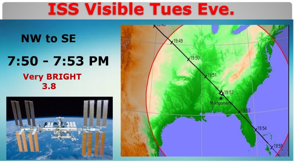
SPACE STATION FLYOVER: Clouds will probably NOT cooperate for viewing Tuesday night’s ISS flyover, but just in case, I already produced a graphic. It’s a good flyover. Our chances of seeing it…NOT good. Fingers crossed.
Thanks for reading this Blog this morning! This morning we are LIVE on the radio from 6 to 9 on NewsTalk 93.1. Watch us on TV on CBS 8 and ABC 32. I’ll have another update for you in the morning. Have a nice day!
–Rich