
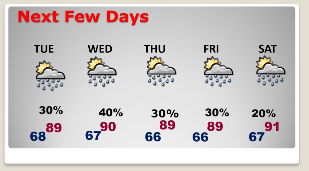
Good Morning! The second week of May will feel more like the second week of June. It’s a very summerlike scenario for our week ahead. Scattered “hit or miss” storms will be a little more common today on radar than yesterday. Warm and humid for the next few days. We’ll be well into the 80’s today and I think we’ll be teasing 90 degrees each day Tuesday through Sunday. Each day will be similar. Like a summer scenario, there will be random scattered “hit or miss” pop up storms around each day, most numerous in the afternoon and evening hours. Sounds like a typical summer fore cast a few weeks too early. Here’s my brief forecast discussion
CLIMATE DATA: Yesterday morning’s low was 62. Sunday’s high was a muggy 89°, with dewpoints in the mid to upper 60’s. (Normal hi/lo 84/59) Airport rainfall: 0.00.
TODAY: Warm & muggy. Sun and cloud mix. Scattered “hit or miss” storms will be a little more common today on radar than yesterday. High 86. Storms will “thin out” later this evening. Low tonight 68.
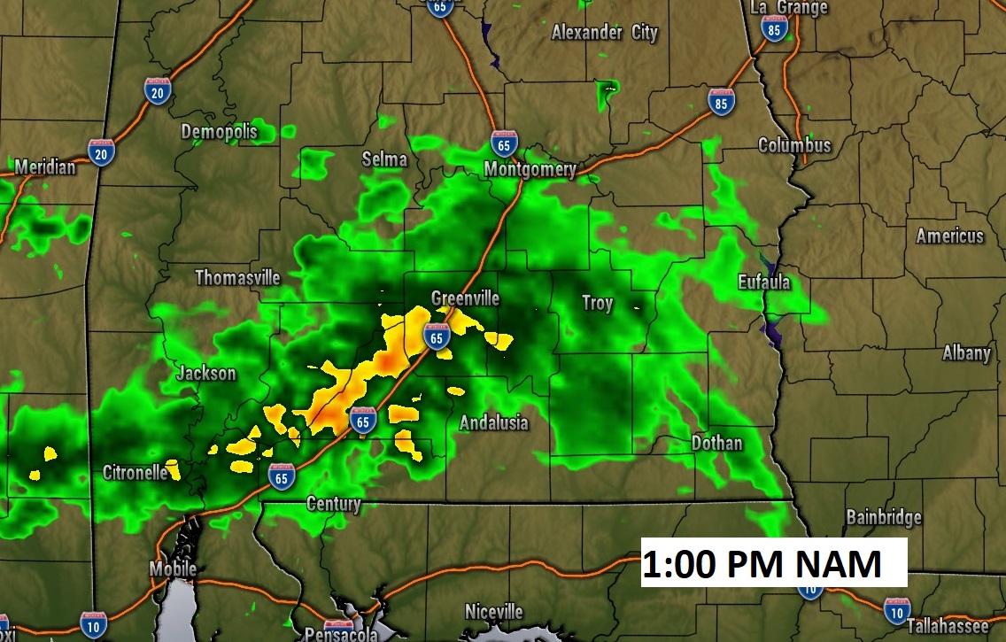
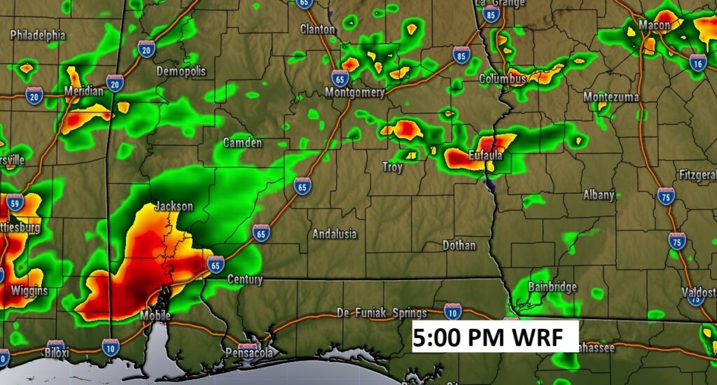
Here’s a couple of high-res Future Radar snapshots this afternoon. Not every town will get wet, but showers and storms will be more numerous than yesterday.
NEXT FEW DAYS: Our summerlike scenario will continue. Warm & humid. We should reach the upper 80’s today & Monday. Tuesday through the end of the week, high temperatures will be close to 90 each day. Today, the rain chance will be relatively small. Expect scattered, random hit or miss storms each day through Saturday. It’ll feel more like the second week of June than the second week of May.
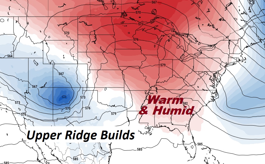
A huge Upper Level Ridge over Gulf South will continue to lock-in our current summer-like pattern. It will also divert potential storm systems away from us.
Thanks for reading this Blog this morning! I’ll have another update for you in the morning. Have a nice day!
–Rich