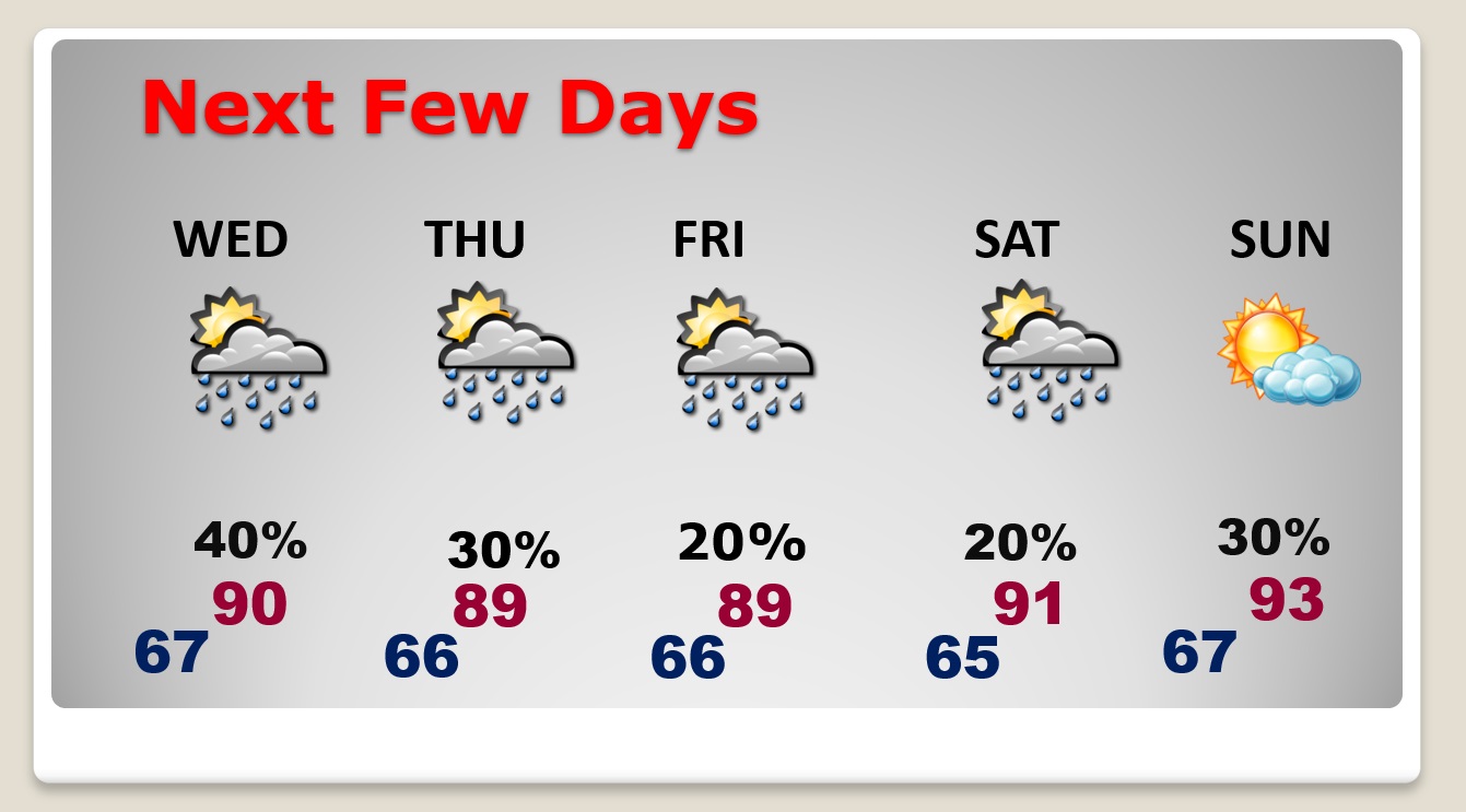
Good Morning! Our summer preview continues. In fact, get used to it. This pattern is locked in for the next several days. Highs today will at least reach the upper 80’s. But, we will be teasing 90 each day through the end of the week. Highs over the Mother’s Day weekend will be in the low 90’s. Of course, the heat is only one part of the equation. Dewpoints in the upper 60’s will make it seem muggy again today, and for the rest of the week. Scattered Pop-up random storms will be around each day, especially in the afternoon & evening. Storms will thin out in number by Friday & Saturday. Here’s my brief forecast discussion.
CLIMATE DATA: Yesterday morning’s low was 70. Sunday’s high was a muggy 83°. (Normal hi/lo 84/59) Airport rainfall: 0.02.
TODAY: Patchy AM fog. Warm & muggy. Sun and cloud mix. Scattered “hit or miss” storms especially this afternoon & this evening, before fading out. High 89. Partly cloudy tonight.. Low tonight 68.
Here’s a couple of high-res Future Radar snapshots this afternoon. The models do not agree. The HRRR model at 2:30 PM looks sparse. The WRF model at the same moment looks much “busier”. The truth probably lies in-between. I have afternoon probability at about 30-40%. Random storms.
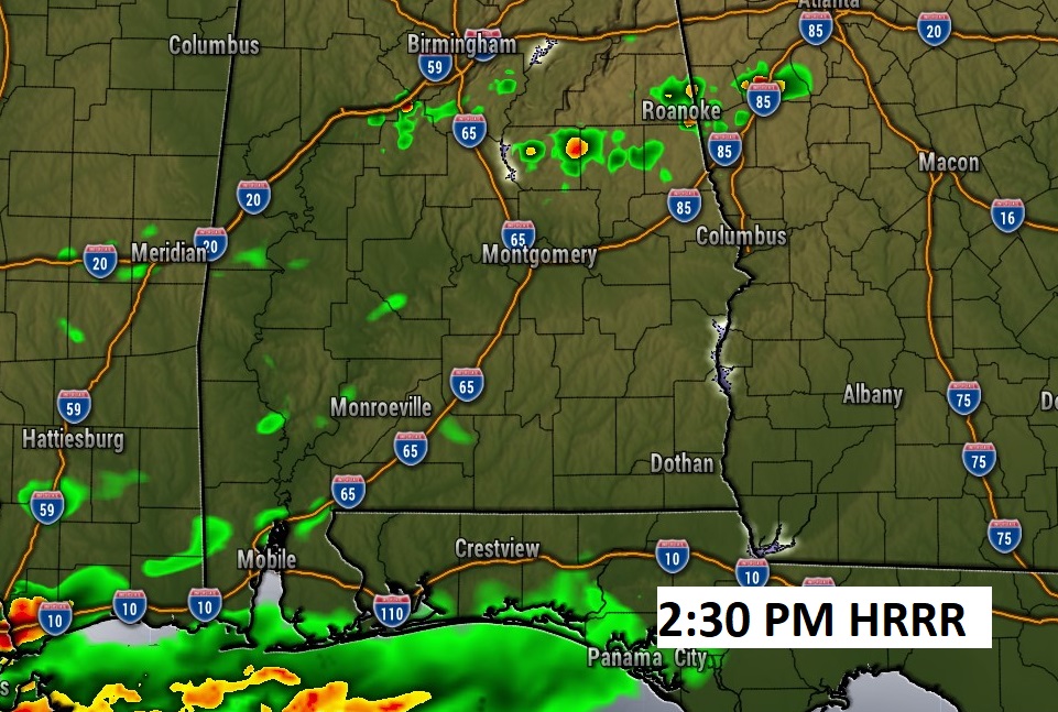
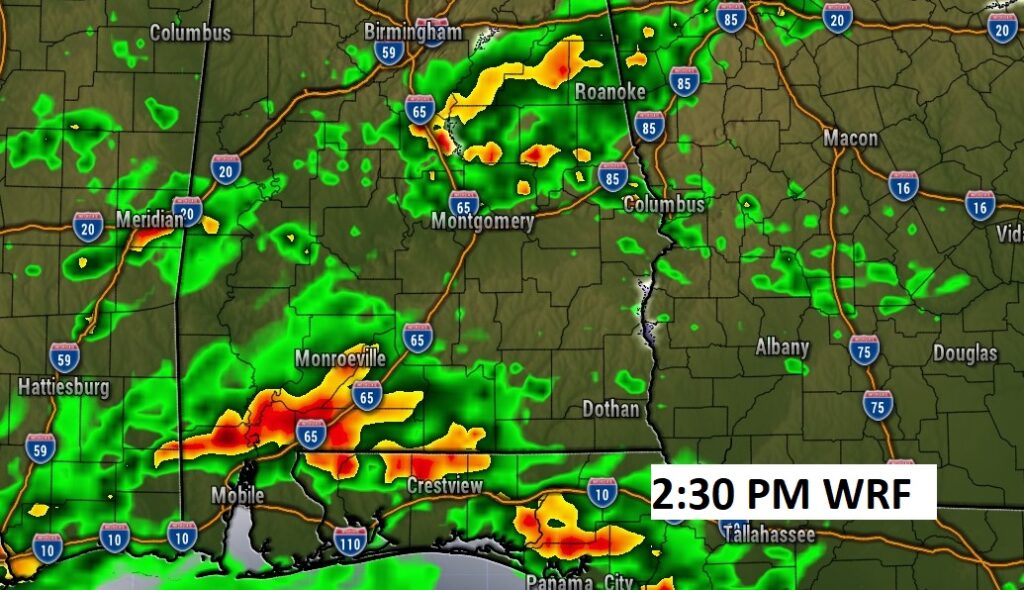
NEXT FEW DAYS: Our summer preview will continue. Warm & humid. We should reach the upper 80’s today. Wednesday through the end of the week, high temperatures will be close to 90 each day. Expect scattered, random hit or miss storms. By Friday & Saturday the number of storms will start to thin out. Mother’s day looks mainly hot and dry so far.
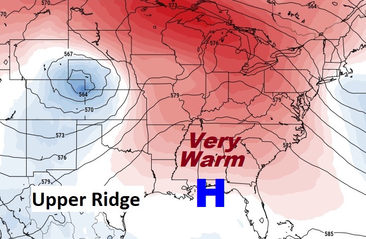
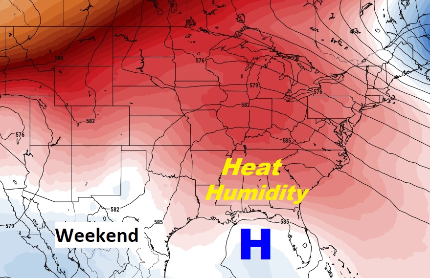
The big upper ridge of high pressure over us is promoting this Summer-like pattern. The upper high only gets stronger by the weekend. Looks like a hot and humid Mother’s Day Weekend.
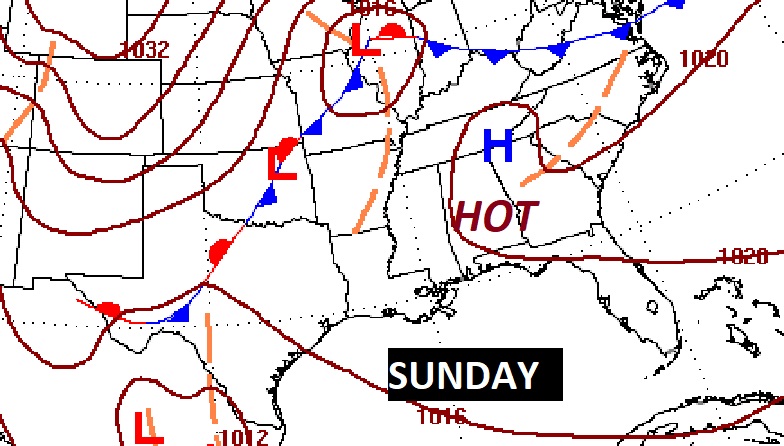
Thanks for reading this Blog this morning! This morning we are LIVE on the radio from 6 to 9 on NewsTalk 93.1. Watch us on TV on CBS 8 and ABC 32. I’ll have another update for you in the morning. Have a nice day!
–Rich
