
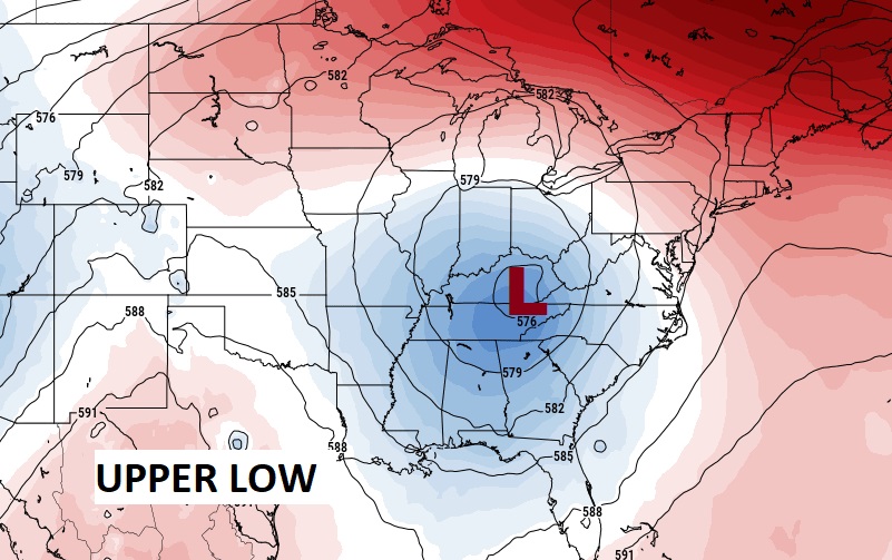
Good morning! Wednesday was another busy thunderstorm day across the area. But, we are going to start to see some subtle changes. The upper low which has been haunting us for days will migrate toward the northeast. So, today there will be fewer storms on the radar. Gradually the trend will be for the number of storms to continue to thin out, Friday and over the weekend. Fewer storms and hotter temperatures. We’ll be back to 90+ temperatures. The heat index will be near or above 100 by the weekend.
TODAY: Sun/cloud mix. There will be scattered random showers & storms, mostly in the afternoon and evening. High today mid 80’s. Low tonight near 70.
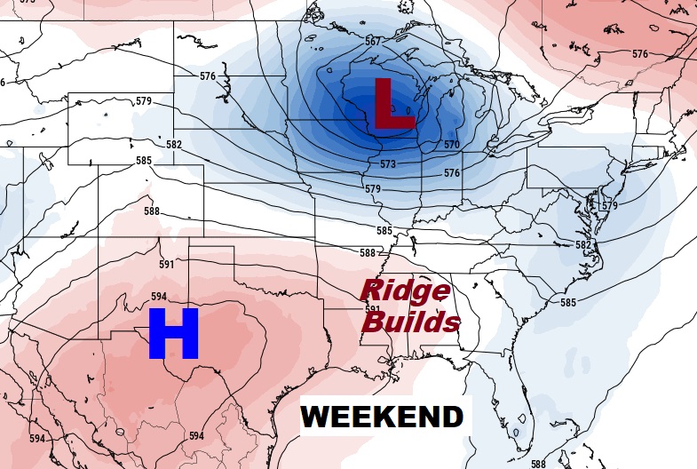
The Upper Low which has been haunting us for days will slide northeastward. This will help stabilize the atmosphere. Over the weekend, an upper ridge of high pressure will build. Storms will thin out. Much lower rain chances each day. Highs back to the lower 90’s. Heat index 100+. A more typical pattern for this time of year.
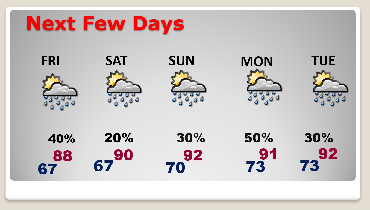
NEXT FEW DAYS: Gradually the trend will be for the number of storms to continue to thin out, Friday and over the weekend. Fewer storms and hotter temperatures. We’ll be back to 90+ temperatures. The heat index will be near or above 100 by the weekend.
TROPICAL UPDATE: Bret is a 70 mph Tropical Storm in the Tropical Atlantic, just below hurricane status as it approaches the Leeward Islands. A hurricane Watch is in effect on St. Lucia. But, Bret is expected to encounter a hostile environment as it reaches the central Caribbean and then dissipate over the weekend.
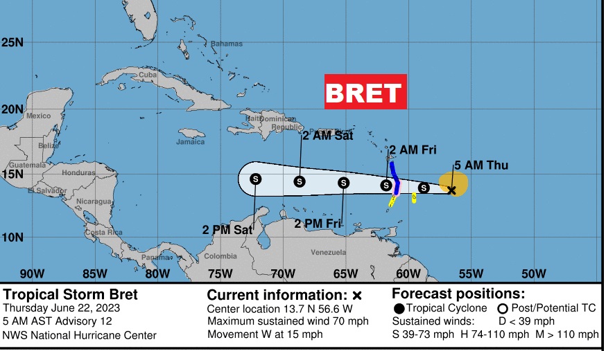
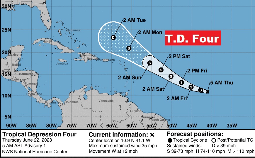
Behind Bret, Invest 93-L has been promoted to Tropical Depression Four in the Tropical Atlantic. It is projected to become Tropical Storm Cindy and curve into the Atlantic.
BEACH OUTLOOK: Your chances of encountering a storm are better than normal on the coast, especially on Friday. Scattered storms over the weekend. Highs in the mid 80’s. Gulf water temp. holding steady at 83. High rip current risk through Saturday and moderate on Sunday.

Thanks for reading this Blog this morning! I’ll have another update for you in the morning. I’m still at the 50th American Meteorological Society Broadcast Conference here in Phoenix. My daily updates will be a bit abbreviated through Saturday. Please bear with me. Thanks. Have a great day.
–Rich