
Good Morning! Radar will be quite active and colorful today. Showers and locally strong/severe storms are likely this afternoon, as a cluster of storms moves southeastward across the area ahead of a frontal system. Most of us are in a Level 2 Severe Risk, with the threat of damaging wind gusts. A Heat Advisory covers part of central Alabama and all of southeast Alabama. Dangerous Heat Indices can be expected again. Otherwise, there’s more Hot Days in our future for the rest of the week, with scattered random storms. Here’s my brief forecast discussion.
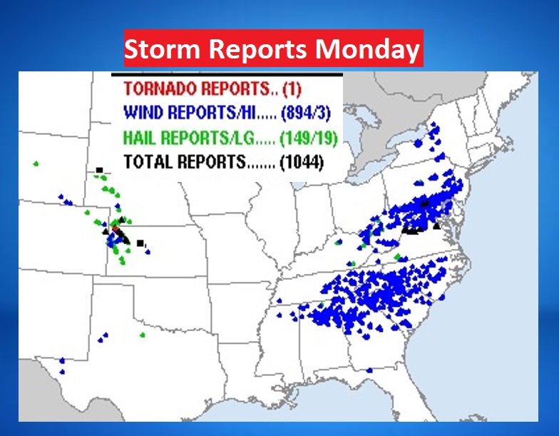
CLIMATE UPDATE: Monday’s high at MGM was 98. (Record high 101 in 2007) Maximum Heat Index 115. (Normal hi/lo 94/72) The airport had No Rain. Yesterday was a very stormy day in the United States with over 1000 severe reports. Mainly wind damage.
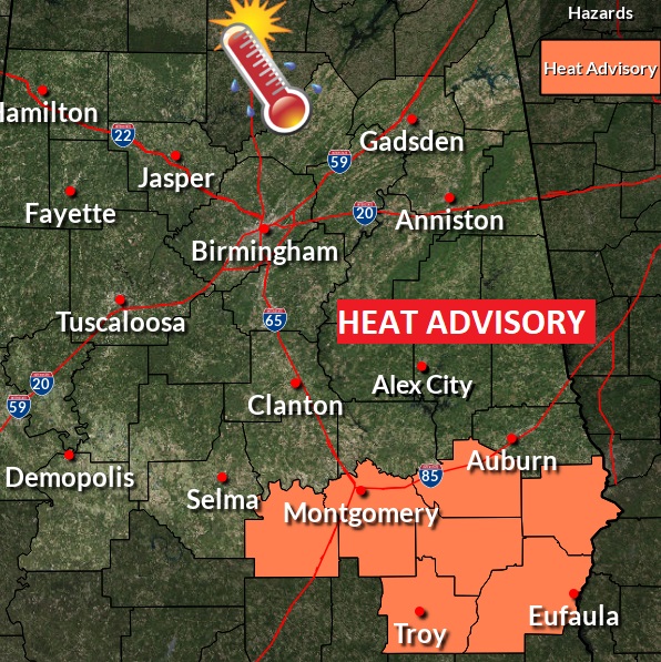
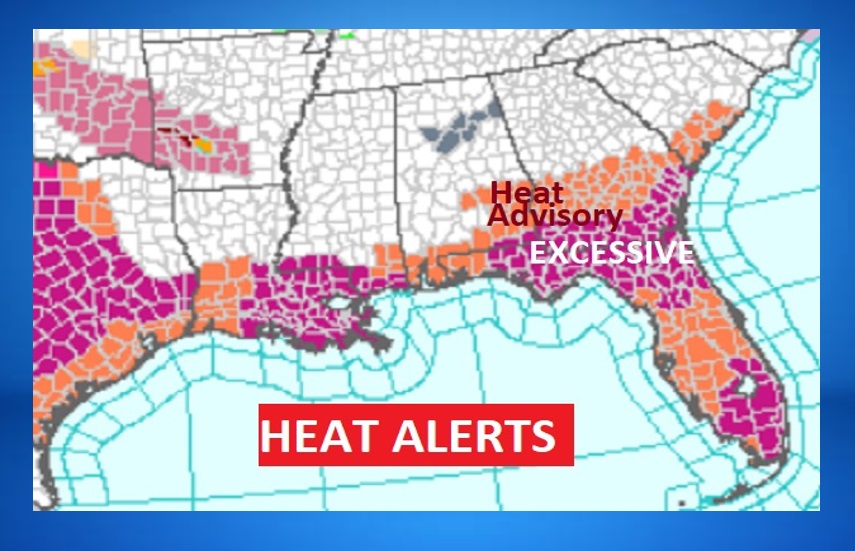
TODAY: Heat Advisory. High near 96. Dangerous Heat Index as high as 107. Showers and storms likely, this afternoon and this evening. Some could be strong to severe with damaging wind gusts. Low tonight 75
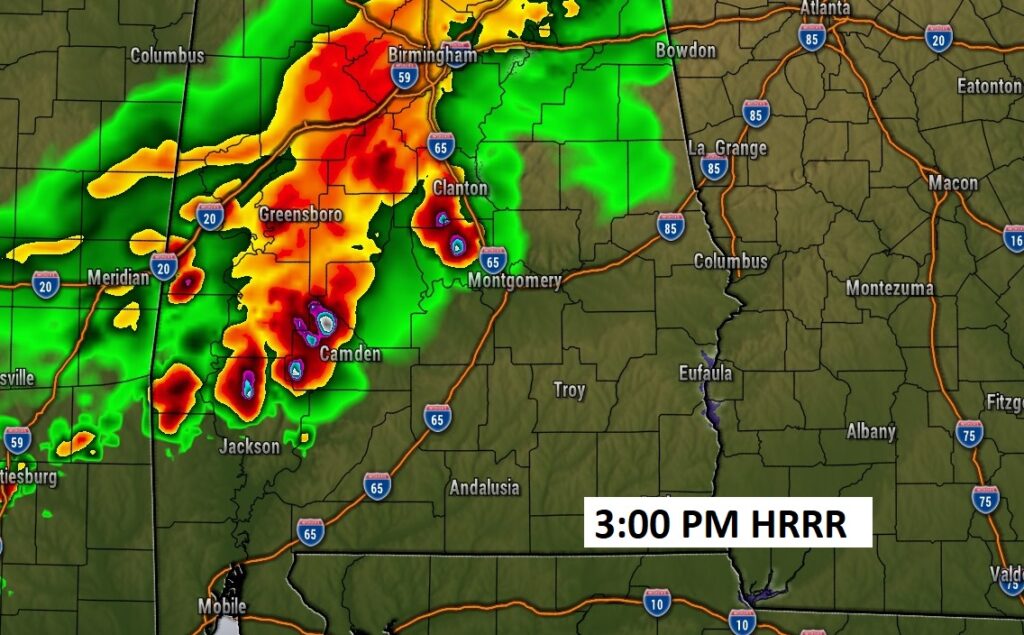
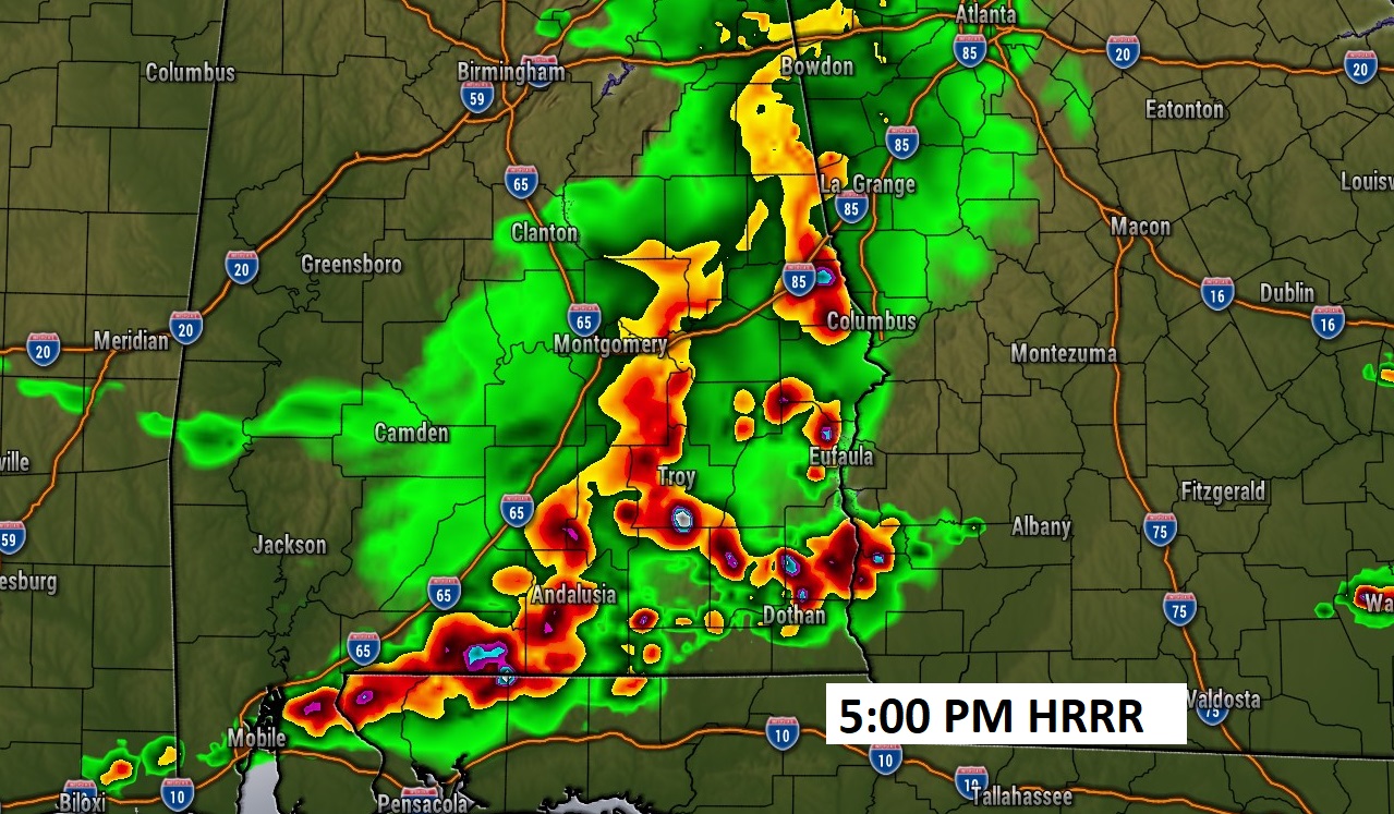
Future radar shows a cluster of strong/severe storms that will move southeastward across the area this afternoon. Numerous warnings are a good bet. Here’s a couple examples of the HRRR model and 3:00 and 5:00 PM.
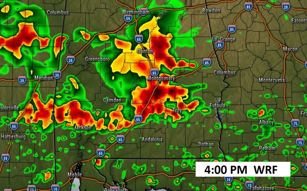
Here’s more model. This is the WRF model at 4:00 PM. Thunderstorms are likely for MOST of us today.
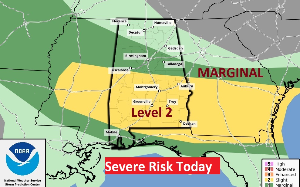
SPC has a large chunk of the state in a severe weather risk. A Large area south of a Clanton/Alex City line are in a Level 2 out of 5 risk. Damaging wind gusts are the main risk. Large hail is also possible.
The Heat Advisory has been suppressed southward. The Advisory starts in Lowndes and Montgomery county and covers southeast Alabama, south of a front moving through the state today.
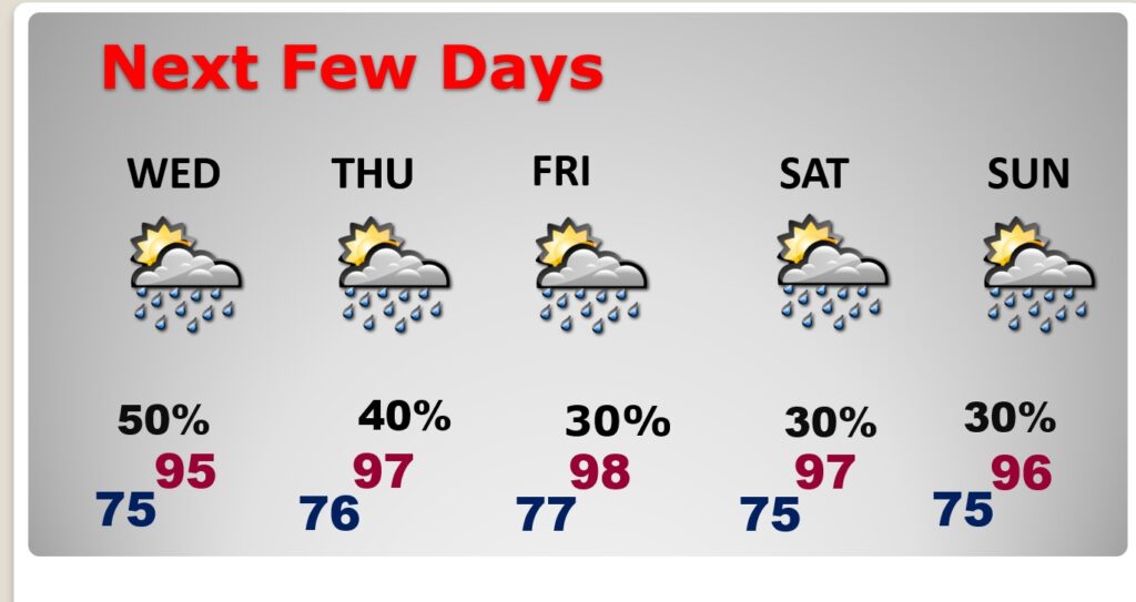
NEXT FEW DAYS: Highs Wednesday through Friday will be in the mid 90’s. Perhaps upper 90’s by Saturday. Scattered random storms each day, mostly in the afternoon & evening hours. Mid 70’s at night.
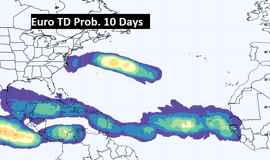
TROPICAL UPDATE: The tropics are quiet for now. We’re watching a series of tropical waves between Africa and the Islands. Here’s the EURO areas to watch next 10 days.
Thanks for reading this Blog this morning! This morning we are LIVE on the radio from 6 to 9 on NewsTalk 93.1. Watch us on TV on CBS 8 and ABC 32. I’ll have another update for you in the morning. Have a nice day!
–Rich