
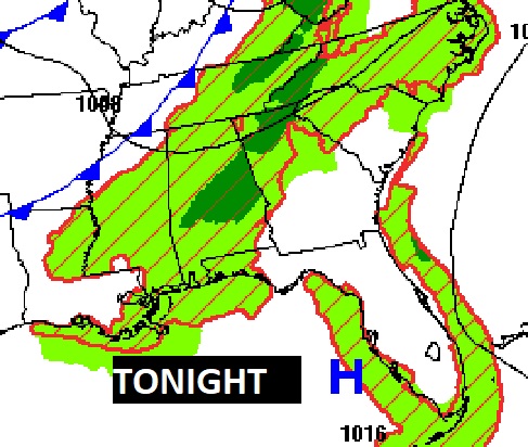
Good Morning! Get ready for another hot & humid day. We’ll be close to triple digits on the heat index. There will be widely scattered storms, mainly in the afternoon and evening hours, but not many today. Showers will be a more numerous later tonight and Thursday as a front approaches. After the front moves through expect lower humidity on Friday and Saturday. Widely scattered storms are possible Sunday. Here’s my brief forecast discussion.
TODAY: Sun/cloud mix. Random spotty scattered showers and pop up storms are possible, mainly in the afternoon and evening hours. High in the lower 90’s. Light wind. Mostly cloudy tonight. Showers and storms become more numerous in the wee hours late tonight and Thursday ahead of an approaching front.
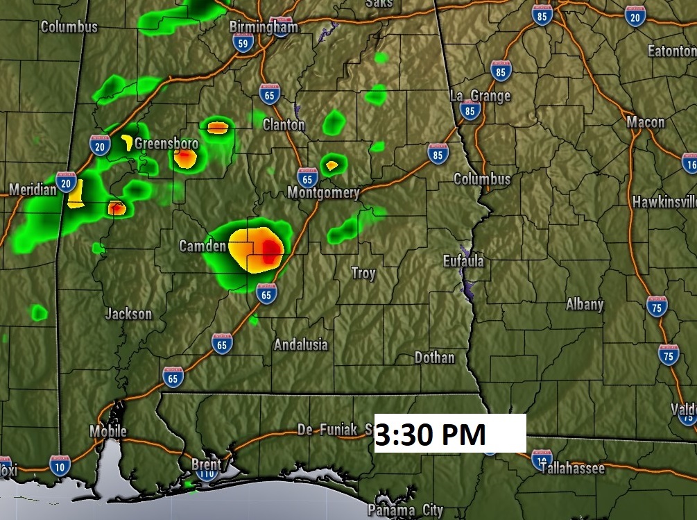
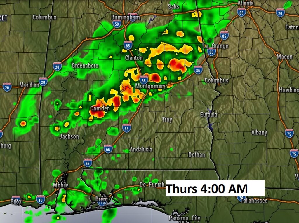
FUTURE RADAR: Not many storms will; be roaming around this afternoon. BUT, showers and storms become more numerous in the wee hours late tonight and Thursday
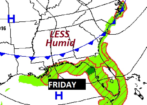
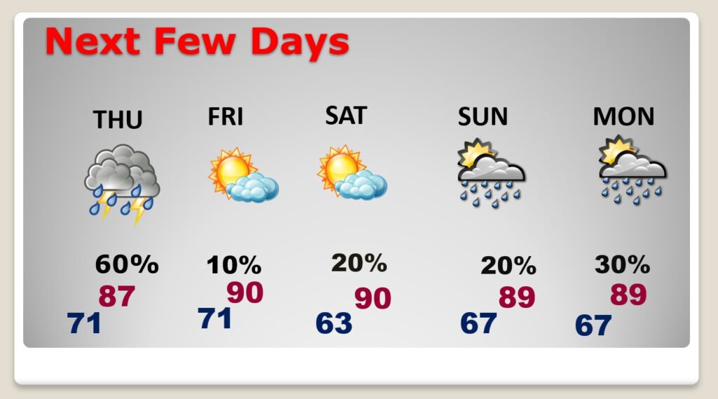
NEXT FEW DAYS: Showers will be a more numerous later tonight and Thursday as a front approaches. After the front moves through expect lower humidity on Friday and Saturday. Widely scattered storms are possible Sunday.
TROPICAL: NHC says no tropical development in the next 7 days.
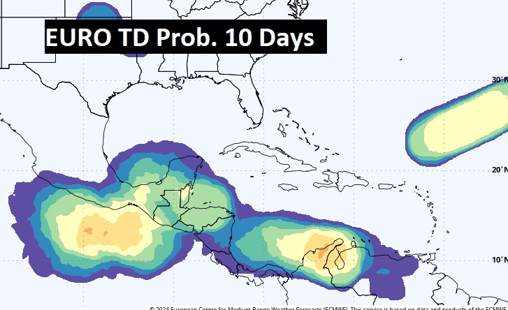
The next week could be different. The EURO is hinting the western Caribbean, southern Gulf and parts of the Atlantic may start to wake up.
Thanks for reading the blog. There will be another complete Blog update and video forecast discussion tomorrow morning. This morning, everything is normal including LIVE on the Radio from 6 to 9AM on NewsTalk 93.1 – WACV. Have a nice weekend!
–Rich