9:45 PM UPDATE:
Tornado Watch extended eastward to the Georgia line till 4:00 AM.
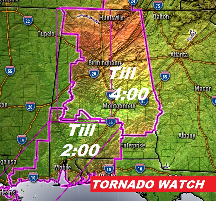
8:10 PM UPDATE:
TORNADO WATCH
(8:10 PM – 12/28/24)
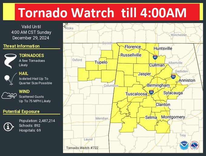
A Tornado Watch now covers much of central and north Alabama until 4:00AM. A few tornado likely. Damaging wind gusts to 75 MPH. Hail up quarter size. So now, Tornado watches cover the western half of the state generally along and west of I-65. Although the city of Montgomery is not currently included, it’s just a matter of time. Be prepared for a watch extension later.
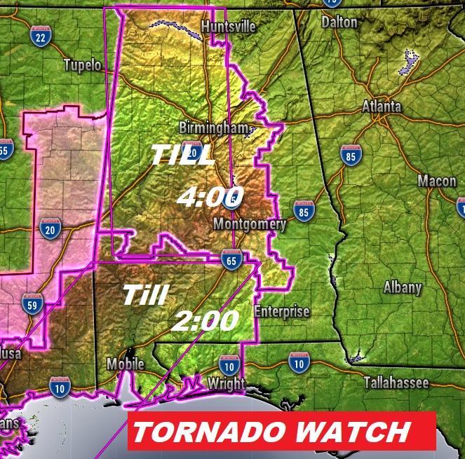
Here’s the latest watch.,
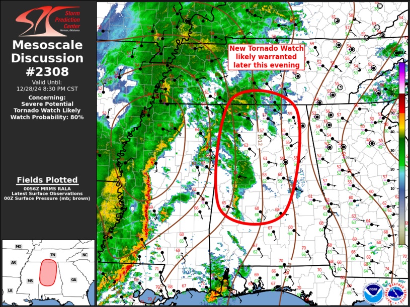
‘7:00 PM UPDATE:
Storm Prediction Center indicating a new tornado watch will be required later this evening for most of us here in central and even into north Alabama. 80% chance. #alwx https://spc.noaa.gov/products/md/md2308.html
6:39 PM UPDATE:
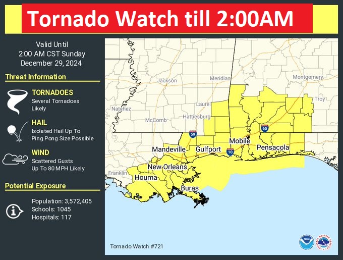
First Alabama Tornado Watch of the evening covers most of southwest Alabama until 2:00AM. It includes Crenshaw, Butler and Covington. Scattered tornado likely. Damaging wind gusts to 80 MPH. Hail up to ping pong size.
5:55 PM UPDATE:
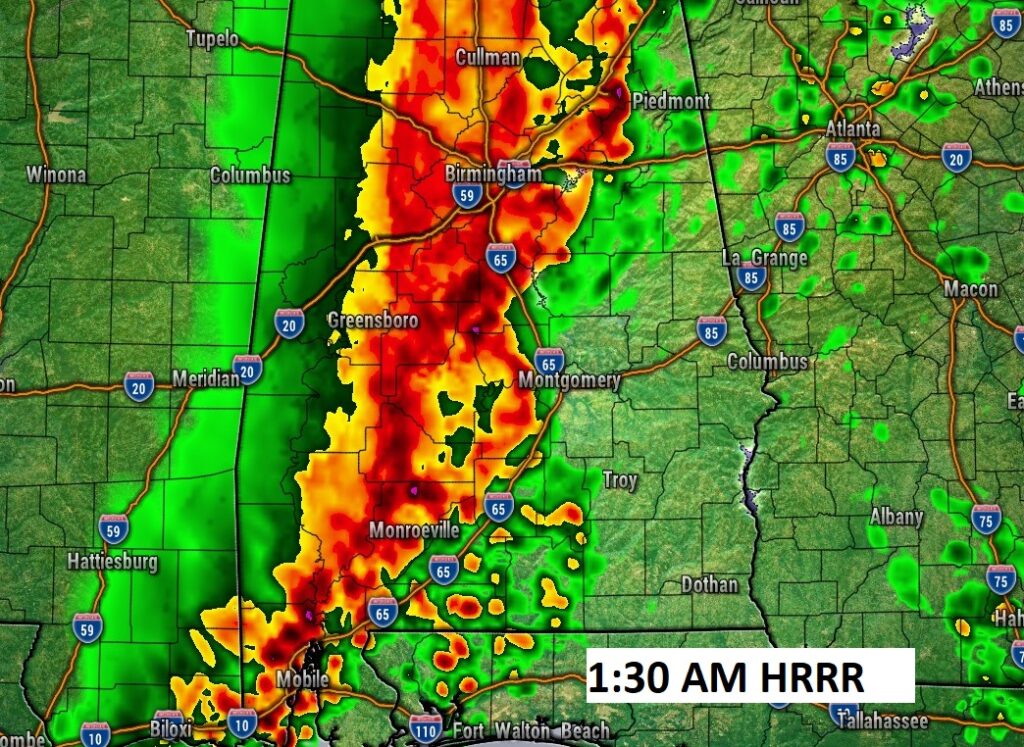
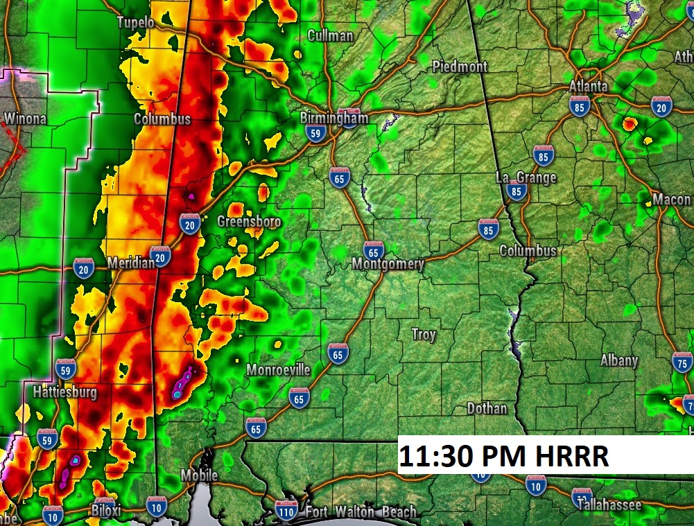
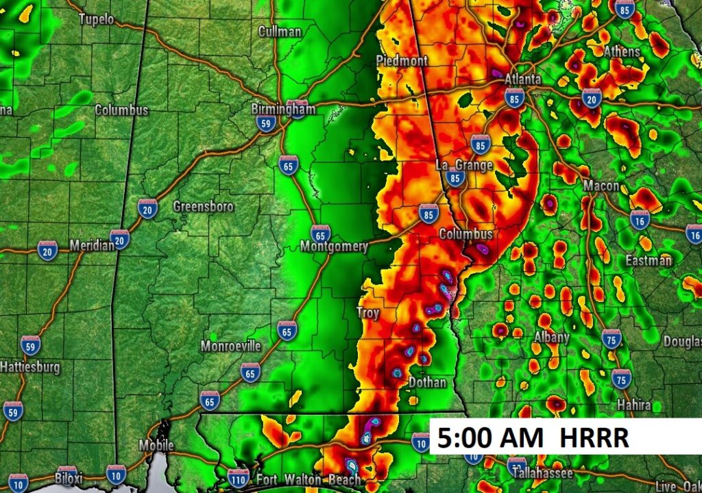
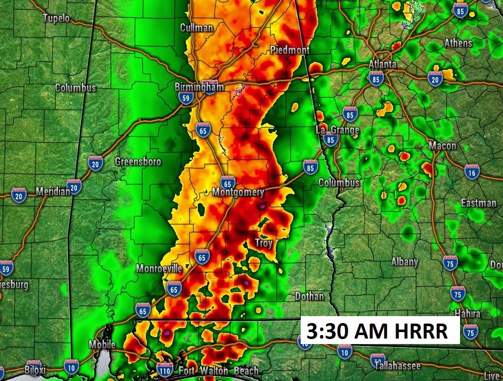
Future hi=res Radar has been doing a great job today, so lets’s look ahead to Alabama’s very turbulent night ahead. Here’s the HRRR model starting at 11:30PM in the west and through 5AM into the east. Damaging wind gusts up to 70 mph, with embedded Tornadoes and potentially large hail. Stay weather aware. #alwx
Good morning! Get ready. There is an increasing Severe Risk of Severe storms & tornadoes across the entire area, particularly tonight, through the overnight hours. especially in the western half of the state, where several strong tornadoes are possible. Some EF-3 long track tornadoes are not out of the question. There’s more details contained in this special Blog update. There could be some leftover showers Sunday morning before afternoon improvement. Much cooler/colder air arrives on New Years Day. Here’s my brief video forecast discussion.
TODAY: Dense fog advisory this morning. Risk of a few spotty showers before Noon. Then, an increasing risk of showers and storms in the afternoon, especially after 3. Some of the storms possibly Severe. SE wind 10 to 15. Hi 71
TONIGHT: Increasing risk of showers and thunderstorms especially after 9PM. Damaging wind gusts to 70+ mph possible. Risk of tornadoes well into the overnight hours. Locally heavy rainfall. SE winds gusting as high as 30 mph. Low tonight 63.
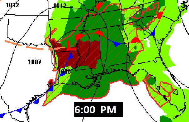
Here’s the potent set-up at 6PM. Much of the South could see a potential significant Tornado Outbreak today and tonight.
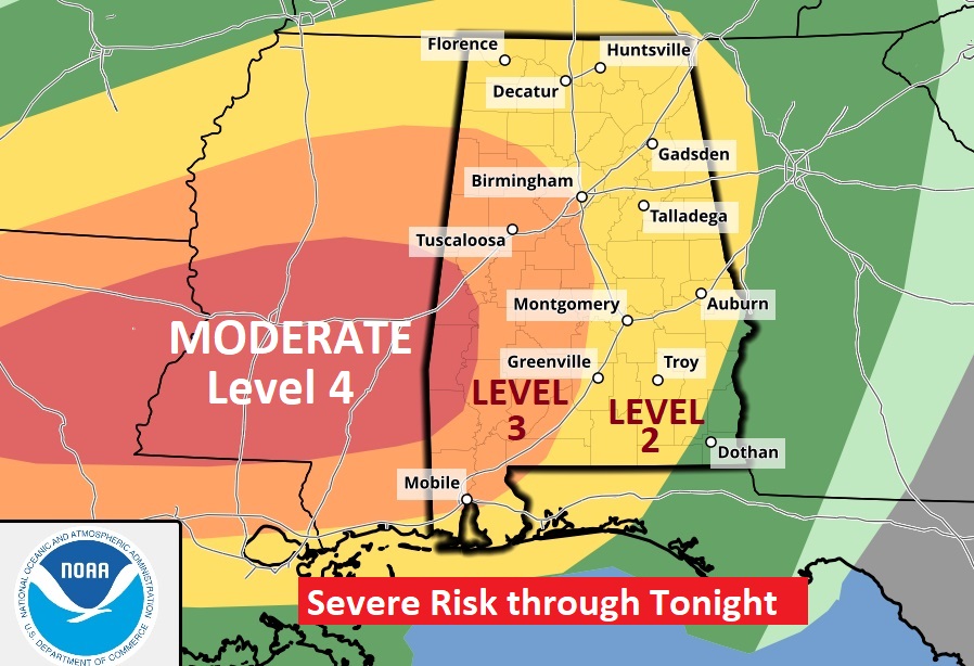
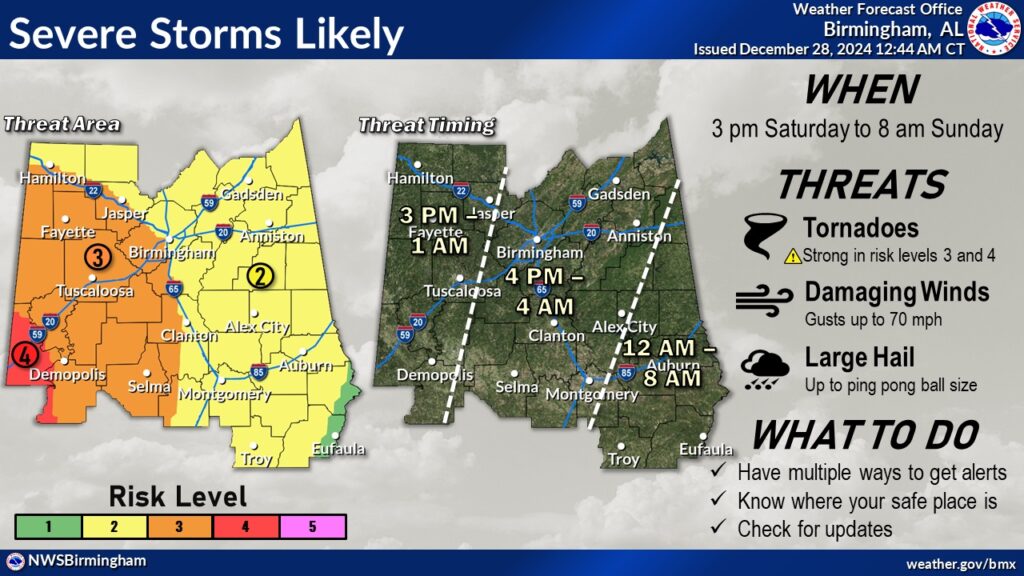
SEVERE THREAT THROUGH TONIGHT: All of the area has a severe threat beginning this afternoon and especially through the overnight hours tonight There is an significant Severe Risk of Severe storms & tornadoes, especially in the western half of the state. A level 3 Enhanced risk covers all of west Alabama, generally west of a Clanton to Greenville line. Extreme WEST Alabama is in a Level 4 Moderate Risk.
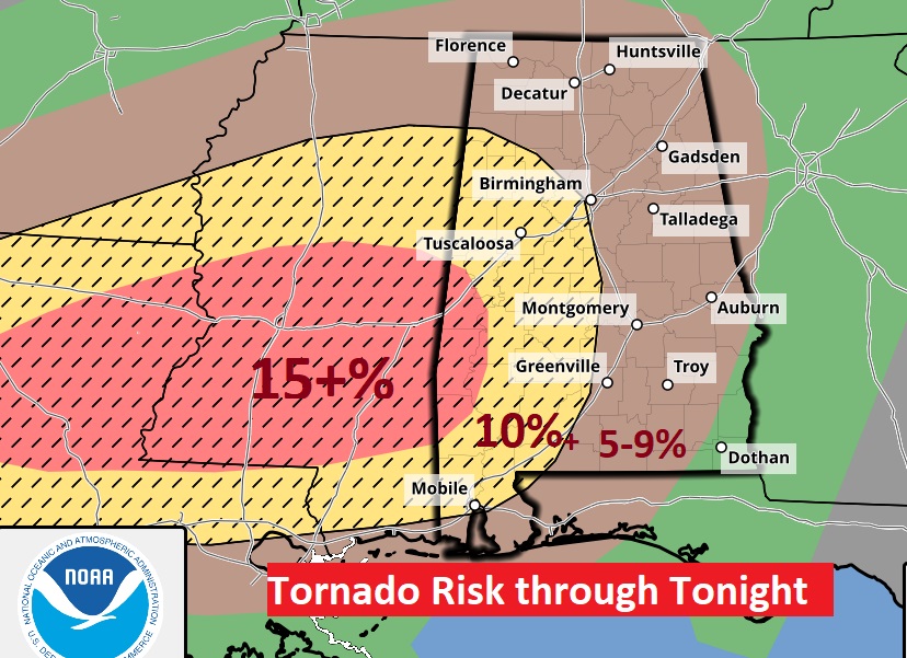
This is a very dangerous set-up, particularly because of the overnight tornado risk. Quoting the Storm Prediction Center: Strong tornadoes (EF-2 +) are likely. This potent set-up “could produce long-track EF-3 tornadoes and there could be several.” Notice that hatched area in west Alabama into Mississippi, This is where the greatest threat of STRONG Tornadoes will exist. The 10% or greater probability is rather significant.
Future Radar. Here’s the HRRR model. It shows the main “squall line “ (QLCS) near the MS/AL line at Midnight, with potentially strong rotating supercells within the line, But, this model also hints at some discrete supercells, by themselves well ahead of the line as far east at I-65, Some of these may rotate and produce tornadoes. Most of the activity is in a wide band across central Alabama, generally aligned with the I-65 corridor at 3:00AM, shifting east of I-65 by 5:30 AM. This could be a long event.
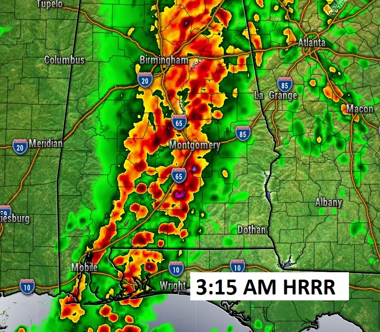
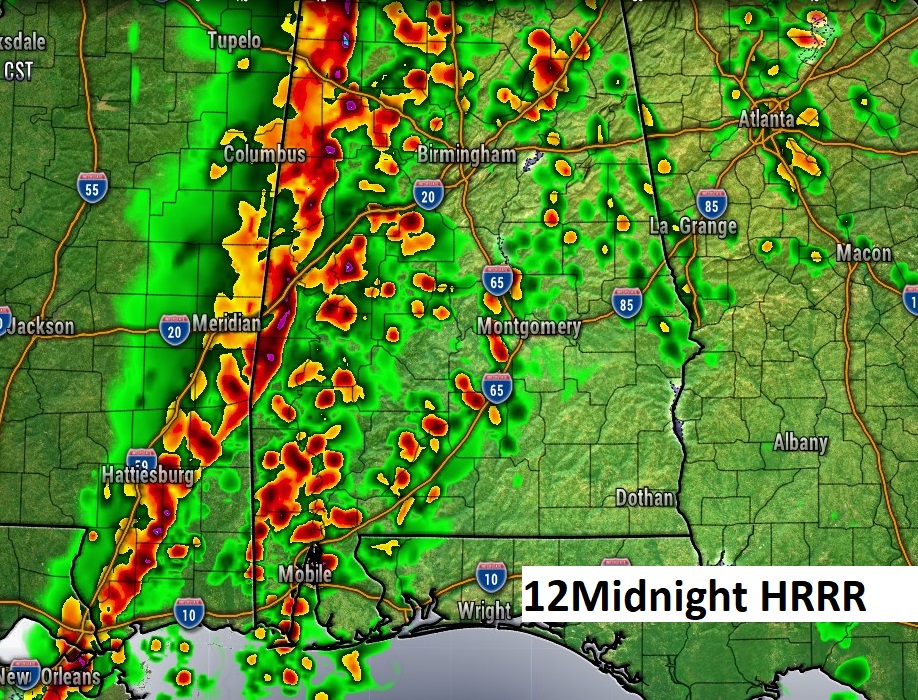
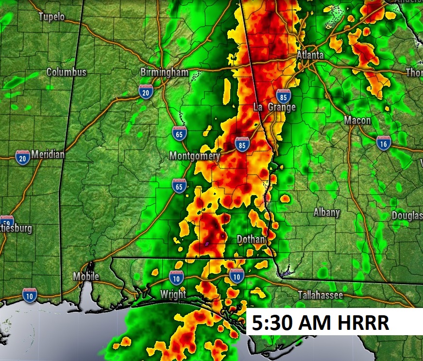
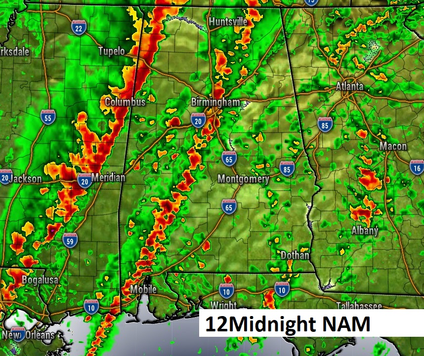
Here’s the NAM model. It likes the idea of two separate lines of storms.
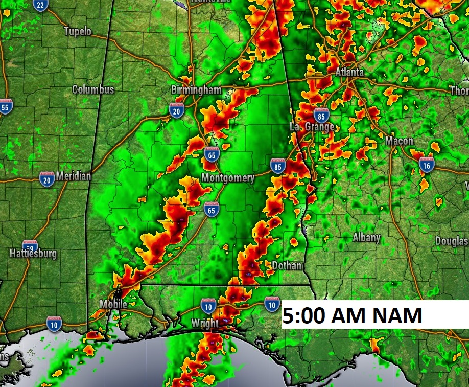
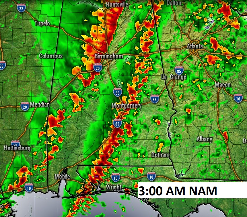
This map is disturbing because most of us will be in a Severe Weather Risk window from 4pM till 4AM.
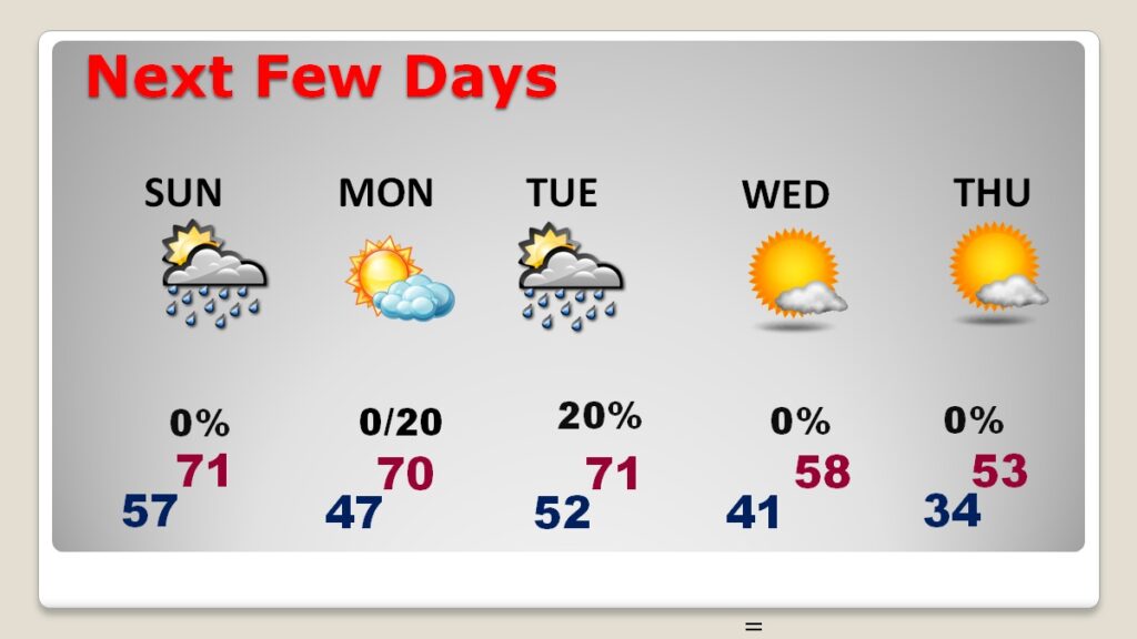
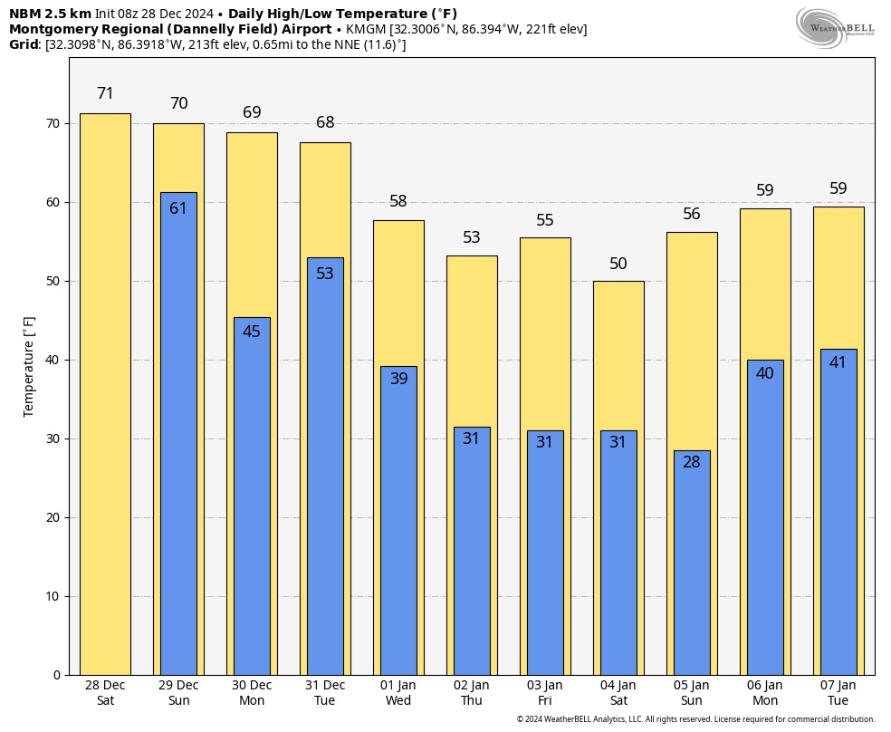
NEXT FEW DAYS: Beyond Sunday, there’s a risk of leftover showers Sunday morning before ending. Expect improvement Sunday afternoon, Mild weekend. High 72 Saturday. Near 70 on Sunday. The next round of showers comes in Monday night and Tuesday. It will begin to turn much cooler by New Years Day.
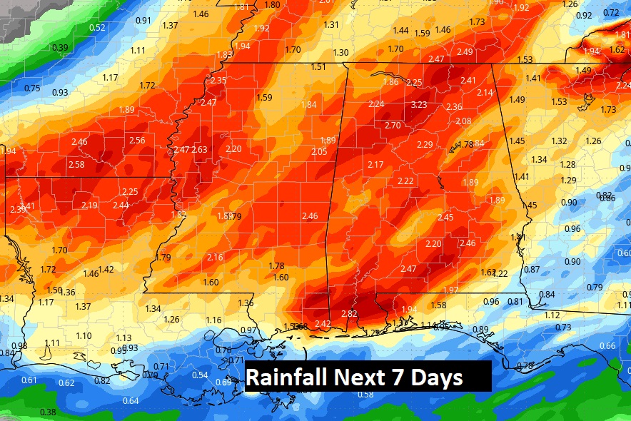
Herse’s the 7 day expected rainfall. Could be some significant rainfall amounts.
Here’s the 10 day model blend temps. Much colder air ahead especially late week.
=
Thanks for reading the blog. Obviously, I’ll be a very budy guy tonight, doing my very best to update you on social media and on 8 stations. But, let me clear OUR WEATHER APP WILL BE YOUR BEST FRIEND TONIGHT, with instant push notifications on watches and warnings. It knows where you are. Our App is FREE in the App store, Search Rich Thomas Weather. Stay weather aware!
–Rich
