
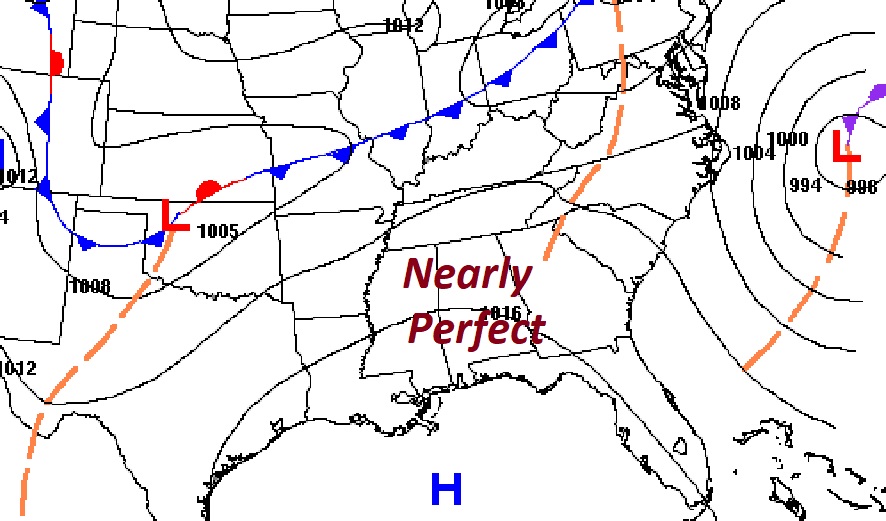
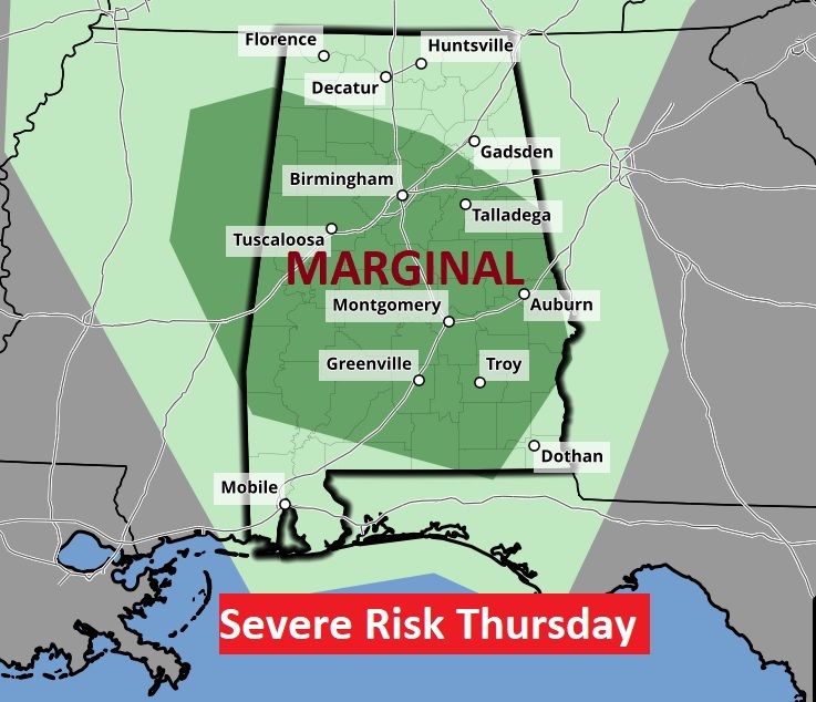
Good Morning! Enjoy tranquil and beautiful weather for a couple of days, before we get into a rough and turbulent stretch. Today through Wednesday will be very nice with plenty of sunshine and highs in the 70’s. The next risk of showers and storms arrives by Thursday afternoon. SPC has now added a Level Marginal Risk for Thursday. Another much more important and potentially significant Severe “Outbreak” arrives by Saturday and Saturday night, through the overnight hours until, perhaps early Sunday morning. Expect all modes of severe weather including tornadoes. Here’s my brief forecast discussion.
TODAY: Sunny and nice. Warmer. High 74. Northwest wind 6 to 12 mph. Mainly clear tonight. Low 45.
NEXT FEW DAYS: Wednesday will be very nice with plenty of sunshine and highs in the upper 70’s. The next risk of showers and storms arrives by Thursday afternoon. Some storms could be strong/severe. Highs will be near 80 by Friday and Saturday. Rich, warm moist Gulf air will add fuel to the fire as this weekend severe weather threat comes together.
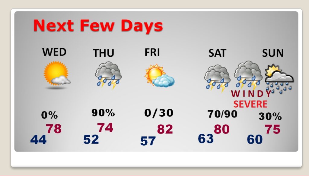
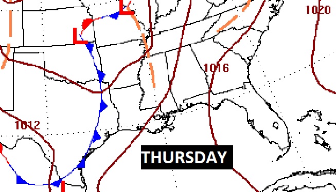
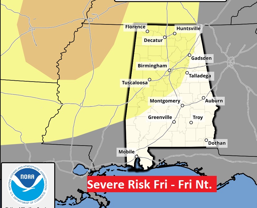
On the Thursday, SPC has now added a Marginal (level 1) severe Risk. The main risk on the Thursday system will be damaging wind gusts. Scroll down for the “meat and potatoes” on the increasing Saturday risk.
INCREEASING WEEKEND SEVERE RISK: Ingredients are coming together for a potentially significant Severe Weather “Outbreak”, including all modes of Severe Weather, including damaging wind gusts 75+ mph, tornadoes, including the risk for strong tornadoes, along with the potential of large hail because of very cold air aloft. wind
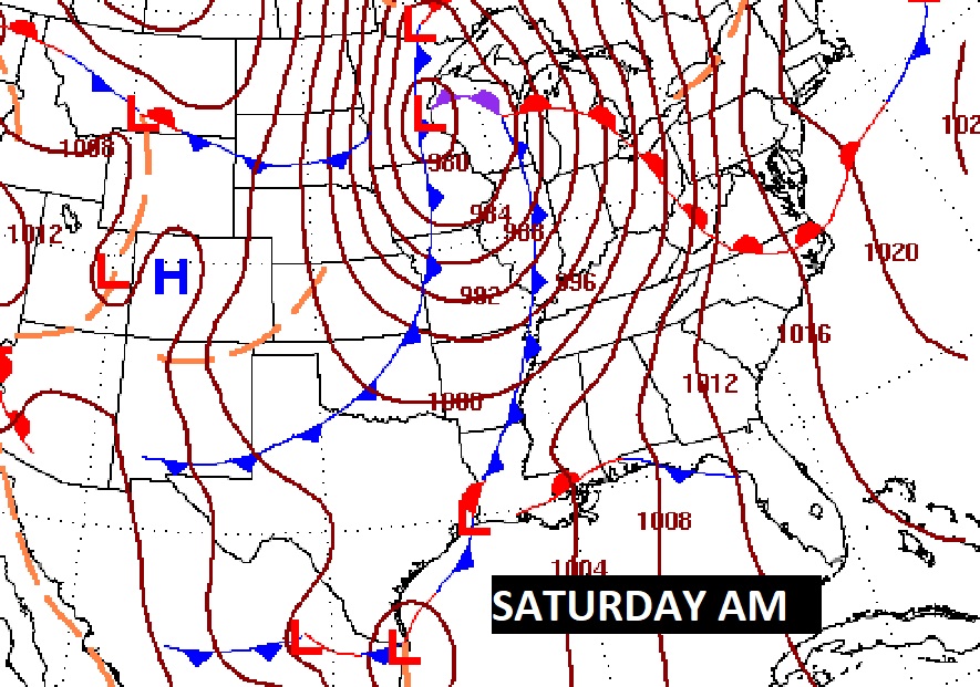

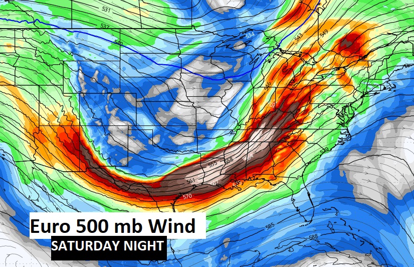
The upper air (500 MB) powerful winds will provide the energy to fuel this significant severe weather outbreak. Here’s the Euro Saturday night up around 18,000 Ft.
Severe Risk could even begin Friday night in North and West Alabama.
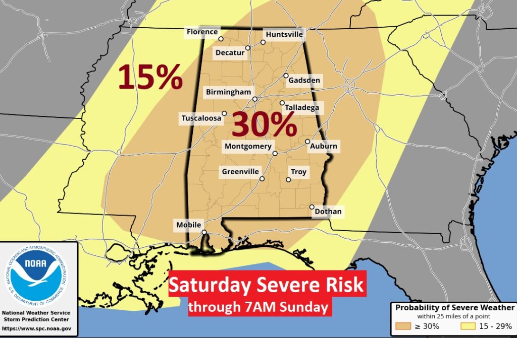
The risk level is notable. SPC is already indicating at least a level 3 out of 5. The 30% Enhanced area has been expanded and now includes the whole state.
Thought you might enjoy the NWS Birmingham Discussion on this developing situation.
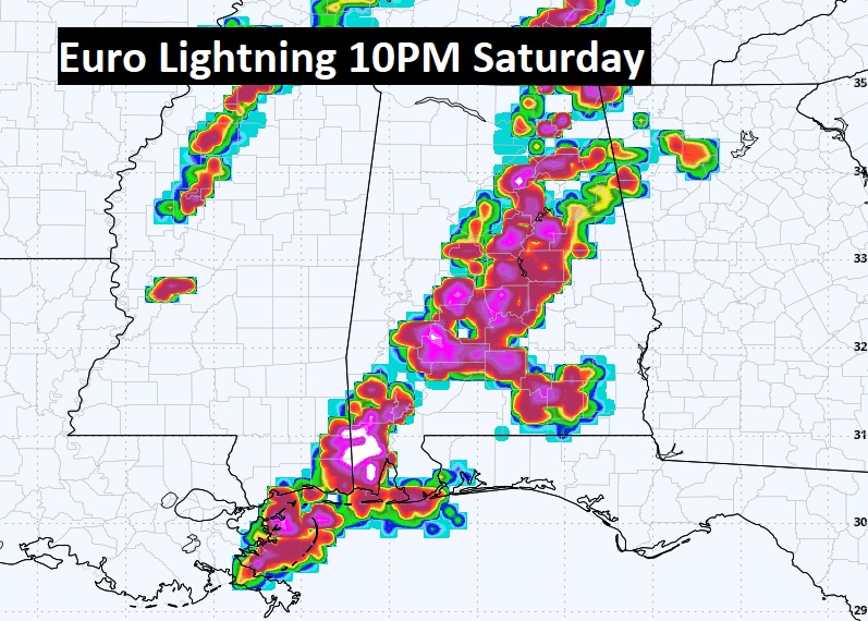
The greatest risk for severe storms (level 3 out of 5) is forecast to occur between Saturday afternoon and Sunday morning. We’re now forecasting severe storms to be LIKELY, with all types of severe weather possible – tornadoes (some strong), damaging winds up to 70+ mph, and large hail up to the size of tennis balls. This could end up being a significant severe weather event across the Deep South with a potential for multiple rounds of severe storms. We’ll have to watch emerging trends very closely over the next couple of days – as there are still some inhibiting factors that may be in play. Particularly, the coverage of showers/storms Saturday morning and cloud cover will have to be watched closely, as that will dictate the amount of daytime heating that is eventually realized by Saturday afternoon. Hopefully we’ll be able to get a better idea of primary storm mode over the next couple of days, but we could be dealing with both supercells and a QLCS especially as we go into Saturday night and into Sunday morning. Stay tuned for the latest!!
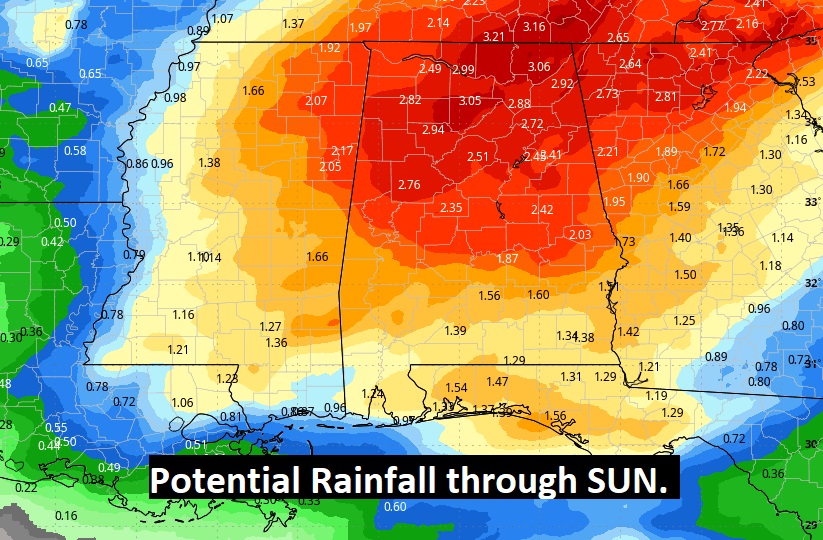
The potential rainfall over the next 7 days could be significant across the Gulf states. Especially heavy across North Alabama.
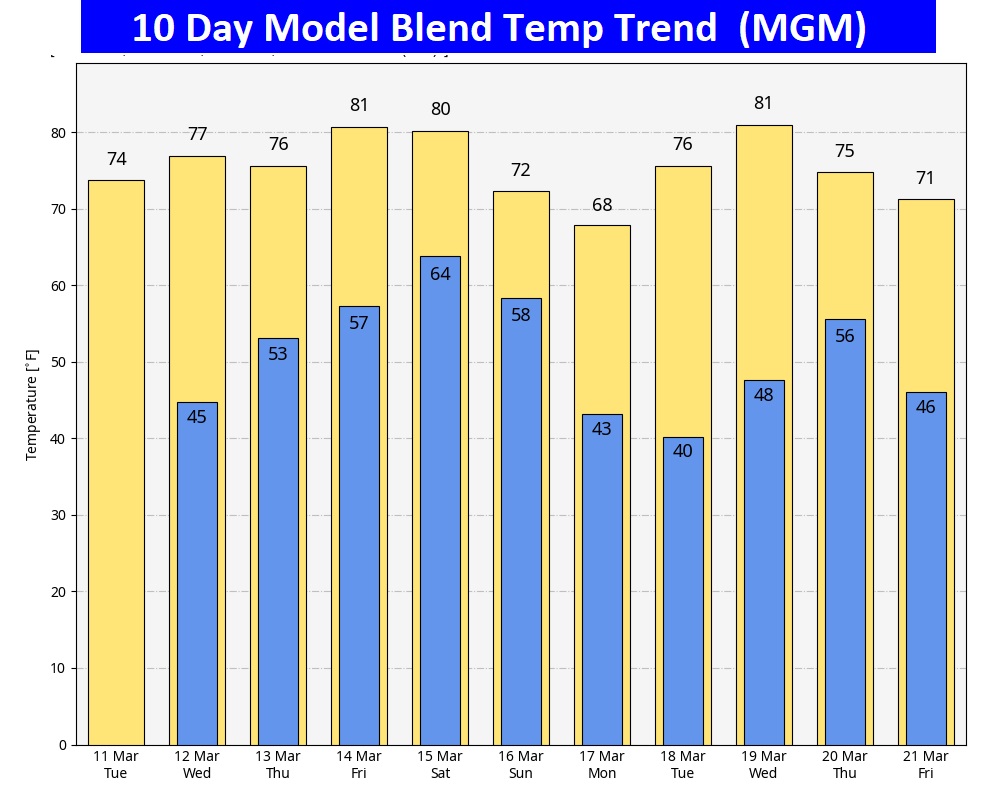
Here’s the 10 day model blend temperature trend. Basically WARMTH. Above normal. (Normal 72/45)
POLLEN: Don’t look now, but we’re getting into the Pollen season again. High range Wednesday and Beyond.
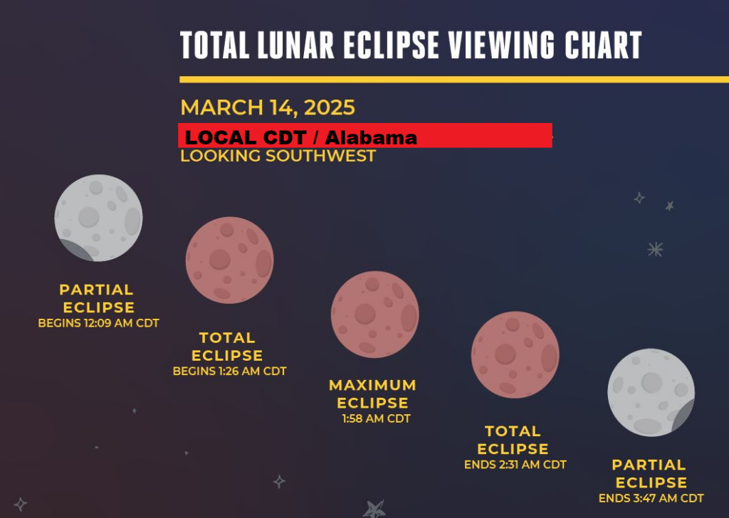
If clouds cooperate — here are the times for the Full Lunar eclipse Thursday night.
Thanks for reading this blog update. This morning everything is normal. We’ll be LIVE on NewsTalk 93.1. There will be another Blog Update and Forecast Video discussion in the 4’o’clock hour tomorrow morning. Have a good day.
–Rich