
Our little taste of the Arctic came and went quickly. Now it’s just a memory, as we shoot for 70 today. Rain is back in our forecast, and it looks like we are in for a very active pattern between now and Christmas Day, with multiple storm systems and up and down temperatures. I’ll walk you through the details, on your 2 minute personal Monday morning weather briefing.
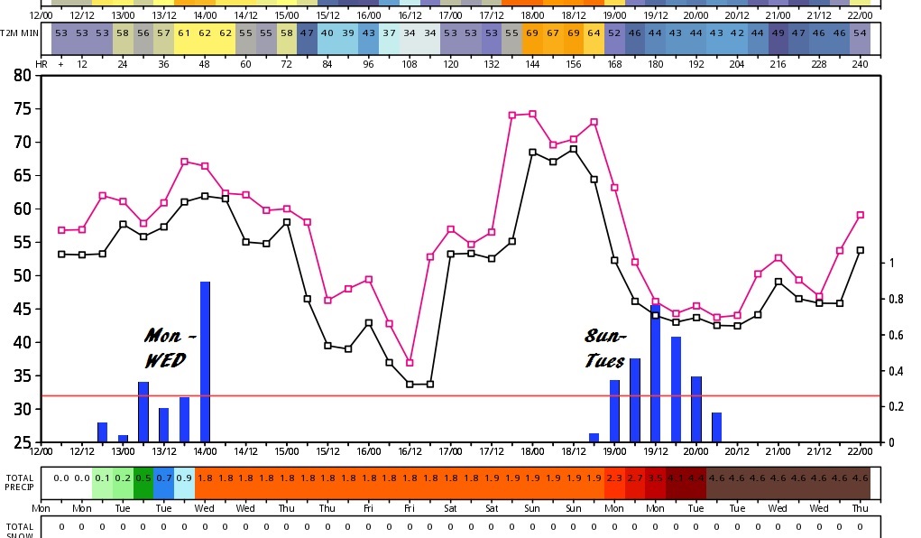
The 10 Day European Model forecast, not only shows the 2 storm systems we’ll be dealing with over the next 10 days. It shows a wild temperature ride, especially for the next 7 days.
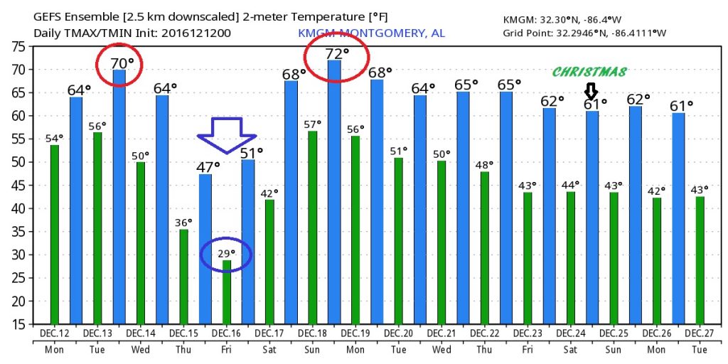
Here’s the 16 day temp trends of the American GFS model. Don’t focus on specific numbers. We are just looking at trends here, through Christmas Day and beyond.
· · ·