
We are enjoying a beautiful start to the month of April today & tomorrow, but this blog focuses on 2 ominous, potentially significant storm systems in the week ahead, both with Severe Weather implications, which includes a tornado threat. Number one, is the first thing Monday morning. The second Wednesday afternoon/evening. Details are still coming together, but I’ll tell you what we know so far, below. First a few words about our tranquil, beautiful weekend.
TODAY: Sunny and nearly perfect. High 79-82. Low tonight 55.
SUNDAY: Mostly sunny & warmer. Hi 85.
SUNDAY: Windy. Scattered showers and thunderstorms late, after Midnight. Low 65.
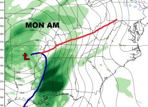
MONDAY SEVERE WEATHER THREAT: Depending on how the details emerge, Monday’s severe weather threat could be significant, starting first thing early in the morning, and continuing through lunch time and into the afternoon. All of the state will be affected, but the strongest threat of tornadoes will be from about the US 80/I-85 corridor south to the coast. I could write five “meaty” paragraphs about some of the technical details and the possible limiting factors. I will spare you those details. Let me simply say, that the severity of the situation depends on how “meso scale” details unfold Monday morning. Will there be a significant cluster of storms on that coast? Will that minimize the threat farther north? The jury is out on these complicated questions. Just be aware. We may be dealing with a significant severe weather situation Monday morning. Here’s the GFS model set-up on Monday. We are in the warm air sector with, as we say in the business, a negative tilted potent system approaching.

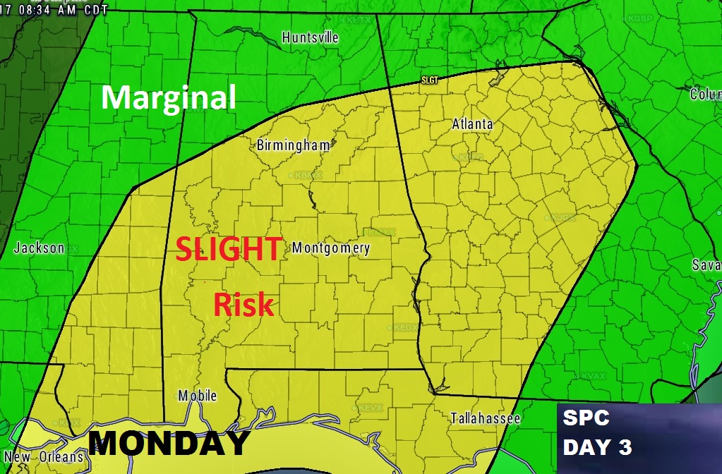
The Storm Prediction Center has us already in a Slight or Standard severe risk for Monday. This could be expanded or upgraded as we get closer.
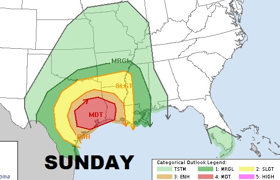
By the way, that same storm system will set up a dangerous situation for the western Gulf states tomorrow.
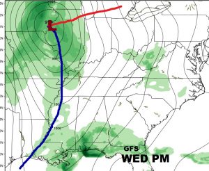
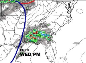
WEDNESDAY Severe Threat?: I’m not going to go into much detail on the potential Wednesday severe threat right now. The complicated details are still emerging. But, let me get your attention with a few words from the NWS in their early morning discussion, which raises eyebrows. “Substantial instability could develop Wednesday afternoon, and this system will have to be watched very closely. “If this trend continues, we could be looking at a serious severe weather event. “
It certainly has my attention, to say the least. Here’s the set up on Wednesday from two global models – the GFS and the Euro.
SPECIAL SUNDAY VIDEO: With the strong potential for 2 severe weather events next week, I am planning a special Sunday morning mini-video that will address the thrats with fresh, new model data and the latest from the Storm Prediction Center. See you in the morning. Enjoy this beautiful weekend.
Rich