Good Morning! Storms will start to thin out in number today as we head for hotter days. In fact, on this video, I’ll tell you about some dangerous heat which will grip a good part of the nation. I’ll show you the days I am most concerned about. Plus, I have an early look at the weekend details, and a new Tropical Storm in the Caribbean, too. With your toast and coffee this morning, here’s your Tuesday morning weather briefing.
Up at 20,000 Ft. (500mb level), Another big Heat Bubble High will spread out and cause excessive, dangerous heat for a huge part of the nation later this week. Our hottest days will be Thursday through Saturday.
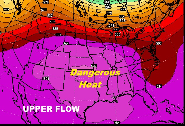
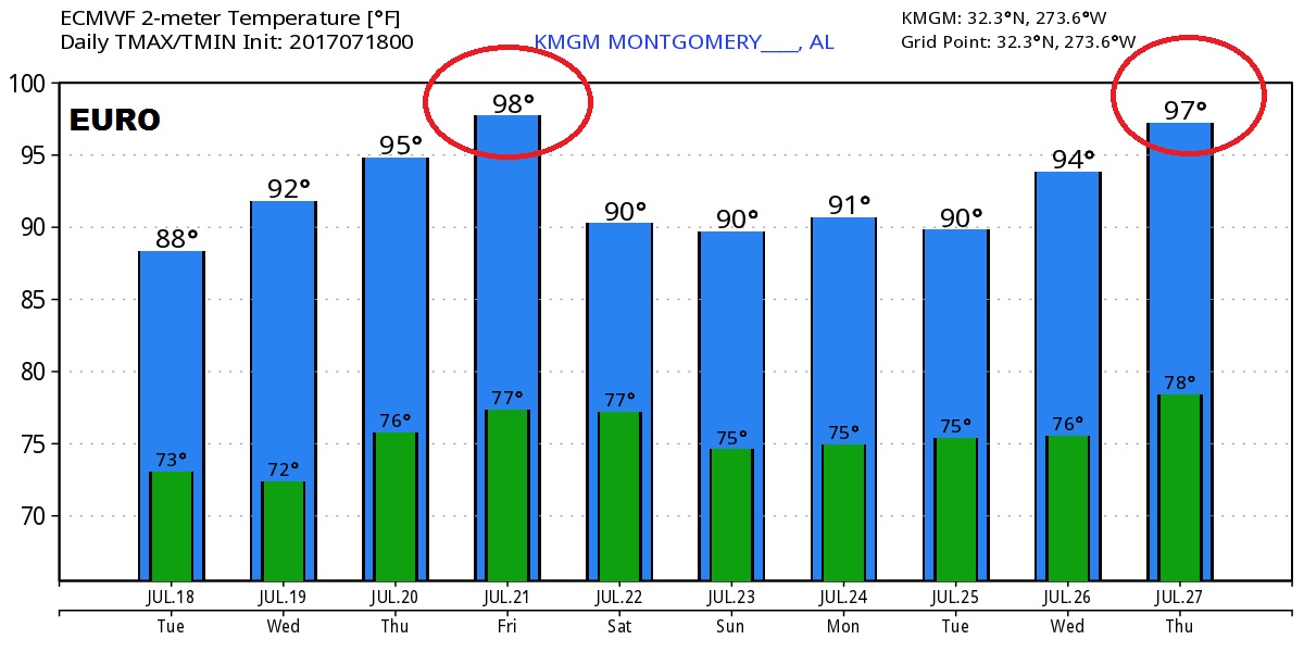
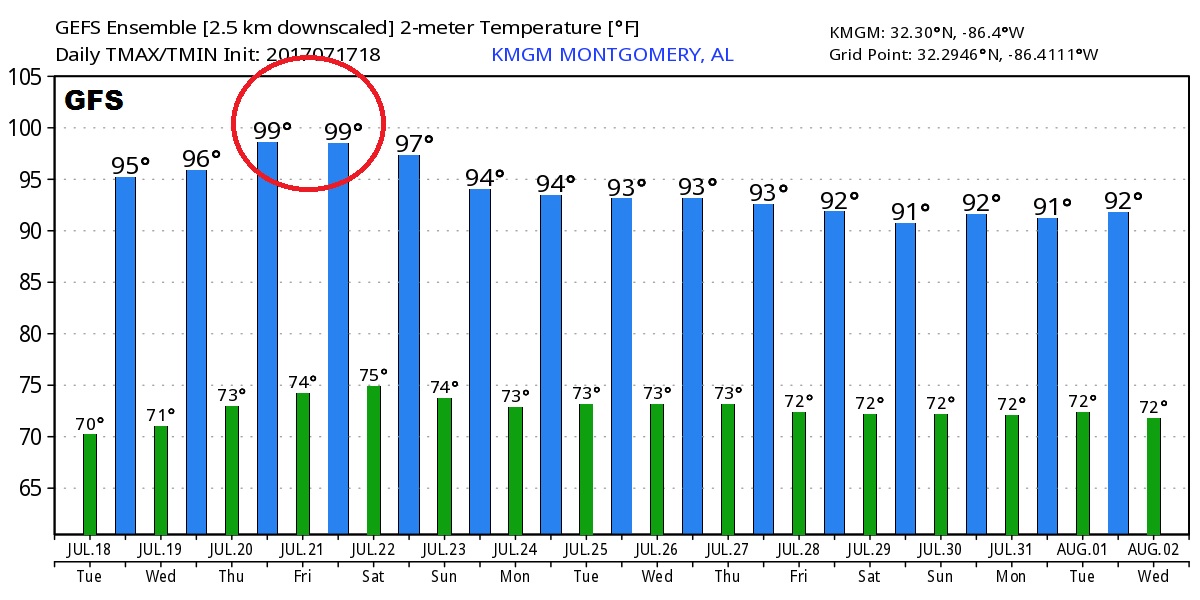
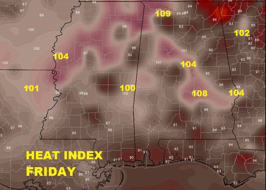
The models are advertising some excessive heat later this week. Here’s a sample of the raw numbers being printed out on the EURO and GFS global models. Also, the GFS Heat Index estimates for Friday.
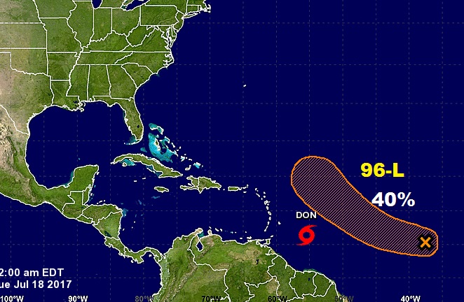
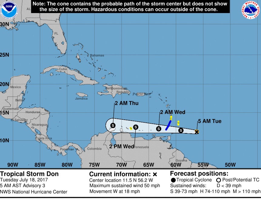
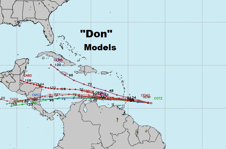
In the Tropics, we are monitoring two systems… Tropical Don with winds of 50 mph heading westward toward the Windward Islands and Invest 96-L.