
Some towns have been missed by the showers/storms over the last three days. If your town needs rain, there’s great hope for the next few days. Storms will be rather numerous, but still quite random every day in the week ahead. Your odds of encountering one of these storms is better than normal.
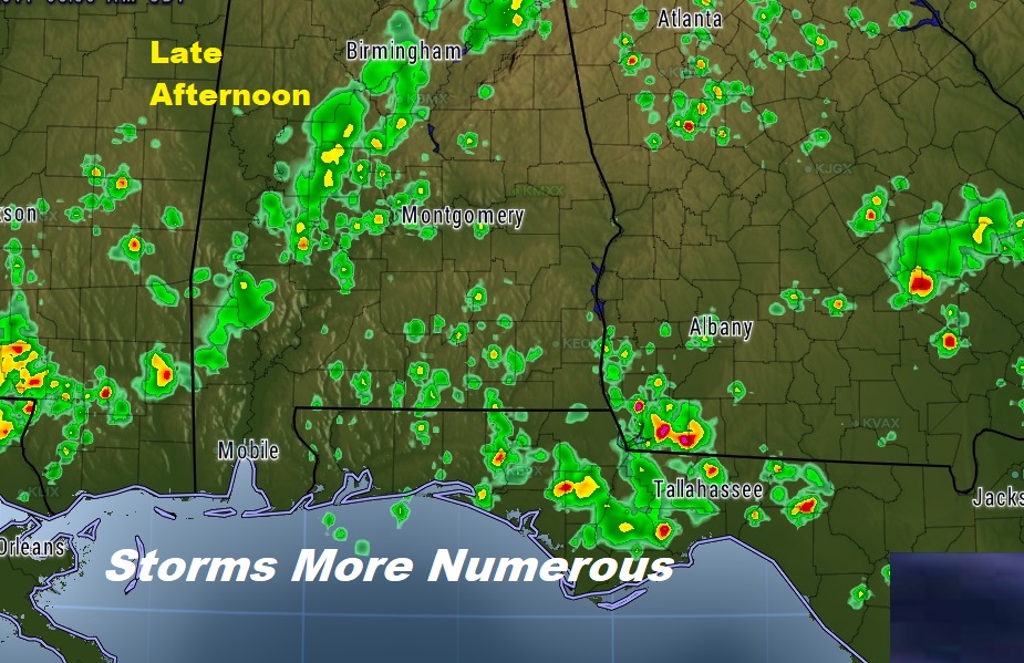
TODAY: Yesterday the storms were limited. Today they will be much more numerous area wide. Limited sunshine. High in the upper 80’s to near 90. Low tonight Mid 70’s Here’s a late afternoon Future Radar snapshot.
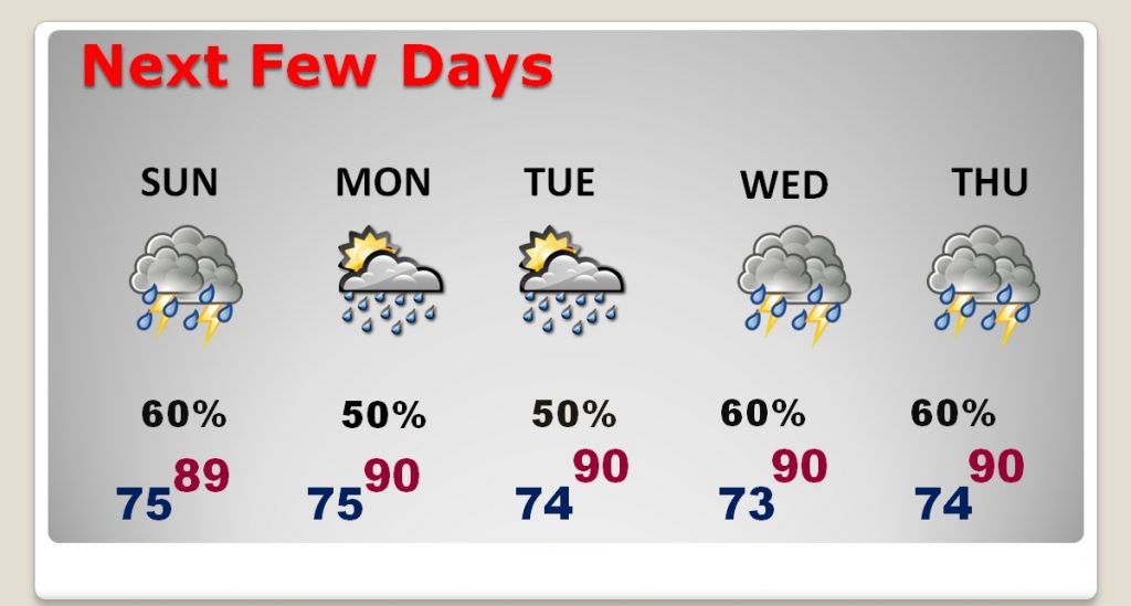
NEXT FEW DAYS: Showers and storms will be in generous supply each day this week, with deep tropical moisture still in place. Very little day to day changes.
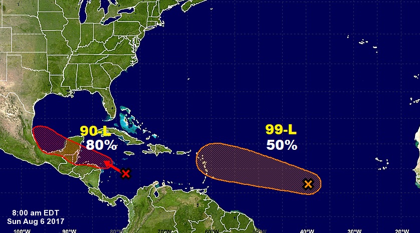
TROPICS: There are two “Invests” the NHC is monitoring. Invest 90-L in the west Caribbean, heading toward the Bay or Campeche . This system could become a Depression or Tropical Storm Franklin in a day or two, perhaps even before it reaches the Yucatan. It was scheduled to be visited by Air Force Recon this afternoon, but that flight has been re-scheduled for tomorrow. The other system, Invest 99-L has a 50% chance of development next few days. If it develops, it could have future implications for the United States, perhaps. Spaghetti models below.
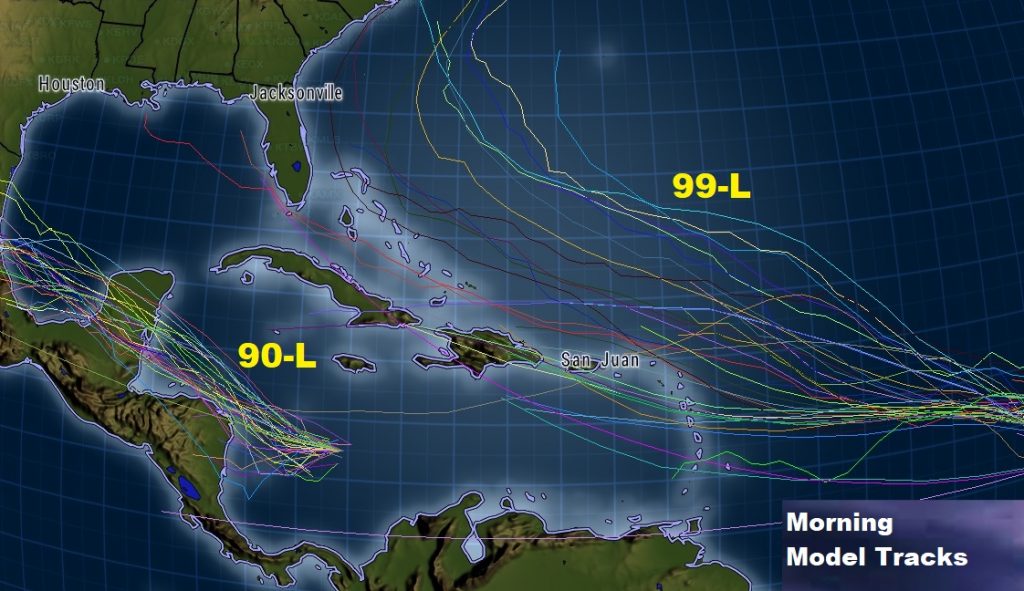
The Morning Model runs show the potential Future Tracks for 90-L and 99-L.
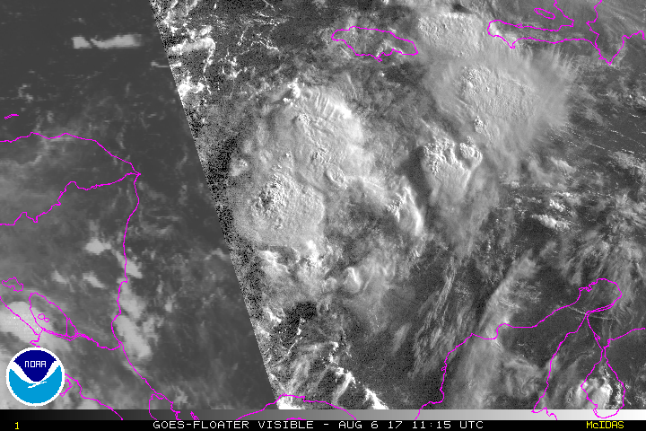
90-L early morning visible satellite image. More convection developing near the apparent center.
Have a nice Sunday! I’ll post more as needed. Follow me on Twitter: @Rich4caster. Next video Tomorrow morning at 4:45.
–Rich