
Although our weather is fairly routine through the end of the week and into the weekend, you may encounter a storm here and there. In fact I have adjusted the rain chance. BIG news concerns Extremely Dangerous Category 5 Maria with 160 mph winds, taking direct aim at the US Virgin Islands and perhaps a catastrophic hit in Puerto Rico. What about the Southeast US. Where will Maria’s track take her? Sit back. Here’s your Tuesday morning weather briefing from southern California, at the National Weather Association Conference.
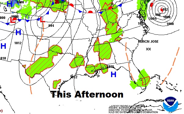
Pretty routine next few days. Hot & humid with scattered mainly afternoon & evening storms. They will be random, and fade out after dark. Highs at or above 90 next few days. Lows at night near 70.

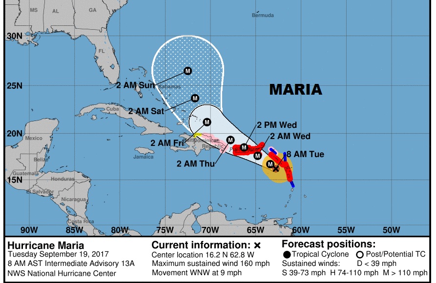
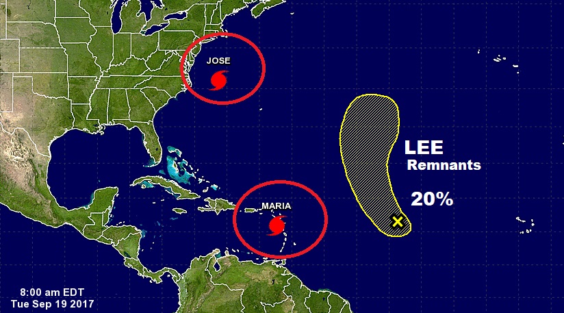
Extremely Dangerous Category 5 Maria made a direct hit on some Leeward Islands overnight, following a rapid intensification cycle late yesterday. Now, sadly the US Virgin Islands and Puerto Rico may take a direct hit from Maria. This is history.
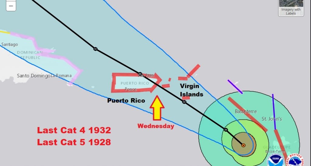
Not Since 1932 has Puerto Rico taken a direct hit from a Cat 4, and not since 1928 has it taken a direct hit from a Cat 5. This is potentially catastrophic
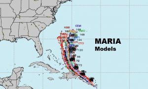
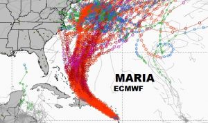
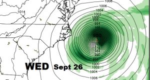
While many models curve Maria’s future path from the US, some models take it dangerously close. The jury is out on Maria’s future US impact. Stay tuned.
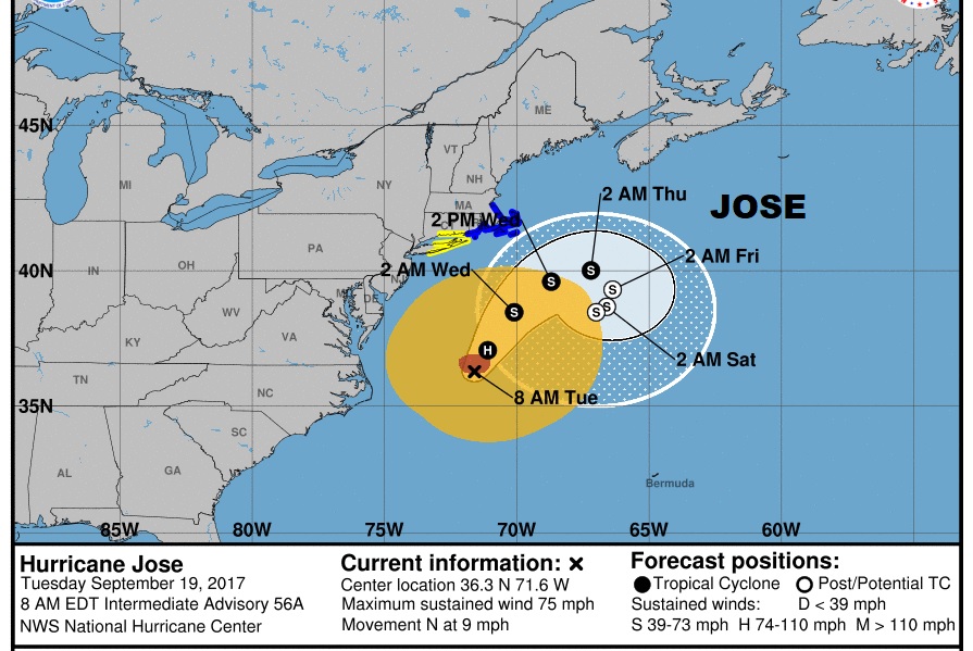
Besides Maria..long-endurance Jose will tease the northeast US coastline with winds and high surf. Tropical Storm Warning.
I’m still here at the National Weather Association Conference in Southern California… But, I’ll return to Alabama late tonight. I don’t think there will be a video tomorrow, but maybe. There will be a blog update for sure, and everything is back to normal Thursday.
–Rich